
| Memorials | : | 3 |
| Location | : | Kenilworth, Wellington County, Canada |
| Coordinate | : | 43.9085900, -80.6464300 |
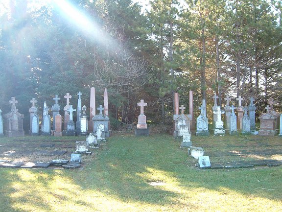
| Description | : | Around 1841, 50 acres [Lot 15, WOSR] was awarded to Bryan & Bridget O'Donnell by the Crown in recognition of their newborn daughter, Mary Ann--the first [pioneer] baby born in Arthur Township. A portion of this land was then donated by the O'Donnell family to the Catholic Church so that a cemetery could be established. By 1908 the Kenilworth Pioneer Catholic Cemetery was giving way to the new and larger Sacred Heart Catholic Cemetery across the highway, beside the new church. The last known burial here was that of Elizabeth Finucan on March 3, 1960. The old cemetery was thereafter neglected... Read More |
frequently asked questions (FAQ):
-
Where is Kenilworth Pioneer Catholic Cemetery?
Kenilworth Pioneer Catholic Cemetery is located at Hwy. 6, Lot 15, Arthur Twp. Kenilworth, Wellington County ,Ontario , N0G 2E0Canada.
-
Kenilworth Pioneer Catholic Cemetery cemetery's updated grave count on graveviews.com?
3 memorials
-
Where are the coordinates of the Kenilworth Pioneer Catholic Cemetery?
Latitude: 43.9085900
Longitude: -80.6464300
Nearby Cemetories:
1. Sacred Heart Roman Catholic Cemetery
Kenilworth, Wellington County, Canada
Coordinate: 43.9067993, -80.6410217
2. Kenilworth Methodist Cemetery
Kenilworth, Wellington County, Canada
Coordinate: 43.8926964, -80.6166458
3. Petherton Pioneer Baptist Cemetery
Petherton, Wellington County, Canada
Coordinate: 43.8842850, -80.6084900
4. Farewell Mennonite Cemetery
Farewell, Wellington County, Canada
Coordinate: 43.9053140, -80.7182690
5. Bethel Pioneer Cemetery
Wellington County, Canada
Coordinate: 43.9274480, -80.7271960
6. Riverdale Mennonite Cemetery
Landerkin, Grey County, Canada
Coordinate: 43.9980545, -80.6197205
7. Derryadd Cemetery
Rothsay, Wellington County, Canada
Coordinate: 43.8168200, -80.6848900
8. Holy Cross Roman Catholic Cemetery
Mount Forest, Wellington County, Canada
Coordinate: 43.9679450, -80.7519100
9. Greenfield Cemetery
Arthur, Wellington County, Canada
Coordinate: 43.8287070, -80.5598260
10. Saint John the Evangelist Roman Catholic Cemetery
Arthur, Wellington County, Canada
Coordinate: 43.8293300, -80.5559700
11. Zion United Church Cemetery
Drayton, Wellington County, Canada
Coordinate: 43.7973382, -80.6375023
12. Mount Forest Cemetery
Southgate Township, Grey County, Canada
Coordinate: 44.0039100, -80.7266500
13. Woodland Cemetery
Egremont Township, Grey County, Canada
Coordinate: 44.0238904, -80.6774183
14. Saint Thomas Roman Catholic Cemetery
Wellington County, Canada
Coordinate: 43.9511810, -80.8071900
15. Berea Mennonite Cemetery
Bosworth, Wellington County, Canada
Coordinate: 43.7793980, -80.6300350
16. Cochrane Cemetery
Mount Forest, Wellington County, Canada
Coordinate: 44.0028500, -80.7740300
17. Westdale Mennonite Cemetery
Minto, Wellington County, Canada
Coordinate: 43.9300750, -80.8287760
18. Chilton Cemetery
Normanby Township, Grey County, Canada
Coordinate: 43.9811480, -80.8129810
19. Saint Patricks Roman Catholic Cemetery
Cedarville, Grey County, Canada
Coordinate: 44.0309029, -80.5493546
20. Bethesda Community Cemetery
Moorefield, Wellington County, Canada
Coordinate: 43.7817530, -80.7380320
21. Drayton Victoria Cemetery
Drayton, Wellington County, Canada
Coordinate: 43.7651972, -80.6629083
22. Hiltz Methodist Cemetery
Southgate Township, Grey County, Canada
Coordinate: 44.0415434, -80.7565276
23. Lymburner Cemetery
Kelvin, Brant County Municipality, Canada
Coordinate: 43.9968000, -80.4688000
24. Drayton Methodist Church and Cemetery
Drayton, Wellington County, Canada
Coordinate: 43.7525000, -80.6641670