
| Memorials | : | 0 |
| Location | : | Smith County, USA |
| Coordinate | : | 32.1202100, -89.6486300 |
| Description | : | From Raleigh, MS proceed West on Mississippi Highway 18 (MS 18 aka White Oak Avenue) 7.2 miles to the intersection of Smith County Road 514-B (SCR 514-B.) Make a slight Left turn (North) and continue on SCR 514-B 1.2 miles to the intersection of Smith County Road 514 (SCR 514.) Turn Left (West) onto SCR 514 and proceed six tenths of a mile, cemetery will be on Left (South) side of road specifically NE1/4 NE1/4, S11. T3N-R6E, Smith, White Oak Quadrangle map USNG 16S BA 50127 56859. |
frequently asked questions (FAQ):
-
Where is Sardis Baptist Cemetery?
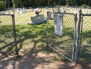
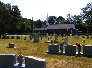
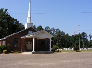
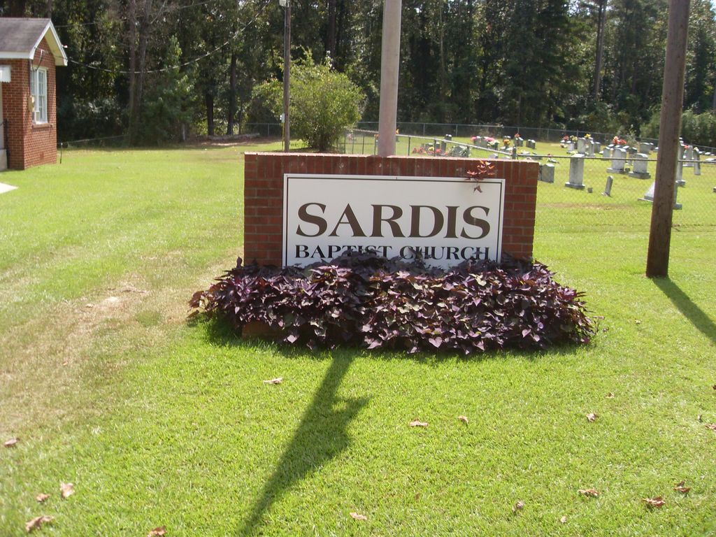
Sardis Baptist Cemetery is located at 1945 SRC 514 Smith County ,Mississippi , 39117USA.
-
Sardis Baptist Cemetery cemetery's updated grave count on graveviews.com?
0 memorials
-
Where are the coordinates of the Sardis Baptist Cemetery?
Latitude: 32.1202100
Longitude: -89.6486300

Nearby Cemetories:
1. Steve Hughes Cemetery
Smith County, USA
Coordinate: 32.1073600, -89.6344000
2. Moulder Cemetery
Smith County, USA
Coordinate: 32.1239014, -89.6007996
3. Terry Cemetery
Raleigh, Smith County, USA
Coordinate: 32.0918800, -89.6831100
4. Moss Cemetery
Smith County, USA
Coordinate: 32.1063995, -89.5919037
5. Gordan Cemetery
Raleigh, Smith County, USA
Coordinate: 32.0950012, -89.5935974
6. Boykin Church Cemetery
Raleigh, Smith County, USA
Coordinate: 32.0985177, -89.5898151
7. Oak Grove Church of God Cemetery
Raleigh, Smith County, USA
Coordinate: 32.1742210, -89.6655850
8. White Oak Cemetery
White Oak, Smith County, USA
Coordinate: 32.0712800, -89.6830100
9. Rock Bluff Cemetery
Daniel, Smith County, USA
Coordinate: 32.1251000, -89.7165400
10. James Cemetery
Smith County, USA
Coordinate: 32.1516900, -89.7069400
11. Miley Cemetery
Smith County, USA
Coordinate: 32.0790200, -89.7026900
12. White Oak Cemetery Old
White Oak, Smith County, USA
Coordinate: 32.0692700, -89.6927900
13. New Chapel Cemetery
Smith County, USA
Coordinate: 32.1710100, -89.5944800
14. Zion Cemetery
Smith County, USA
Coordinate: 32.1689700, -89.5918000
15. Myers Cemetery
Raleigh, Smith County, USA
Coordinate: 32.0950012, -89.5730972
16. Derrick Cemetery
Smith County, USA
Coordinate: 32.1484800, -89.5742400
17. Dukes Cemetery
Smith County, USA
Coordinate: 32.0581700, -89.6848700
18. Partridge Cemetery
Smith County, USA
Coordinate: 32.0581700, -89.6848700
19. Sharon Baptist Church Cemetery
Raleigh, Smith County, USA
Coordinate: 32.0909100, -89.5740800
20. Hailes Cemetery
Polkville, Smith County, USA
Coordinate: 32.1911011, -89.6605988
21. Jack Gray Family Cemetery
Polkville, Smith County, USA
Coordinate: 32.1933920, -89.6725290
22. New Prospect Cemetery
Brandon, Rankin County, USA
Coordinate: 32.1574900, -89.7320900
23. Polkville Baptist Church Cemetery
Polkville, Smith County, USA
Coordinate: 32.1917700, -89.6925200
24. Everett Cemetery
Smith County, USA
Coordinate: 32.0643997, -89.7182999