
| Memorials | : | 0 |
| Location | : | Smith County, USA |
| Coordinate | : | 32.1239014, -89.6007996 |
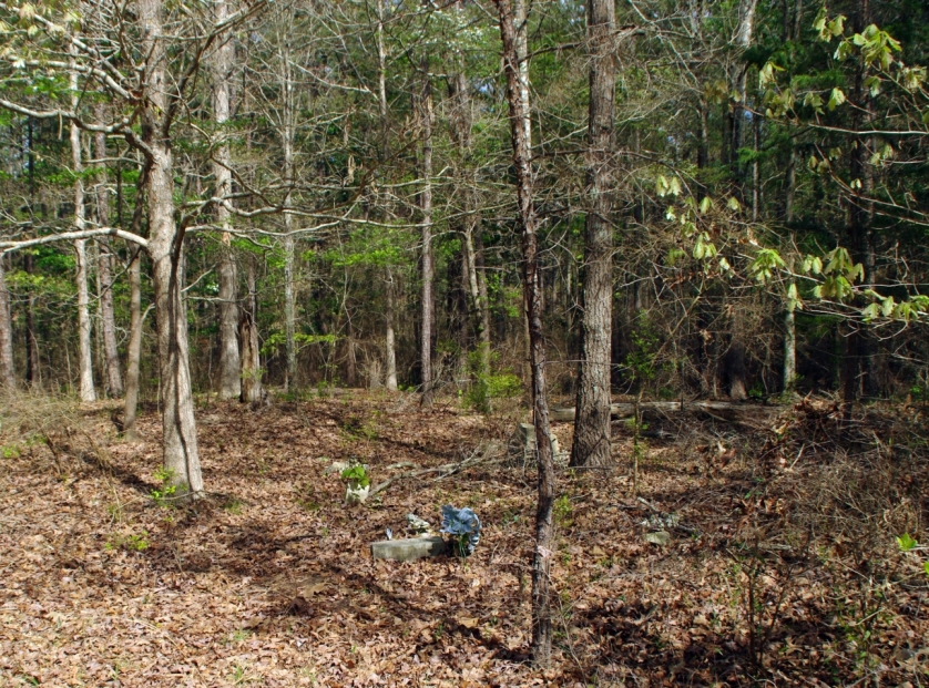
| Description | : | From Raleigh, Mississippi proceed West on Highway 18 for 7.2 miles to the intersection of Smith County Road 503 (SCF 503, also known as "Heater" road.) Turn right (North) and proceed 5.9 miles to the intersection of US Forest Service Road 526 (FSR 526,) and turn right (SouthEast) then continue 1.2 miles, Moulder cemetery will be on the right (East) side of FSR 526, specifically: SW1/4 SE1/4, S5, T3N-R7E, Smith, Raleigh Quadrangle map, USNG: 16S BA 54618 57147. The cemetery is unfenced and no signs exist to mark its location. There appears to be at least three graves, but two... Read More |
frequently asked questions (FAQ):
-
Where is Moulder Cemetery?
Moulder Cemetery is located at US Forest Service Road 526 Smith County ,Mississippi , 39152USA.
-
Moulder Cemetery cemetery's updated grave count on graveviews.com?
0 memorials
-
Where are the coordinates of the Moulder Cemetery?
Latitude: 32.1239014
Longitude: -89.6007996
Nearby Cemetories:
1. Moss Cemetery
Smith County, USA
Coordinate: 32.1063995, -89.5919037
2. Boykin Church Cemetery
Raleigh, Smith County, USA
Coordinate: 32.0985177, -89.5898151
3. Gordan Cemetery
Raleigh, Smith County, USA
Coordinate: 32.0950012, -89.5935974
4. Steve Hughes Cemetery
Smith County, USA
Coordinate: 32.1073600, -89.6344000
5. Derrick Cemetery
Smith County, USA
Coordinate: 32.1484800, -89.5742400
6. Myers Cemetery
Raleigh, Smith County, USA
Coordinate: 32.0950012, -89.5730972
7. Sharon Baptist Church Cemetery
Raleigh, Smith County, USA
Coordinate: 32.0909100, -89.5740800
8. Sardis Baptist Cemetery
Smith County, USA
Coordinate: 32.1202100, -89.6486300
9. Providence Cemetery
Burns, Smith County, USA
Coordinate: 32.1357400, -89.5528600
10. Zion Cemetery
Smith County, USA
Coordinate: 32.1689700, -89.5918000
11. New Chapel Cemetery
Smith County, USA
Coordinate: 32.1710100, -89.5944800
12. Burns United Methodist Church Cemetery
Burns, Smith County, USA
Coordinate: 32.1310501, -89.5399399
13. Barber Cemetery
Raleigh, Smith County, USA
Coordinate: 32.1321810, -89.5385960
14. Burns Baptist Church Cemetery
Raleigh, Smith County, USA
Coordinate: 32.1321880, -89.5384430
15. Page Cemetery
Raleigh, Smith County, USA
Coordinate: 32.0891991, -89.5432968
16. Craft Cemetery
Smith County, USA
Coordinate: 32.0774994, -89.5460968
17. Good Hope Cemetery
Smith County, USA
Coordinate: 32.1613100, -89.5345100
18. Bethel Baptist Church Cemetery
Smith County, USA
Coordinate: 32.1830920, -89.5565660
19. Henderson Family Cemetery
Smith County, USA
Coordinate: 32.1207008, -89.5181122
20. Oak Grove Church of God Cemetery
Raleigh, Smith County, USA
Coordinate: 32.1742210, -89.6655850
21. Austin Cemetery
Shongelo, Smith County, USA
Coordinate: 32.0875015, -89.5233002
22. Terry Cemetery
Raleigh, Smith County, USA
Coordinate: 32.0918800, -89.6831100
23. Roberts Cemetery
Smith County, USA
Coordinate: 32.1968100, -89.5688000
24. Gasque Chapel Cemetery
Smith County, USA
Coordinate: 32.1793540, -89.5297340