
| Memorials | : | 0 |
| Location | : | Bucklebury, West Berkshire Unitary Authority, England |
| Coordinate | : | 51.4442400, -1.2400690 |
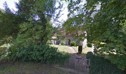
| Description | : | The chapel was built in the 12th century by Geoffrey Martel, Lord of the Manor of Bucklebury, as a chapel of ease to the parish church of Bucklebury. |
frequently asked questions (FAQ):
-
Where is Marlston Chapel?
Marlston Chapel is located at Marlston Road Bucklebury, West Berkshire Unitary Authority ,Berkshire , RG18 9ULEngland.
-
Marlston Chapel cemetery's updated grave count on graveviews.com?
0 memorials
-
Where are the coordinates of the Marlston Chapel?
Latitude: 51.4442400
Longitude: -1.2400690
Nearby Cemetories:
1. Holy Trinity Churchyard
Hermitage, West Berkshire Unitary Authority, England
Coordinate: 51.4578340, -1.2609900
2. St Mary the Virgin Churchyard
Bucklebury, West Berkshire Unitary Authority, England
Coordinate: 51.4341310, -1.2059030
3. Bucklebury Churchyard
Bucklebury, West Berkshire Unitary Authority, England
Coordinate: 51.4163030, -1.2162090
4. St Peter and St Paul Churchyard
Yattendon, West Berkshire Unitary Authority, England
Coordinate: 51.4671669, -1.2036310
5. Thatcham United Reform Church Burial Ground
Thatcham, West Berkshire Unitary Authority, England
Coordinate: 51.4025141, -1.2595003
6. St Mary's
Thatcham, West Berkshire Unitary Authority, England
Coordinate: 51.4017420, -1.2591060
7. Shaw Cemetery
Newbury, West Berkshire Unitary Authority, England
Coordinate: 51.4138160, -1.3106410
8. St Peter Churchyard
Woolhampton, West Berkshire Unitary Authority, England
Coordinate: 51.4053580, -1.1715340
9. Shaw St Marys Churchyard
Newbury, West Berkshire Unitary Authority, England
Coordinate: 51.4116940, -1.3186810
10. Buckhold (Holy Trinity) Churchyard
Pangbourne, West Berkshire Unitary Authority, England
Coordinate: 51.4710470, -1.1438470
11. St Nicolas Churchyard
Newbury, West Berkshire Unitary Authority, England
Coordinate: 51.4009920, -1.3248370
12. St Mary the Virgin Churchyard
Greenham, West Berkshire Unitary Authority, England
Coordinate: 51.3883350, -1.3030280
13. Newbury Friends Burial Ground (Defunct)
Reading Borough, England
Coordinate: 51.3987240, -1.3228830
14. Saint Mary and Saint Nicholas Churchyard
Compton, West Berkshire Unitary Authority, England
Coordinate: 51.5131760, -1.2430860
15. St. Mary the Virgin Churchyard
Aldworth, West Berkshire Unitary Authority, England
Coordinate: 51.5106800, -1.2030150
16. Newtown Road Cemetery
Newbury, West Berkshire Unitary Authority, England
Coordinate: 51.3924300, -1.3252900
17. St. Mary the Virgin Churchyard
Speen, West Berkshire Unitary Authority, England
Coordinate: 51.4076540, -1.3469800
18. Saint Mark's Church
Englefield, West Berkshire Unitary Authority, England
Coordinate: 51.4435960, -1.1036540
19. St Peter Churchyard
Headley, Basingstoke and Deane Borough, England
Coordinate: 51.3601370, -1.2620360
20. St Marys Churchyard
East Ilsley, West Berkshire Unitary Authority, England
Coordinate: 51.5249930, -1.2903250
21. St Mary and St John the Baptist Churchyard
Newtown, Basingstoke and Deane Borough, England
Coordinate: 51.3702000, -1.3169200
22. Isley Baptist Churchyard
East Ilsley, West Berkshire Unitary Authority, England
Coordinate: 51.5270990, -1.2896650
23. St Paul Churchyard
Ashford Hill, Basingstoke and Deane Borough, England
Coordinate: 51.3556440, -1.2120460
24. St John the Baptist
Padworth, West Berkshire Unitary Authority, England
Coordinate: 51.3911075, -1.1198134