
| Memorials | : | 0 |
| Location | : | Marsum, Menaldumadeel Municipality, Netherlands |
| Phone | : | +31 58 253 17 70 |
| Coordinate | : | 53.2108700, 5.7280502 |
frequently asked questions (FAQ):
-
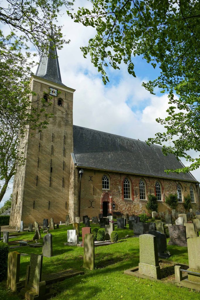
Where is Sint-Pontianustsjerke?
Sint-Pontianustsjerke is located at Buorren 20 Marsum, Menaldumadeel Municipality ,Friesland , 9034 HKNetherlands.
-
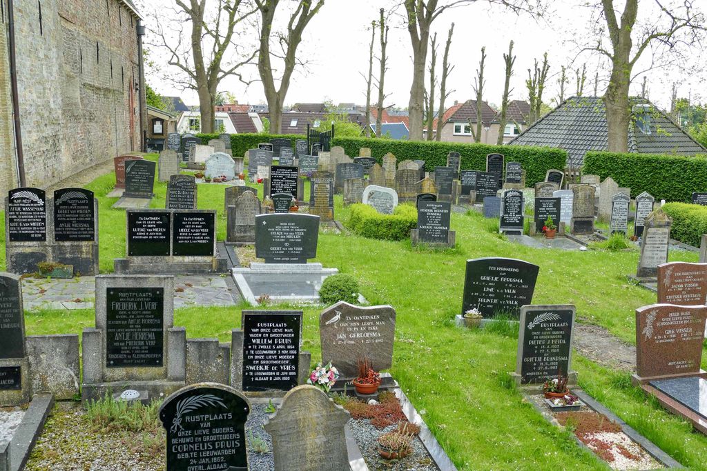
Sint-Pontianustsjerke cemetery's updated grave count on graveviews.com?
0 memorials
-
Where are the coordinates of the Sint-Pontianustsjerke?
Latitude: 53.2108700
Longitude: 5.7280502
Nearby Cemetories:
1. Algemene Rooms-Katholieke Begraafplaats Vitushof
Leeuwarden, Leeuwarden Municipality, Netherlands
Coordinate: 53.2061700, 5.7694100
2. Leeuwarden Noorderbegraafplaats
Leeuwarden, Leeuwarden Municipality, Netherlands
Coordinate: 53.2135900, 5.7733900
3. Joodse begraafplaats
Leeuwarden, Leeuwarden Municipality, Netherlands
Coordinate: 53.2089720, 5.7912400
4. Tsjerkhôf Menaam
Menaam, Menaldumadeel Municipality, Netherlands
Coordinate: 53.2161718, 5.6616600
5. Kerkhof Cornjum
Cornjum, Leeuwarderadeel Municipality, Netherlands
Coordinate: 53.2431266, 5.7825235
6. Kerkhof Salviuskerk / 'd Alde Wite
Dronrijp, Menaldumadeel Municipality, Netherlands
Coordinate: 53.1967232, 5.6435867
7. Stiens Protestant Churchyard
Stiens, Leeuwarderadeel Municipality, Netherlands
Coordinate: 53.2624810, 5.7572899
8. Mariatsjerke
Beers, Littenseradiel Municipality, Netherlands
Coordinate: 53.1558525, 5.7329919
9. Kerkhof Johanneskerk
Britsum, Leeuwarderadeel Municipality, Netherlands
Coordinate: 53.2542998, 5.7855996
10. Lekkum Churchyard
Lekkum, Leeuwarden Municipality, Netherlands
Coordinate: 53.2263300, 5.8194900
11. Agnestsjerke
Goutum, Leeuwarden Municipality, Netherlands
Coordinate: 53.1786867, 5.8068433
12. Dionysiustsjerke
Slappeterp, Menaldumadeel Municipality, Netherlands
Coordinate: 53.2136468, 5.6199275
13. Redbadtsjerke churchyard
Jorwerd, Littenseradiel Municipality, Netherlands
Coordinate: 53.1457503, 5.7113044
14. Stevenskerk kerkhof
Skingen, Menaldumadeel Municipality, Netherlands
Coordinate: 53.2022626, 5.6179534
15. Sint-Vituskerk
Wyns, Tytsjerksteradiel Municipality, Netherlands
Coordinate: 53.2516880, 5.8322860
16. Wirdum Protestant Churchyard
Wirdum, Leeuwarden Municipality, Netherlands
Coordinate: 53.1497300, 5.8036500
17. Algemene Begraafplaats
Vrouwenparochie, Het Bildt Municipality, Netherlands
Coordinate: 53.2849877, 5.6946783
18. Kerkepad Begraafplaats
Wytgaard, Leeuwarden Municipality, Netherlands
Coordinate: 53.1418671, 5.7857350
19. Kerkhof
Baard, Littenseradiel Municipality, Netherlands
Coordinate: 53.1423432, 5.6684373
20. Sint Gertrudistsjerke
Peins, Franekeradeel Municipality, Netherlands
Coordinate: 53.2059212, 5.5950833
21. Walburgatsjerke
Ried, Franekeradeel Municipality, Netherlands
Coordinate: 53.2231866, 5.5900183
22. Schillaard General Cemetery
Schillaard, Littenseradiel Municipality, Netherlands
Coordinate: 53.1237600, 5.7074600
23. Minnertsga Kerkhof
Minnertsga, Het Bildt Municipality, Netherlands
Coordinate: 53.2512016, 5.5942001
24. Sint Jacobiparochie General Cemetery
Sint Jacobiparochie, Het Bildt Municipality, Netherlands
Coordinate: 53.2684100, 5.6041100