
| Memorials | : | 0 |
| Location | : | Beers, Littenseradiel Municipality, Netherlands |
| Coordinate | : | 53.1558525, 5.7329919 |
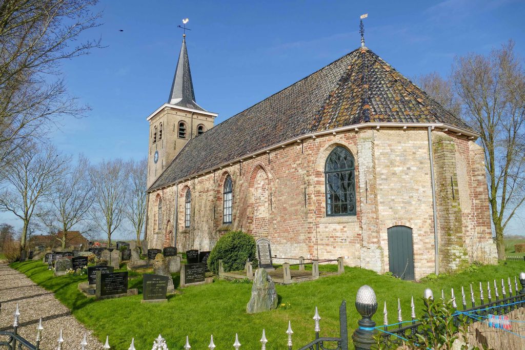
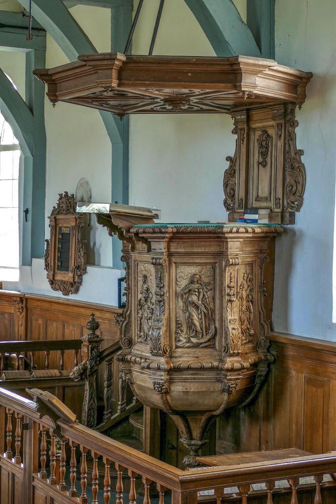
| Description | : | St Mary's Church of Bears stands on a mound with a wrought-iron gated cemetery. The church's original gable-roof tower was replaced in 1857 by a tower of small yellow bricks and a constricted spire. The nave dates from the thirteenth century and the choir from the fourteenth century. The eighteenth-century furniture is very fine. Highlights are the baptismal garden with baptismal basin and the beautifully carved pulpit from 1759. The wood carvings on the pulpit were made by master sculptor and woodcarver Eylardus Albartus Swalue from Leeuwarden. He was probably commissioned partly through the hands of his distant cousin Eelco Alta,... Read More |
frequently asked questions (FAQ):
-
Where is Mariatsjerke?
Mariatsjerke is located at Tsjerkepaad 3 Beers, Littenseradiel Municipality ,Friesland , 9025 BMNetherlands.
-
Mariatsjerke cemetery's updated grave count on graveviews.com?
0 memorials
-
Where are the coordinates of the Mariatsjerke?
Latitude: 53.1558525
Longitude: 5.7329919
Nearby Cemetories:
1. Redbadtsjerke churchyard
Jorwerd, Littenseradiel Municipality, Netherlands
Coordinate: 53.1457503, 5.7113044
2. Kerkepad Begraafplaats
Wytgaard, Leeuwarden Municipality, Netherlands
Coordinate: 53.1418671, 5.7857350
3. Schillaard General Cemetery
Schillaard, Littenseradiel Municipality, Netherlands
Coordinate: 53.1237600, 5.7074600
4. Kerkhof
Baard, Littenseradiel Municipality, Netherlands
Coordinate: 53.1423432, 5.6684373
5. Wirdum Protestant Churchyard
Wirdum, Leeuwarden Municipality, Netherlands
Coordinate: 53.1497300, 5.8036500
6. Agnestsjerke
Goutum, Leeuwarden Municipality, Netherlands
Coordinate: 53.1786867, 5.8068433
7. Algemene Rooms-Katholieke Begraafplaats Vitushof
Leeuwarden, Leeuwarden Municipality, Netherlands
Coordinate: 53.2061700, 5.7694100
8. Sint-Pontianustsjerke
Marsum, Menaldumadeel Municipality, Netherlands
Coordinate: 53.2108700, 5.7280502
9. Leeuwarden Noorderbegraafplaats
Leeuwarden, Leeuwarden Municipality, Netherlands
Coordinate: 53.2135900, 5.7733900
10. Joodse begraafplaats
Leeuwarden, Leeuwarden Municipality, Netherlands
Coordinate: 53.2089720, 5.7912400
11. Kerkhof Salviuskerk / 'd Alde Wite
Dronrijp, Menaldumadeel Municipality, Netherlands
Coordinate: 53.1967232, 5.6435867
12. Sint-MartinusKerk
Sudwest Fryslan Municipality, Netherlands
Coordinate: 53.0900008, 5.6961870
13. Tsjerkhôf Menaam
Menaam, Menaldumadeel Municipality, Netherlands
Coordinate: 53.2161718, 5.6616600
14. Stevenskerk kerkhof
Skingen, Menaldumadeel Municipality, Netherlands
Coordinate: 53.2022626, 5.6179534
15. Rooms-Katholiek Kerkhof Jirnsum
Jirnsum, Leeuwarden Municipality, Netherlands
Coordinate: 53.0815796, 5.7954741
16. Grouw Begraafplaats
Grou, Leeuwarden Municipality, Netherlands
Coordinate: 53.0943700, 5.8365700
17. Lekkum Churchyard
Lekkum, Leeuwarden Municipality, Netherlands
Coordinate: 53.2263300, 5.8194900
18. Dionysiustsjerke
Slappeterp, Menaldumadeel Municipality, Netherlands
Coordinate: 53.2136468, 5.6199275
19. Kerkhof Cornjum
Cornjum, Leeuwarderadeel Municipality, Netherlands
Coordinate: 53.2431266, 5.7825235
20. Wartena General Cemetery
Wartena, Leeuwarden Municipality, Netherlands
Coordinate: 53.1489700, 5.8919100
21. Sint Gertrudistsjerke
Peins, Franekeradeel Municipality, Netherlands
Coordinate: 53.2059212, 5.5950833
22. Kerkhof Hervormde Kerk Wartena
Wartena, Leeuwarden Municipality, Netherlands
Coordinate: 53.1495985, 5.8972222
23. Johanneskerk - Protestantse Gemeente Tzum
Tzum, Franekeradeel Municipality, Netherlands
Coordinate: 53.1589801, 5.5629124
24. Kerkhof Johanneskerk
Britsum, Leeuwarderadeel Municipality, Netherlands
Coordinate: 53.2542998, 5.7855996