
| Memorials | : | 0 |
| Location | : | Jones Springs, Berkeley County, USA |
| Coordinate | : | 39.2912590, -78.0344780 |
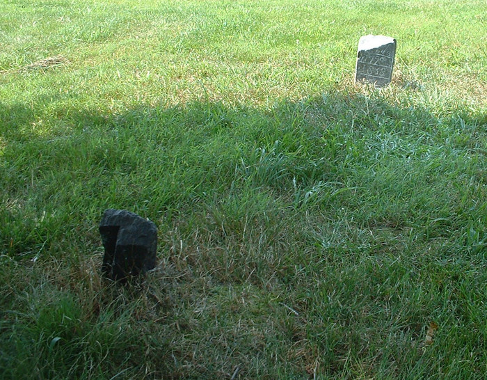
| Description | : | This small farm cemetery is located on the property at 2697 Swinging Bridge Road in Back Creek Valley near Jones Spring in Berkeley Co., West Virginia. The first burial here is that of Jacob Snider who died in 1790. Jacob's grave marker and Rev War marker are the only existing evidence of this cemetery. Jacob's son Abraham obtained the land and lived on it until he died in 1845. During that 55 year span Abraham had two wives that died including at least one daughter. It is believed that they may also lie there in an... Read More |
frequently asked questions (FAQ):
-
Where is Snider Cemetery?
Snider Cemetery is located at 2697 Swinging Bridge Road Jones Springs, Berkeley County ,West Virginia , 25427USA.
-
Snider Cemetery cemetery's updated grave count on graveviews.com?
0 memorials
-
Where are the coordinates of the Snider Cemetery?
Latitude: 39.2912590
Longitude: -78.0344780

Nearby Cemetories:
1. Paynes Chapel Cemetery
Bunker Hill, Berkeley County, USA
Coordinate: 39.2897700, -78.0539900
2. Grace Bible Fellowship Cemetery
Clear Brook, Frederick County, USA
Coordinate: 39.2643747, -78.0620388
3. Rest United Methodist Church Cemetery
Rest, Frederick County, USA
Coordinate: 39.2919006, -78.0820999
4. Weaver Family Cemetery
Middleway, Jefferson County, USA
Coordinate: 39.2981410, -77.9846050
5. Watson Graveyard
Middleway, Jefferson County, USA
Coordinate: 39.3019000, -77.9822250
6. Union Church Cemetery
Middleway, Jefferson County, USA
Coordinate: 39.3041560, -77.9817900
7. Mount Tabor Church Cemetery
Bunker Hill, Berkeley County, USA
Coordinate: 39.3317032, -78.0534286
8. Grace Episcopal Church Cemetery
Middleway, Jefferson County, USA
Coordinate: 39.3035011, -77.9806976
9. Mountain View Church of the Brethren Cemetery
Inwood, Berkeley County, USA
Coordinate: 39.3320600, -78.0146000
10. Brucetown United Methodist Church Cemetery
Clear Brook, Frederick County, USA
Coordinate: 39.2524986, -78.0606003
11. Middleway Masonic Cemetery
Middleway, Jefferson County, USA
Coordinate: 39.3035860, -77.9800060
12. Priestfield Pastoral Center Cemetery
Middleway, Jefferson County, USA
Coordinate: 39.3185143, -77.9886678
13. Jabbers Hill Cemetery
Clear Brook, Frederick County, USA
Coordinate: 39.2472000, -78.0505981
14. Bunker Hill Cemetery
Bunker Hill, Berkeley County, USA
Coordinate: 39.3339005, -78.0585022
15. Prosperity Baptist Church Cemetery
Summit Point, Jefferson County, USA
Coordinate: 39.2387730, -77.9843590
16. Cedar Grove Christian Church Cemetery
Inwood, Berkeley County, USA
Coordinate: 39.3476900, -77.9884700
17. Stones Chapel Cemetery
Clarke County, USA
Coordinate: 39.2261009, -78.0105972
18. Fox Middleway Cemetery Lot
Kearneysville, Jefferson County, USA
Coordinate: 39.3225720, -77.9562790
19. Jamestown Cemetery
Summit Point, Jefferson County, USA
Coordinate: 39.2346800, -77.9842300
20. Hopewell Friends Burial Ground
Clear Brook, Frederick County, USA
Coordinate: 39.2564011, -78.1147003
21. Saint Leo Cemetery
Inwood, Berkeley County, USA
Coordinate: 39.3541985, -77.9876022
22. Mount Zion A.M.E. Church Cemetery
Mount Pleasant, Jefferson County, USA
Coordinate: 39.2575322, -77.9485543
23. Weidman - Suver Cemetery
Bunker Hill, Berkeley County, USA
Coordinate: 39.3335340, -78.1162690
24. Bullskin Presbyterian Churchyard
Summit Point, Jefferson County, USA
Coordinate: 39.2372940, -77.9578650