
| Memorials | : | 18 |
| Location | : | Friendship, Crockett County, USA |
| Coordinate | : | 35.9363540, -89.2006050 |
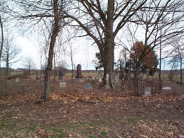
| Description | : | From the intersection of Friendship Eaton Rd. & Depot St, in Friendship, travel east on Friendship Eaton Rd. for 1.5 mi., turning north (left) onto Parks Rd., going 1.2 mi.; turning east (right) onto Mays Cemetery Rd., going 0.4 mi. to this 'deeded' cemetery adjacent to the south (right) side of the road, as notated on USGS topo maps. The old Mays Chapel Methodist-Episcopal Church was located just beyond and adjacent to the cemetery on the right. The old church building was abandoned in the 20's or 30's, when the church merged with Elizabeth Methodist Church. |
frequently asked questions (FAQ):
-
Where is Mays Chapel Cemetery?
Mays Chapel Cemetery is located at Mays Cemetery Road Friendship, Crockett County ,Tennessee ,USA.
-
Mays Chapel Cemetery cemetery's updated grave count on graveviews.com?
17 memorials
-
Where are the coordinates of the Mays Chapel Cemetery?
Latitude: 35.9363540
Longitude: -89.2006050
Nearby Cemetories:
1. Deaton Cemetery
Friendship, Crockett County, USA
Coordinate: 35.9350080, -89.2122640
2. Edwards Cemetery
Friendship, Crockett County, USA
Coordinate: 35.9314120, -89.2146810
3. Williams Chapel Baptist Church Cemetery
Friendship, Crockett County, USA
Coordinate: 35.9258940, -89.1916320
4. Hendrix Cemetery
Tigrett, Dyer County, USA
Coordinate: 35.9511500, -89.2206950
5. Allen Chapel Cemetery
Tigrett, Dyer County, USA
Coordinate: 35.9511400, -89.2207500
6. Mount Zion Cemetery
Friendship, Crockett County, USA
Coordinate: 35.9131950, -89.2032590
7. Bowen Chapel Cemetery
Friendship, Dyer County, USA
Coordinate: 35.9311810, -89.2353720
8. Elizabeth Methodist Church Cemetery
Elizabeth, Crockett County, USA
Coordinate: 35.9605010, -89.1770140
9. Young & Williams Cemetery
Elizabeth, Crockett County, USA
Coordinate: 35.9707990, -89.1937240
10. Bethesda Cemetery
Wilcox, Crockett County, USA
Coordinate: 35.9361230, -89.1557970
11. Friendship Cemetery
Friendship, Crockett County, USA
Coordinate: 35.9146430, -89.2381450
12. Sanders Cemetery
Crockett Mills, Crockett County, USA
Coordinate: 35.9096750, -89.1609030
13. Bellevernon Cemetery
Friendship, Crockett County, USA
Coordinate: 35.9135830, -89.2495910
14. Saint Peter Cemetery
Tigrett, Dyer County, USA
Coordinate: 35.9616440, -89.2520140
15. Warren Cemetery
Crockett Mills, Crockett County, USA
Coordinate: 35.9074790, -89.1521770
16. McGary Family Cemetery
Tigrett, Dyer County, USA
Coordinate: 35.9649530, -89.2501520
17. Old Dyer Church Cemetery
Friendship, Crockett County, USA
Coordinate: 35.8844600, -89.2101900
18. Old Mayfield Cemetery
Eaton, Gibson County, USA
Coordinate: 35.9894960, -89.1666780
19. Mayfield Cemetery
Eaton, Gibson County, USA
Coordinate: 35.9910230, -89.1678300
20. Mount Moriah Cemetery
Friendship, Crockett County, USA
Coordinate: 35.8955420, -89.2576300
21. Providence Baptist Church Cemetery
Crockett Mills, Crockett County, USA
Coordinate: 35.8839830, -89.1595080
22. Mose M. Thompson Cemetery
Friendship, Dyer County, USA
Coordinate: 35.9243680, -89.2765870
23. Hardin Cemetery
Friendship, Dyer County, USA
Coordinate: 35.9243270, -89.2766430
24. Jones Cemetery
Tigrett, Dyer County, USA
Coordinate: 35.9552230, -89.2747450