
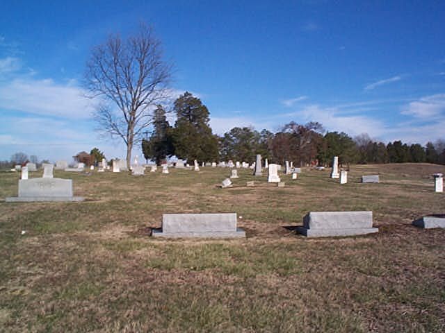
| Memorials | : | 10 |
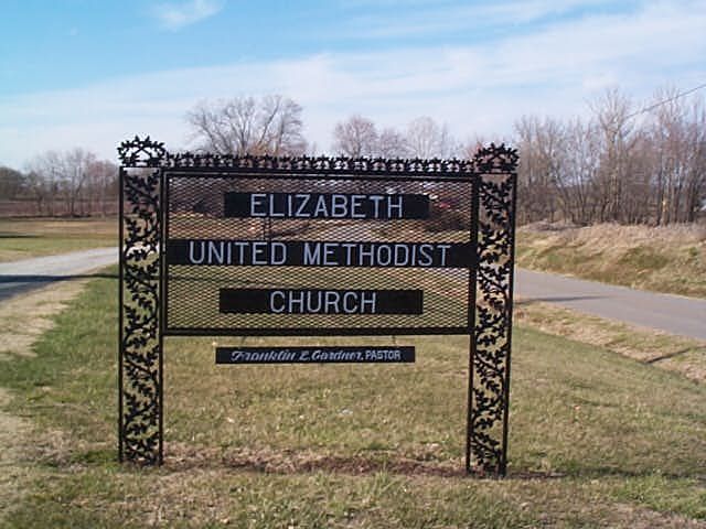
| Location | : | Elizabeth, Crockett County, USA |
| Coordinate | : | 35.9605010, -89.1770140 |
| Description | : | From the intersection of Elizabeth Rd. & TN-188 S, near the county line with Gibson Co., travel northwest on Elizabeth Rd. for 1.6 mi. turning south (left) into the parking lot of the Elizabeth Methodist Church & to their adjoining cemetery to the south, as notated on USGS topo maps. |
frequently asked questions (FAQ):
-
Where is Elizabeth Methodist Church Cemetery?
Elizabeth Methodist Church Cemetery is located at 1609 Elizabeth Road Elizabeth, Crockett County ,Tennessee ,USA.
-
Elizabeth Methodist Church Cemetery cemetery's updated grave count on graveviews.com?
10 memorials
-
Where are the coordinates of the Elizabeth Methodist Church Cemetery?
Latitude: 35.9605010
Longitude: -89.1770140
Nearby Cemetories:
1. Young & Williams Cemetery
Elizabeth, Crockett County, USA
Coordinate: 35.9707990, -89.1937240
2. Bethesda Cemetery
Wilcox, Crockett County, USA
Coordinate: 35.9361230, -89.1557970
3. Old Mayfield Cemetery
Eaton, Gibson County, USA
Coordinate: 35.9894960, -89.1666780
4. Mays Chapel Cemetery
Friendship, Crockett County, USA
Coordinate: 35.9363540, -89.2006050
5. Mayfield Cemetery
Eaton, Gibson County, USA
Coordinate: 35.9910230, -89.1678300
6. Hendrix Cemetery
Tigrett, Dyer County, USA
Coordinate: 35.9511500, -89.2206950
7. Williams Chapel Baptist Church Cemetery
Friendship, Crockett County, USA
Coordinate: 35.9258940, -89.1916320
8. Allen Chapel Cemetery
Tigrett, Dyer County, USA
Coordinate: 35.9511400, -89.2207500
9. Deaton Cemetery
Friendship, Crockett County, USA
Coordinate: 35.9350080, -89.2122640
10. Edwards Cemetery
Friendship, Crockett County, USA
Coordinate: 35.9314120, -89.2146810
11. Spring Hill Baptist Church Cemetery
Eaton, Gibson County, USA
Coordinate: 35.9859520, -89.1221080
12. Mount Zion Cemetery
Friendship, Crockett County, USA
Coordinate: 35.9131950, -89.2032590
13. Sanders Cemetery
Crockett Mills, Crockett County, USA
Coordinate: 35.9096750, -89.1609030
14. Springhill MB Church Cemetery
Eaton, Gibson County, USA
Coordinate: 35.9871860, -89.1210420
15. Bowen Chapel Cemetery
Friendship, Dyer County, USA
Coordinate: 35.9311810, -89.2353720
16. Warren Cemetery
Crockett Mills, Crockett County, USA
Coordinate: 35.9074790, -89.1521770
17. McGary Family Cemetery
Tigrett, Dyer County, USA
Coordinate: 35.9649530, -89.2501520
18. Saint Peter Cemetery
Tigrett, Dyer County, USA
Coordinate: 35.9616440, -89.2520140
19. Wilson Cemetery
Gibson County, USA
Coordinate: 35.9706001, -89.0980988
20. Friendship Cemetery
Friendship, Crockett County, USA
Coordinate: 35.9146430, -89.2381450
21. Bellevernon Cemetery
Friendship, Crockett County, USA
Coordinate: 35.9135830, -89.2495910
22. Providence Baptist Church Cemetery
Crockett Mills, Crockett County, USA
Coordinate: 35.8839830, -89.1595080
23. Asprey Cemetery
Crockett Mills, Crockett County, USA
Coordinate: 35.8844990, -89.1532570
24. Lanier Cemetery
Crockett Mills, Crockett County, USA
Coordinate: 35.8852830, -89.1465090