
| Memorials | : | 0 |
| Location | : | Woolaston, Forest of Dean District, England |
| Coordinate | : | 51.6912000, -2.5982900 |
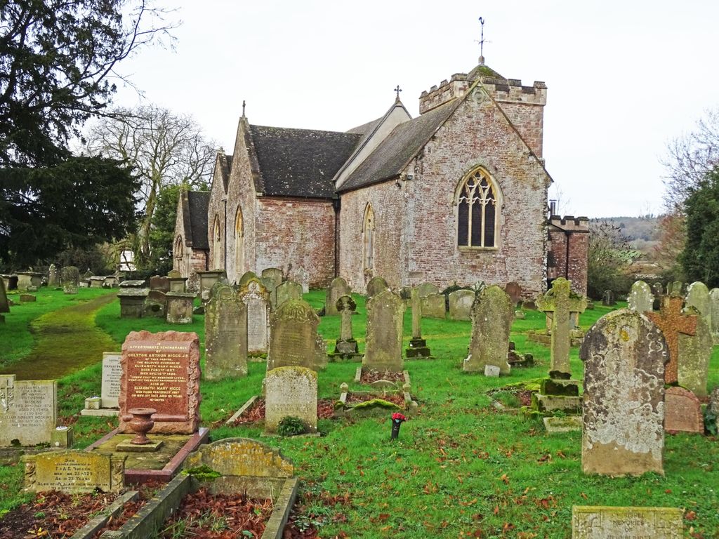
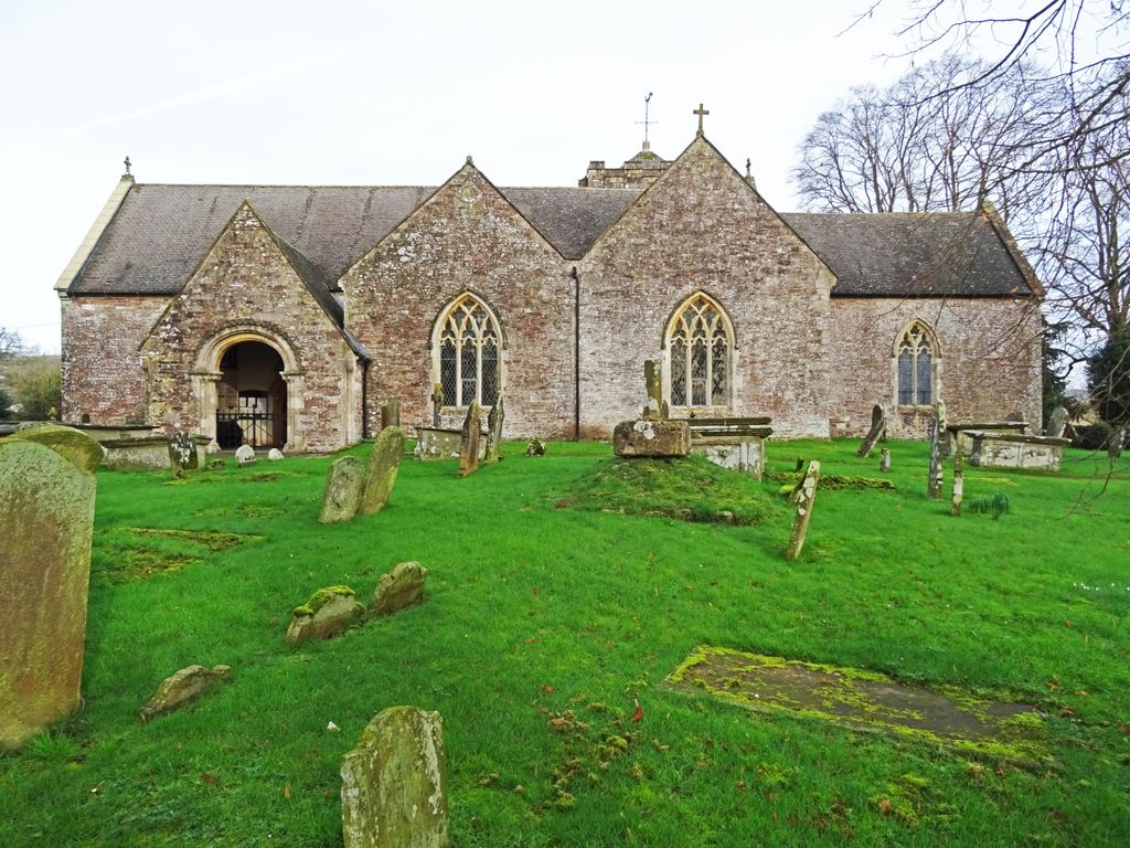
| Description | : | Woolaston is a rural parish in gently sloping farmland rising from the north bank of the River Severn in the west of Gloucestershire. It is on the western edge of the Forest of Dean and close to the Wye Valley on the A48 road between Chepstow and Lydney. It is approximately 5 miles from the Welsh border at Chepstow. St. Andrew's parish church at Woolaston is about a mile south west of Netherend along the A48 towards Chepstow. Church Lane is just off A48 behind Peters Cross car park/picnic site. The earliest record of its existence is in 1131.... Read More |
frequently asked questions (FAQ):
-
Where is St. Andrew's Churchyard?
St. Andrew's Churchyard is located at Church Lane Woolaston, Forest of Dean District ,Gloucestershire , GL15 6PREngland.
-
St. Andrew's Churchyard cemetery's updated grave count on graveviews.com?
0 memorials
-
Where are the coordinates of the St. Andrew's Churchyard?
Latitude: 51.6912000
Longitude: -2.5982900

Nearby Cemetories:
1. St. Andrew's Churchyard
Alvington, Forest of Dean District, England
Coordinate: 51.7033900, -2.5754460
2. St Michael & All Angels Churchyard
Tidenham Chase, Forest of Dean District, England
Coordinate: 51.6862323, -2.6432188
3. St. Mary and St. Peter Churchyard
Tidenham Chase, Forest of Dean District, England
Coordinate: 51.6601690, -2.6434850
4. Lydney Cemetery
Lydney, Forest of Dean District, England
Coordinate: 51.7189747, -2.5338209
5. St. Mary the Virgin Churchyard
Lydney, Forest of Dean District, England
Coordinate: 51.7202430, -2.5326060
6. St. Mary the Virgin Churchyard
St Briavels, Forest of Dean District, England
Coordinate: 51.7388290, -2.6405550
7. St. Luke's Churchyard
Tutshill, Forest of Dean District, England
Coordinate: 51.6544740, -2.6660020
8. St. James' Churchyard
Bream, Forest of Dean District, England
Coordinate: 51.7468630, -2.5795910
9. Clearwell Cemetery Chapel
Clearwell, Forest of Dean District, England
Coordinate: 51.7685400, -2.6167800
10. St. John the Evangelist Churchyard
Beachley, Forest of Dean District, England
Coordinate: 51.6184750, -2.6505640
11. Beachley Barracks Military Cemetery
Beachley, Forest of Dean District, England
Coordinate: 51.6185000, -2.6512000
12. St Paul's Churchyard
Parkend, Forest of Dean District, England
Coordinate: 51.7659090, -2.5521630
13. St Oswald Churchyard
Rockhampton, South Gloucestershire Unitary Authority, England
Coordinate: 51.6374200, -2.5003500
14. Berkeley Cemetery
Berkeley, Stroud District, England
Coordinate: 51.6946845, -2.4601617
15. St. Mary the Virgin Churchyard
Berkeley, Stroud District, England
Coordinate: 51.6890940, -2.4576150
16. St Mary the Virgin Parish Churchyard
Thornbury, South Gloucestershire Unitary Authority, England
Coordinate: 51.6132330, -2.5300090
17. All Saints Churchyard
Viney Hill, Forest of Dean District, England
Coordinate: 51.7569980, -2.5017310
18. Thornbury Cemetery
Thornbury, South Gloucestershire Unitary Authority, England
Coordinate: 51.6099460, -2.5323000
19. St. John's Churchyard
Aust, South Gloucestershire Unitary Authority, England
Coordinate: 51.5991080, -2.6186160
20. All Saints Churchyard
Stone, Stroud District, England
Coordinate: 51.6566800, -2.4575600
21. All Saints Churchyard
Newland, Forest of Dean District, England
Coordinate: 51.7825990, -2.6499310
22. Mount Pleasant Chapel
Wotton-under-Edge, Stroud District, England
Coordinate: 51.6331000, -2.4610000
23. All Saints Churchyard
Blakeney, Forest of Dean District, England
Coordinate: 51.7615380, -2.4765280
24. Coleford Cemetery
Coleford, Forest of Dean District, England
Coordinate: 51.7933080, -2.6245110