
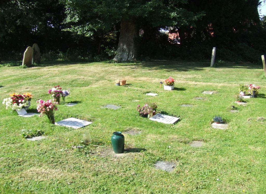
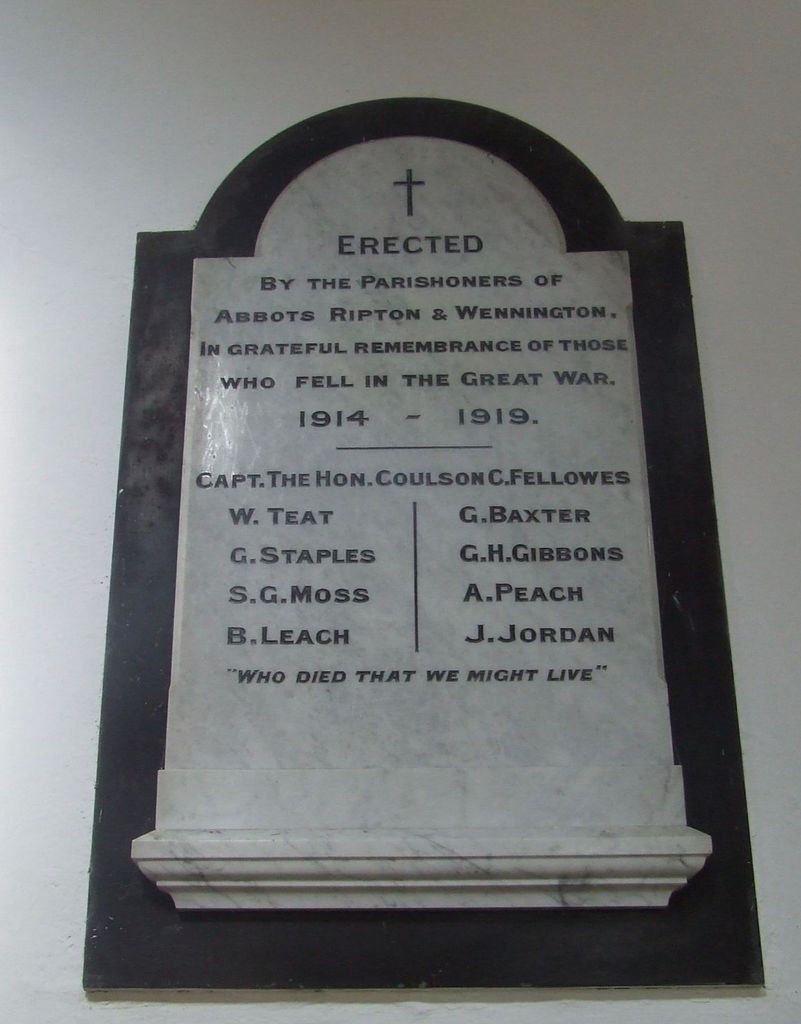
| Memorials | : | 1 |
| Location | : | Abbots Ripton, Huntingdonshire District, England |
| Coordinate | : | 52.3863790, -0.1932260 |
| Description | : | Nearest Post Code:PE28 2PR Abbots Ripton is a village and civil parish in Cambridgeshire, England. It is situated five miles north of Huntingdon, on the B1090. The civil parish includes the nearby hamlet of Wennington. The village is notable as the location of the Abbots Ripton railway disaster in 1876 in which a "Flying Scotsman" train was wrecked during a blizzard. The disaster led to important safety improvements in railway signalling. The village's parish church, dedicated to St Andrew, was built in the second half of the 13th century and was dedicated by the Bishop of Lincoln in 1242. There has been a... Read More |
frequently asked questions (FAQ):
-
Where is St Andrew Churchyard?
St Andrew Churchyard is located at Abbots Ripton, Huntingdonshire District ,Cambridgeshire ,England.
-
St Andrew Churchyard cemetery's updated grave count on graveviews.com?
1 memorials
-
Where are the coordinates of the St Andrew Churchyard?
Latitude: 52.3863790
Longitude: -0.1932260
Nearby Cemetories:
1. St. Martin’s Churchyard
Little Stukeley, Huntingdonshire District, England
Coordinate: 52.3659040, -0.2252790
2. St Peter Churchyard
Kings Ripton, Huntingdonshire District, England
Coordinate: 52.3725600, -0.1487900
3. St Andrew's Churchyard, Wood Walton
Woodwalton, Huntingdonshire District, England
Coordinate: 52.4239863, -0.2235789
4. St. Peter & St. Paul Churchyard
Alconbury, Huntingdonshire District, England
Coordinate: 52.3697800, -0.2610200
5. All Saints Churchyard
Broughton, Huntingdonshire District, England
Coordinate: 52.3842502, -0.1198858
6. Upwood Cemetery
Upwood, Huntingdonshire District, England
Coordinate: 52.4240800, -0.1525400
7. Sawtry Abbey
Sawtry, Huntingdonshire District, England
Coordinate: 52.4270330, -0.2411420
8. St.Margaret Churchyard
Upton, Huntingdonshire District, England
Coordinate: 52.3918700, -0.2753400
9. St. John the Baptist Churchyard
Wistow, Huntingdonshire District, England
Coordinate: 52.4117600, -0.1214880
10. All Saints Churchyard
Huntingdon, Huntingdonshire District, England
Coordinate: 52.3366363, -0.1607257
11. Priory Road Cemetery
Huntingdon, Huntingdonshire District, England
Coordinate: 52.3334320, -0.1796500
12. Primrose Lane Lawn Cemetery
Huntingdonshire District, England
Coordinate: 52.3334666, -0.1760611
13. All Saints Parish Churchyard
Huntingdon, Huntingdonshire District, England
Coordinate: 52.3307170, -0.1849760
14. St Marys Churchyard
Huntingdon, Huntingdonshire District, England
Coordinate: 52.3289548, -0.1799861
15. St Peter's Churchyard
Huntingdonshire District, England
Coordinate: 52.3782650, -0.0914604
16. Godmanchester War Memorial
Godmanchester, Huntingdonshire District, England
Coordinate: 52.3225780, -0.1759580
17. Warboys Church Cemetery
Warboys, Huntingdonshire District, England
Coordinate: 52.3983080, -0.0875820
18. St Mary Magdalene Churchyard
Warboys, Huntingdonshire District, England
Coordinate: 52.4012820, -0.0867350
19. Brampton Cemetery
Brampton, Huntingdonshire District, England
Coordinate: 52.3212480, -0.2177190
20. St Margaret and All Saints Churchyard
Wyton, Huntingdonshire District, England
Coordinate: 52.3335810, -0.1257620
21. St. Mary the Virgin Churchyard
Godmanchester, Huntingdonshire District, England
Coordinate: 52.3202190, -0.1744400
22. Houghton Chapel
Houghton, Huntingdonshire District, England
Coordinate: 52.3322400, -0.1219200
23. St Mary The Virgin
Houghton, Huntingdonshire District, England
Coordinate: 52.3320200, -0.1213200
24. Houghton and Wyton Burial Ground
Wyton, Huntingdonshire District, England
Coordinate: 52.3352100, -0.1135900