
| Memorials | : | 0 |
| Location | : | Sawtry, Huntingdonshire District, England |
| Coordinate | : | 52.4270330, -0.2411420 |
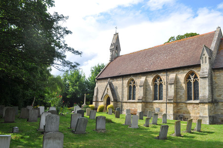
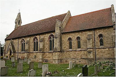
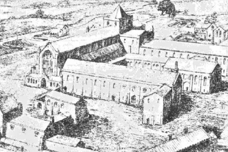
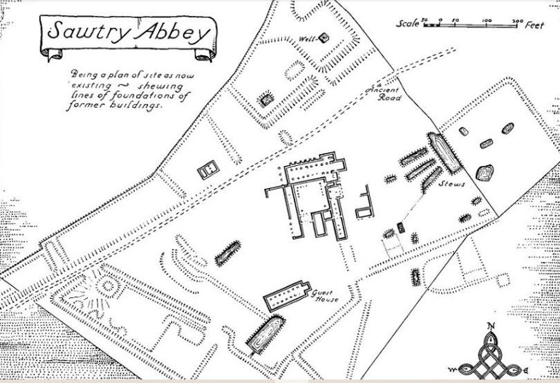
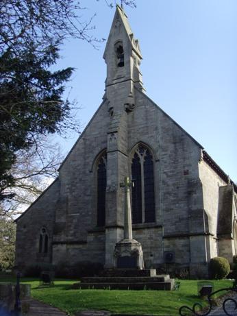
| Description | : | The Abbey of Saint Mary was founded in 1147 by Simon de Senlis, earl of Huntingdon and Northampton whose family descended from William the Conqueror. The abbey was the first house colonised by monks from the abbey of Warden near Bedford. The abbey took 91 years to construct, built of local stone from Barnack. Consecrated in 1238, the abbey never achieved great prominence but it was visited by Kings, and in 1536 Catherine of Aragon's body rested there when her funeral cortege broke its journey from Kimbolton Castle to Peterborough. The abbey was dissolved in 1536 and the buildings were... Read More |
frequently asked questions (FAQ):
-
Where is Sawtry Abbey?
Sawtry Abbey is located at Sawtry, Huntingdonshire District ,Cambridgeshire ,England.
-
Sawtry Abbey cemetery's updated grave count on graveviews.com?
0 memorials
-
Where are the coordinates of the Sawtry Abbey?
Latitude: 52.4270330
Longitude: -0.2411420
Nearby Cemetories:
1. St Andrew's Churchyard, Wood Walton
Woodwalton, Huntingdonshire District, England
Coordinate: 52.4239863, -0.2235789
2. Sawtry St Andrew
Sawtry, Huntingdonshire District, England
Coordinate: 52.4406931, -0.2716515
3. Sawtry All Saints
Sawtry, Huntingdonshire District, England
Coordinate: 52.4410949, -0.2771430
4. All Saints Churchyard
Conington, Huntingdonshire District, England
Coordinate: 52.4581985, -0.2642000
5. St.Margaret Churchyard
Upton, Huntingdonshire District, England
Coordinate: 52.3918700, -0.2753400
6. Holme Cemetery
Holme, Huntingdonshire District, England
Coordinate: 52.4726120, -0.2408410
7. St. Giles' Churchyard
Holme, Huntingdonshire District, England
Coordinate: 52.4767090, -0.2502880
8. St Andrew Churchyard
Abbots Ripton, Huntingdonshire District, England
Coordinate: 52.3863790, -0.1932260
9. St Nicholas Churchyard
Glatton, Huntingdonshire District, England
Coordinate: 52.4607440, -0.3035450
10. Upwood Cemetery
Upwood, Huntingdonshire District, England
Coordinate: 52.4240800, -0.1525400
11. St. Peter & St. Paul Churchyard
Alconbury, Huntingdonshire District, England
Coordinate: 52.3697800, -0.2610200
12. St. Andrew's Churchyard
Steeple Gidding, Huntingdonshire District, England
Coordinate: 52.4184500, -0.3368200
13. All Saints Churchyard
Hamerton, Huntingdonshire District, England
Coordinate: 52.4028700, -0.3308800
14. St. Martin’s Churchyard
Little Stukeley, Huntingdonshire District, England
Coordinate: 52.3659040, -0.2252790
15. All Saints Church
Buckworth, Huntingdonshire District, England
Coordinate: 52.3770200, -0.3147570
16. Stilton Cemetery
Stilton, Huntingdonshire District, England
Coordinate: 52.4895230, -0.2923260
17. Great Gidding Baptist Church Cemetery
Great Gidding, Huntingdonshire District, England
Coordinate: 52.4336468, -0.3575526
18. St. John the Baptist Churchyard
Wistow, Huntingdonshire District, England
Coordinate: 52.4117600, -0.1214880
19. St Peter Churchyard
Kings Ripton, Huntingdonshire District, England
Coordinate: 52.3725600, -0.1487900
20. St. Mary Churchyard
Woolley, Metropolitan Borough of Wakefield, England
Coordinate: 52.3565791, -0.3125185
21. All Saints Churchyard
Broughton, Huntingdonshire District, England
Coordinate: 52.3842502, -0.1198858
22. Saint Peter's Churchyard
Yaxley, Huntingdonshire District, England
Coordinate: 52.5117400, -0.2672200
23. Ramsey Abbey
Ramsey, Huntingdonshire District, England
Coordinate: 52.4483330, -0.1008330
24. Yaxley Cemetery
Peterborough, Peterborough Unitary Authority, England
Coordinate: 52.5137400, -0.2700500