
| Memorials | : | 0 |
| Location | : | Warboys, Huntingdonshire District, England |
| Coordinate | : | 52.3983080, -0.0875820 |
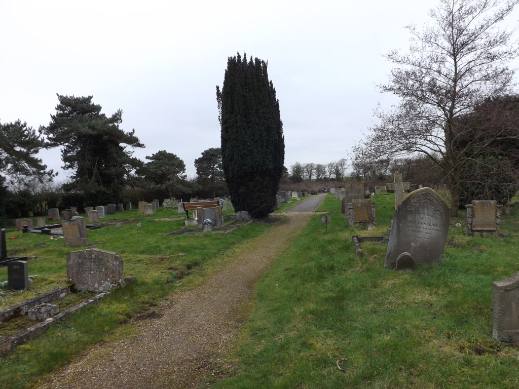
| Description | : | Warboys is a large village and civil parish in Cambridgeshire, England lying approximately 7 miles north-east of Huntingdon, near Ramsey. It is situated within Huntingdonshire which is a non-metropolitan district of Cambridgeshire as well as being a historic county of England. The church cemetery is a considerable distance from the village, just outside the Warboys 'town limit' signs. It is on the right hand side, immediately before 'Gladwins Body Repair Cente'. The cemetery belongs to St. Mary Magdalene Church [formerly the Blessed Mary the Virgin]. The entrance gates were dontaed by members of the Pathfinder Force, Royal Air Force... Read More |
frequently asked questions (FAQ):
-
Where is Warboys Church Cemetery?
Warboys Church Cemetery is located at Warboys, Huntingdonshire District ,Cambridgeshire ,England.
-
Warboys Church Cemetery cemetery's updated grave count on graveviews.com?
0 memorials
-
Where are the coordinates of the Warboys Church Cemetery?
Latitude: 52.3983080
Longitude: -0.0875820

Nearby Cemetories:
1. St Mary Magdalene Churchyard
Warboys, Huntingdonshire District, England
Coordinate: 52.4012820, -0.0867350
2. Warboys Grace Baptist Churchyard
Warboys, Huntingdonshire District, England
Coordinate: 52.4043400, -0.0774800
3. St Peter's Churchyard
Huntingdonshire District, England
Coordinate: 52.3782650, -0.0914604
4. All Saints Churchyard
Broughton, Huntingdonshire District, England
Coordinate: 52.3842502, -0.1198858
5. St. John the Baptist Churchyard
Wistow, Huntingdonshire District, England
Coordinate: 52.4117600, -0.1214880
6. All Saints Churchyard
Pidley, Huntingdonshire District, England
Coordinate: 52.3863792, -0.0513670
7. St Peter Churchyard
Kings Ripton, Huntingdonshire District, England
Coordinate: 52.3725600, -0.1487900
8. Upwood Cemetery
Upwood, Huntingdonshire District, England
Coordinate: 52.4240800, -0.1525400
9. Ramsey Abbey
Ramsey, Huntingdonshire District, England
Coordinate: 52.4483330, -0.1008330
10. Ramsey Road Cemetery
St Ives, Huntingdonshire District, England
Coordinate: 52.3442700, -0.0854900
11. Wood Lane Cemetery
Ramsey, Huntingdonshire District, England
Coordinate: 52.4525800, -0.0994800
12. Houghton and Wyton Burial Ground
Wyton, Huntingdonshire District, England
Coordinate: 52.3352100, -0.1135900
13. Graveyard of St. Helen's Old Church
Colne, Huntingdonshire District, England
Coordinate: 52.3661989, 0.0058234
14. St Andrew Churchyard
Abbots Ripton, Huntingdonshire District, England
Coordinate: 52.3863790, -0.1932260
15. St Margaret and All Saints Churchyard
Wyton, Huntingdonshire District, England
Coordinate: 52.3335810, -0.1257620
16. Houghton Chapel
Houghton, Huntingdonshire District, England
Coordinate: 52.3322400, -0.1219200
17. St Mary The Virgin
Houghton, Huntingdonshire District, England
Coordinate: 52.3320200, -0.1213200
18. St Ives Church Cemetery
St Ives, Huntingdonshire District, England
Coordinate: 52.3287800, -0.0821800
19. St. Ives All Saints Churchyard
St Ives, Huntingdonshire District, England
Coordinate: 52.3265900, -0.0794200
20. All Saints Churchyard
St Ives, Huntingdonshire District, England
Coordinate: 52.3265800, -0.0794490
21. St Ives Public Cemetery
St Ives, Huntingdonshire District, England
Coordinate: 52.3264600, -0.0744300
22. Baptist Church Cemetery
Bluntisham, Huntingdonshire District, England
Coordinate: 52.3525450, 0.0075530
23. All Saints Churchyard
Huntingdon, Huntingdonshire District, England
Coordinate: 52.3366363, -0.1607257
24. St Margaret of Antioch Churchyard
Hemingford Abbots, Huntingdonshire District, England
Coordinate: 52.3237400, -0.1192820