
| Memorials | : | 1 |
| Location | : | Nantwich, Cheshire East Unitary Authority, England |
| Coordinate | : | 53.0671000, -2.5206000 |
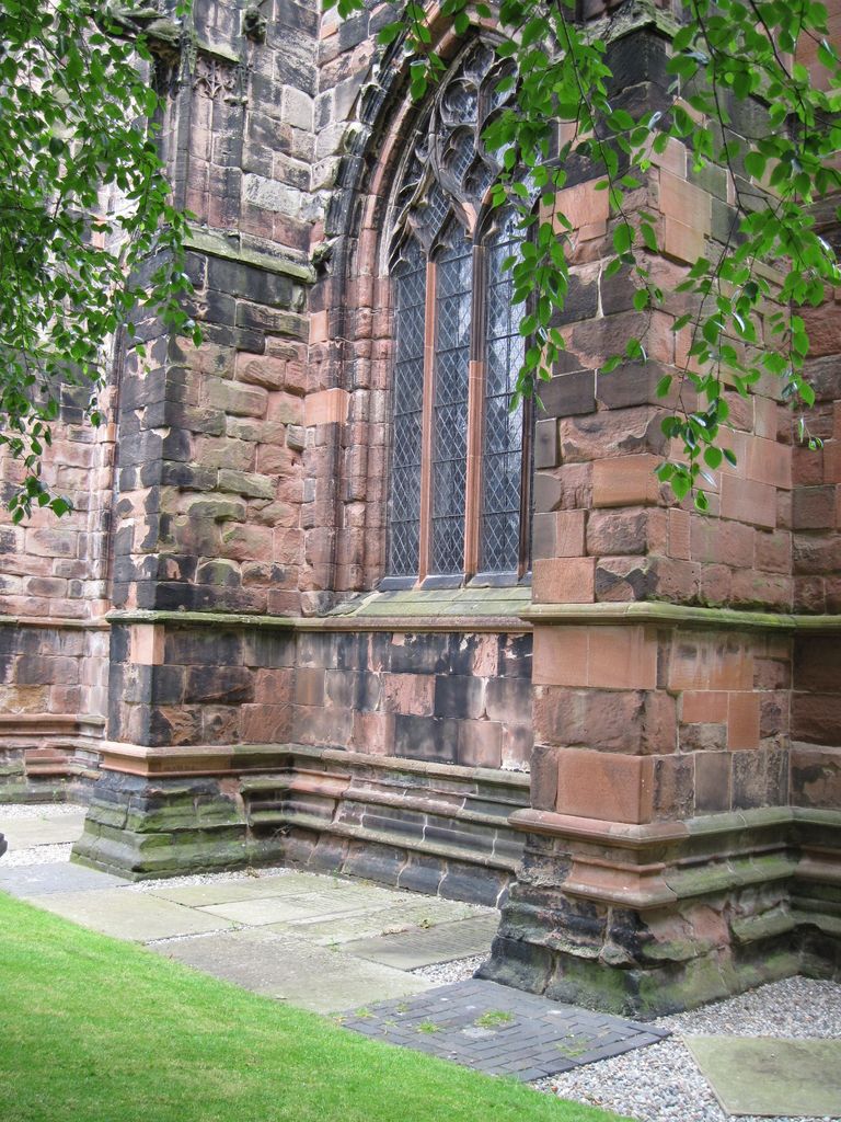
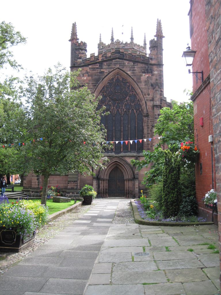
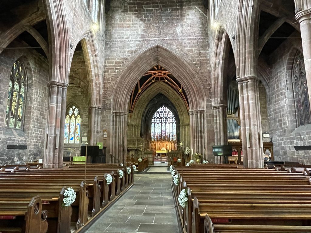
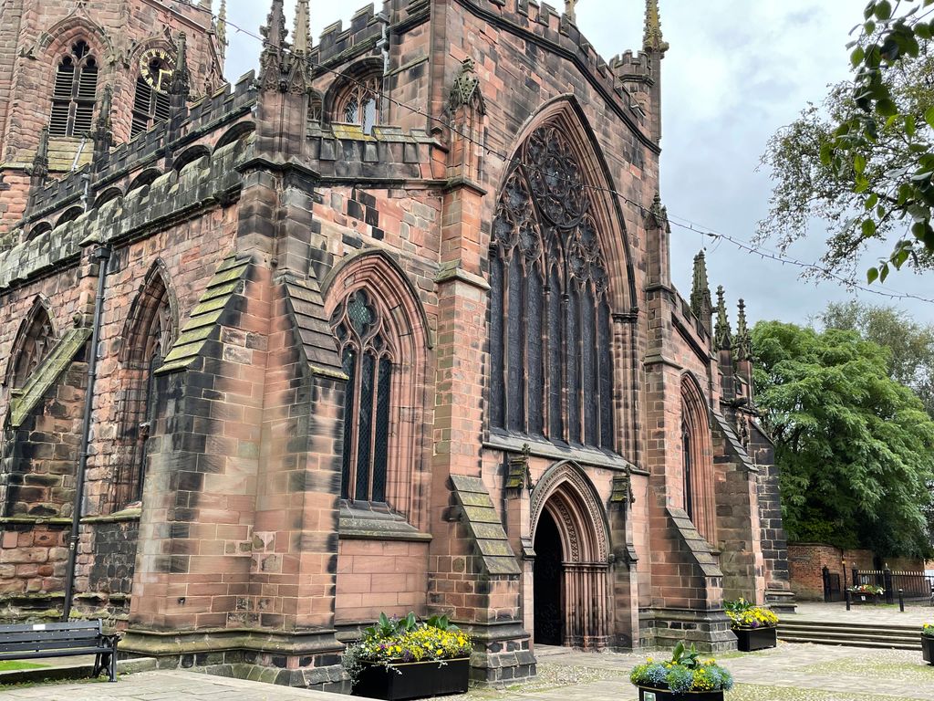
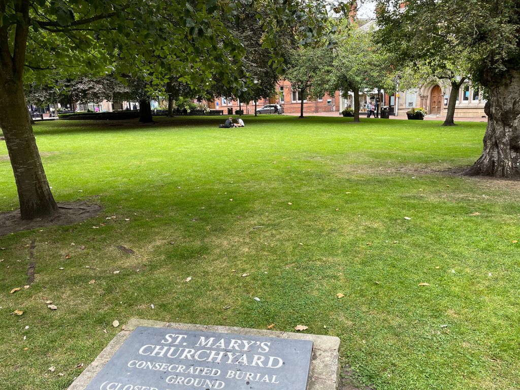
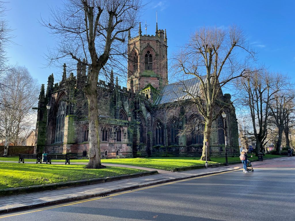
| Description | : | St Mary's Church, Nantwich, is in the centre of the market town of Nantwich, Cheshire, England. The church is designated by English Heritage as a Grade I listed building. It has been called the "Cathedral of South Cheshire" and it is considered by some to be one of the finest medieval churches, not only in Cheshire, but in the whole of England. The building dates from the 14th century, although a number of changes have since been made, particularly a substantial 19th-century restoration by Sir George Gilbert Scott. |
frequently asked questions (FAQ):
-
Where is St Mary's Church?
St Mary's Church is located at Nantwich, Cheshire East Unitary Authority ,Cheshire ,England.
-
St Mary's Church cemetery's updated grave count on graveviews.com?
1 memorials
-
Where are the coordinates of the St Mary's Church?
Latitude: 53.0671000
Longitude: -2.5206000
Nearby Cemetories:
1. Barker Street Chapel Chapelyard
Nantwich, Cheshire East Unitary Authority, England
Coordinate: 53.0658770, -2.5222890
2. Nantwich Quaker Burial Ground (Defunct)
Nantwich, Cheshire East Unitary Authority, England
Coordinate: 53.0645719, -2.5214206
3. Nantwich Cemetery
Nantwich, Cheshire East Unitary Authority, England
Coordinate: 53.0765120, -2.5108130
4. St Mary Churchyard
Acton, Cheshire East Unitary Authority, England
Coordinate: 53.0737140, -2.5511740
5. St Mary's Churchyard
Wistaston, Cheshire East Unitary Authority, England
Coordinate: 53.0790200, -2.4771400
6. St Oswald Churchyard
Worleston, Cheshire East Unitary Authority, England
Coordinate: 53.1072140, -2.5223120
7. Quaker Burial Ground at Stoke Nantwich
Stoke, Cheshire East Unitary Authority, England
Coordinate: 53.0989400, -2.5670000
8. St Michael Churchyard
Baddiley, Cheshire East Unitary Authority, England
Coordinate: 53.0488780, -2.5905830
9. St. Chad Churchyard
Wybunbury, Cheshire East Unitary Authority, England
Coordinate: 53.0452760, -2.4488530
10. Meadow Brook Cemetery
Crewe, Cheshire East Unitary Authority, England
Coordinate: 53.1083460, -2.4690380
11. St. Michael Churchyard
Crewe, Cheshire East Unitary Authority, England
Coordinate: 53.1058200, -2.4475200
12. Crewe Cemetery & Crematorium
Crewe, Cheshire East Unitary Authority, England
Coordinate: 53.1030540, -2.4415159
13. St Margaret Churchyard
Wrenbury-cum-Frith, Cheshire East Unitary Authority, England
Coordinate: 53.0256700, -2.6073340
14. Weston Cemetery
Weston, Cheshire East Unitary Authority, England
Coordinate: 53.0680861, -2.4095799
15. St Peter Churchyard
Minshull Vernon, Cheshire East Unitary Authority, England
Coordinate: 53.1308770, -2.4772320
16. Bateman Memorial Chapel
Chorley, Cheshire East Unitary Authority, England
Coordinate: 53.0549000, -2.6368300
17. St Michael's
Haslington, Cheshire East Unitary Authority, England
Coordinate: 53.0946170, -2.4097820
18. St Bartholomew's Churchyard
Church Minshull, Cheshire East Unitary Authority, England
Coordinate: 53.1414200, -2.5007800
19. St. Matthew's Churchyard
Haslington, Cheshire East Unitary Authority, England
Coordinate: 53.1011010, -2.3933740
20. St. Boniface Churchyard
Bunbury, Cheshire East Unitary Authority, England
Coordinate: 53.1182360, -2.6453990
21. St. Leonard's Churchyard
Warmingham, Cheshire East Unitary Authority, England
Coordinate: 53.1462213, -2.4367574
22. Weaver Methodist Church Cemetery
Winsford, Cheshire West and Chester Unitary Authority, England
Coordinate: 53.1652870, -2.5207080
23. St Margaret Churchyard
Betley, Newcastle-Under-Lyme Borough, England
Coordinate: 53.0328100, -2.3658530
24. Wheelock Heath Baptist Chapelyard
Sandbach, Cheshire East Unitary Authority, England
Coordinate: 53.1132940, -2.3730320