
| Memorials | : | 0 |
| Location | : | North Crawley, Milton Keynes Borough, England |
| Coordinate | : | 52.0924400, -0.6485000 |
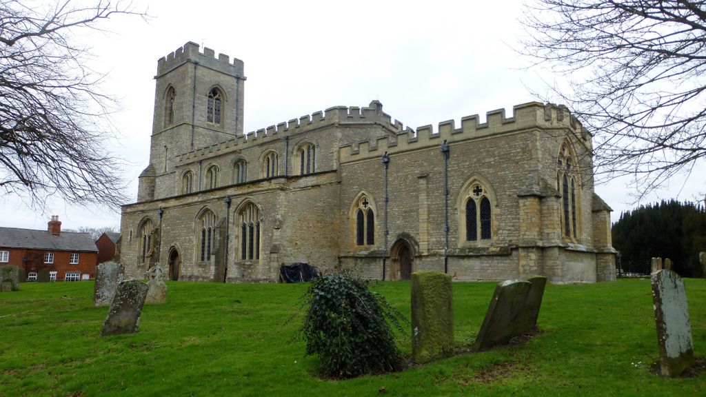
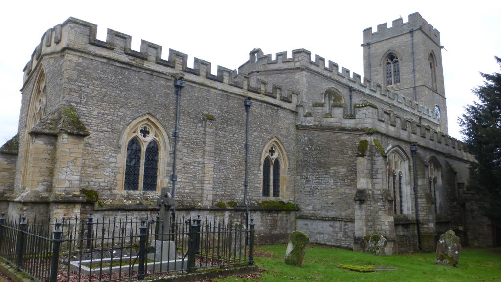
| Description | : | National Grid Reference: SP 927 447 Part of the Diocese of Oxford, St. Firmin's is on the main road through North Crawley, and sits back from the street. In 1197 the area of the village previously known as just 'Crawley' was split into Great Crawley and Little Crawley; Great Crawley was later renamed North Crawley prior to 1398. A handsome structure, this Grade-II listed church is dedicated to St. Firmin, the patron saint of an ancient Cluniac monastery which used to stand here and was recorded in the Domesday Book. The cornerstone is said to have been laid in the year 1200; the chancel... Read More |
frequently asked questions (FAQ):
-
Where is St. Firmin Churchyard?
St. Firmin Churchyard is located at High Street North Crawley, Milton Keynes Borough ,Buckinghamshire , MK16 9LLEngland.
-
St. Firmin Churchyard cemetery's updated grave count on graveviews.com?
0 memorials
-
Where are the coordinates of the St. Firmin Churchyard?
Latitude: 52.0924400
Longitude: -0.6485000
Nearby Cemetories:
1. St Lawrence Churchyard
Chicheley, Milton Keynes Borough, England
Coordinate: 52.1037000, -0.6807000
2. St. Mary's Churchyard
Hardmead, Milton Keynes Borough, England
Coordinate: 52.1196000, -0.6358000
3. Cranfield Friend's Burial Ground
Cranfield, Central Bedfordshire Unitary Authority, England
Coordinate: 52.0820192, -0.5998549
4. Mount Zion Burial Ground
Cranfield, Central Bedfordshire Unitary Authority, England
Coordinate: 52.0703595, -0.6110791
5. Assumption of the Blessed Virgin Mary Churchyard
Moulsoe, Milton Keynes Borough, England
Coordinate: 52.0666500, -0.6790070
6. St. Peter's Churchyard
Astwood, Milton Keynes Borough, England
Coordinate: 52.1164390, -0.6135200
7. St Peter and St Paul Churchyard
Cranfield, Central Bedfordshire Unitary Authority, England
Coordinate: 52.0679750, -0.6071570
8. Cranfield Cemetery
Cranfield, Central Bedfordshire Unitary Authority, England
Coordinate: 52.0683000, -0.6041200
9. St Lauds Churchyard
Sherington, Milton Keynes Borough, England
Coordinate: 52.1122500, -0.7018140
10. Tickford Street Cemetery
Newport Pagnell, Milton Keynes Borough, England
Coordinate: 52.0807670, -0.7121200
11. Newport Pagnell Old Cemetery
Newport Pagnell, Milton Keynes Borough, England
Coordinate: 52.0873930, -0.7186730
12. St. Peter and St. Paul's Churchyard
Newport Pagnell, Milton Keynes Borough, England
Coordinate: 52.0869970, -0.7203080
13. Lathbury Churchyard
Lathbury, Milton Keynes Borough, England
Coordinate: 52.0963900, -0.7247400
14. St. Lawrence's Churchyard
Broughton, Milton Keynes Borough, England
Coordinate: 52.0522000, -0.6980000
15. St. Mary the Virgin Churchyard
Salford, Central Bedfordshire Unitary Authority, England
Coordinate: 52.0424070, -0.6368910
16. Willen Churchyard
Campbell Park, Milton Keynes Borough, England
Coordinate: 52.0624000, -0.7200000
17. St Nicholas Churchyard
Hulcote, Central Bedfordshire Unitary Authority, England
Coordinate: 52.0399000, -0.6246000
18. All Saints Churchyard
Emberton, Milton Keynes Borough, England
Coordinate: 52.1365770, -0.7082700
19. All Saints Churchyard
Milton Keynes, Milton Keynes Borough, England
Coordinate: 52.0438000, -0.7070000
20. St. Nicholas Churchyard
Newton Blossomville, Milton Keynes Borough, England
Coordinate: 52.1546343, -0.6482556
21. St Mary's Churchyard
Clifton Reynes, Milton Keynes Borough, England
Coordinate: 52.1520000, -0.6820000
22. St. Peter's Churchyard
Tyringham, Milton Keynes Borough, England
Coordinate: 52.1119430, -0.7465510
23. St. Leonard's Churchyard
Stagsden, Bedford Borough, England
Coordinate: 52.1313467, -0.5662217
24. St Peter and St Paul Churchyard
Olney, Milton Keynes Borough, England
Coordinate: 52.1498710, -0.7009460