
| Memorials | : | 0 |
| Location | : | New Mills, High Peak Borough, England |
| Coordinate | : | 53.3658550, -1.9940870 |
frequently asked questions (FAQ):
-
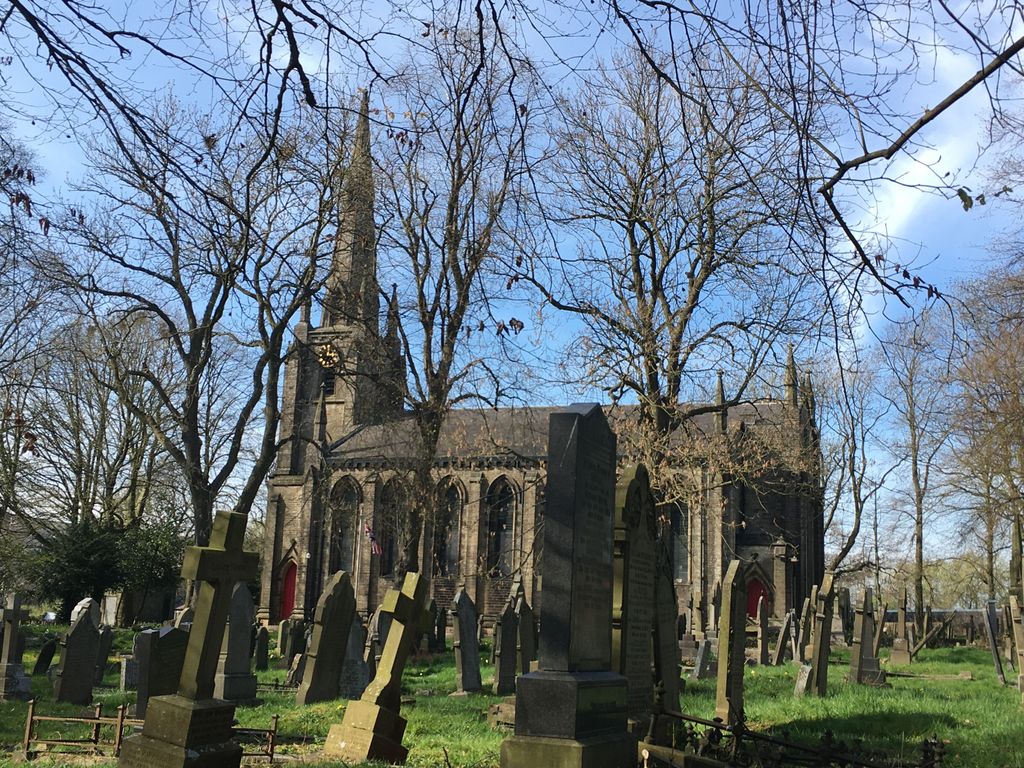
Where is St. George's Churchyard?
St. George's Churchyard is located at New Mills, High Peak Borough ,Derbyshire ,England.
-
St. George's Churchyard cemetery's updated grave count on graveviews.com?
0 memorials
-
Where are the coordinates of the St. George's Churchyard?
Latitude: 53.3658550
Longitude: -1.9940870
Nearby Cemetories:
1. New Mills Wesleyan Cemetery
New Mills, High Peak Borough, England
Coordinate: 53.3693695, -1.9974647
2. Mount Pleasant Methodist Free Chapel
New Mills, High Peak Borough, England
Coordinate: 53.3683310, -2.0012190
3. Church of the Annunciation St Mary's Catholic
New Mills, High Peak Borough, England
Coordinate: 53.3664315, -2.0050768
4. Thornsett Cemetery
New Mills, High Peak Borough, England
Coordinate: 53.3777150, -1.9873620
5. Hayfield Cemetery
Hayfield, High Peak Borough, England
Coordinate: 53.3787660, -1.9527010
6. Saint Mary's Parish Church
Disley, Cheshire East Unitary Authority, England
Coordinate: 53.3574410, -2.0397980
7. St. Matthew's Churchyard
Hayfield, High Peak Borough, England
Coordinate: 53.3794310, -1.9461140
8. St. James Churchyard
Buxworth, High Peak Borough, England
Coordinate: 53.3362500, -1.9688500
9. Primitive Methodist Chapel 1841
Buxworth, High Peak Borough, England
Coordinate: 53.3363378, -1.9667282
10. Buxworth Primitive Methodist Churchyard
Chinley, High Peak Borough, England
Coordinate: 53.3364680, -1.9662910
11. St. Thomas Churchyard
Mellor, Metropolitan Borough of Stockport, England
Coordinate: 53.3970440, -2.0277450
12. All Saints Churchyard
Marple, Metropolitan Borough of Stockport, England
Coordinate: 53.3889850, -2.0597220
13. White Knowle Methodist Chapel
Chinley, High Peak Borough, England
Coordinate: 53.3427389, -1.9242500
14. St. James Churchyard
Whaley Bridge, High Peak Borough, England
Coordinate: 53.3153270, -1.9918840
15. Chinley Independent Chapelyard
Chapel-en-le-Frith, High Peak Borough, England
Coordinate: 53.3349830, -1.9182290
16. Fernilee Methodist Church
Fernilee, High Peak Borough, England
Coordinate: 53.3072690, -1.9752940
17. St Thomas A Beckett Churchyard
Chapel-en-le-Frith, High Peak Borough, England
Coordinate: 53.3243340, -1.9148240
18. Town End Methodist Churchyard
Chapel-en-le-Frith, High Peak Borough, England
Coordinate: 53.3246590, -1.9090850
19. St. Mary's Independent Chapel
Charlesworth, High Peak Borough, England
Coordinate: 53.4317127, -1.9856703
20. St. John the Evangelist Churchyard
Charlesworth, High Peak Borough, England
Coordinate: 53.4327430, -1.9945570
21. Norbury St Thomas Churchyard
Hazel Grove, Metropolitan Borough of Stockport, England
Coordinate: 53.3761440, -2.1160440
22. Saint Chad's Churchyard
Romiley, Metropolitan Borough of Stockport, England
Coordinate: 53.4128520, -2.0896350
23. Hatherlow United Reformed Church Cemetery
Romiley, Metropolitan Borough of Stockport, England
Coordinate: 53.4107180, -2.0989830
24. Saint James Churchyard
Whitfield, High Peak Borough, England
Coordinate: 53.4388640, -1.9529100