
| Memorials | : | 0 |
| Location | : | Whaley Bridge, High Peak Borough, England |
| Coordinate | : | 53.3153270, -1.9918840 |
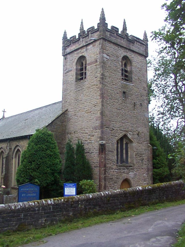
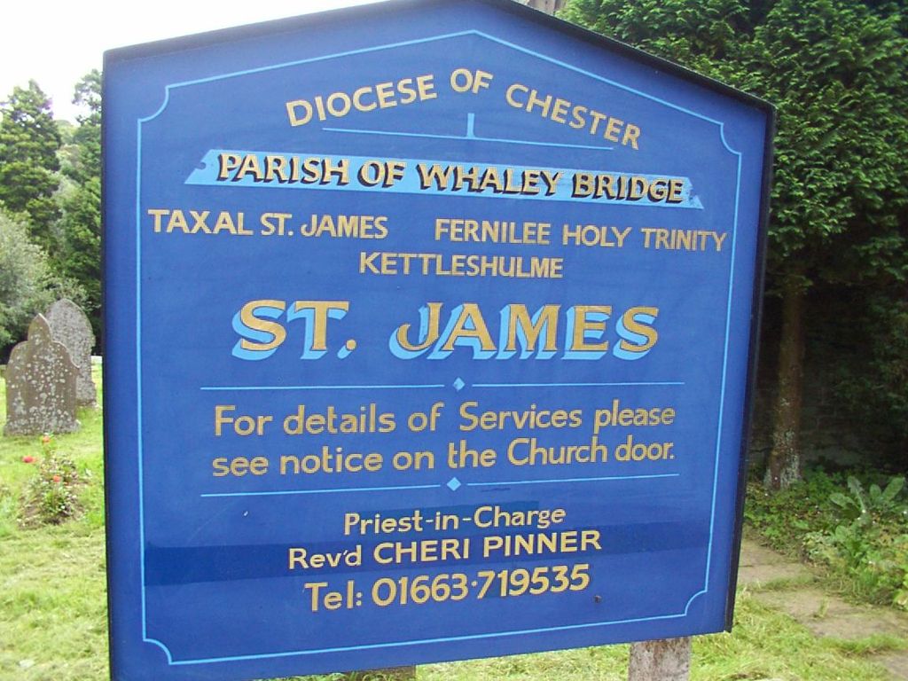
| Description | : | Taxal St James The church stands on a slope above the river Goyt, in the hamlet of Taxal, which is within the Peak District National Park, approximately one mile from Whaley Bridge. There has been a church at Taxal since the 12th century. The first recorded rector was in 1287. Part of the tower is very old and possibly 12th century. The tower has six bells, which are rung every Sunday and for special occasions. The church itself has been enlarged and restored mostly in the 17th and 19th centuries. There are several interesting memorials. Of particular interest is a slate slab on... Read More |
frequently asked questions (FAQ):
-
Where is St. James Churchyard?
St. James Churchyard is located at Taxal Whaley Bridge, High Peak Borough ,Derbyshire , SK23 7DYEngland.
-
St. James Churchyard cemetery's updated grave count on graveviews.com?
0 memorials
-
Where are the coordinates of the St. James Churchyard?
Latitude: 53.3153270
Longitude: -1.9918840
Nearby Cemetories:
1. Fernilee Methodist Church
Fernilee, High Peak Borough, England
Coordinate: 53.3072690, -1.9752940
2. St. James Churchyard
Buxworth, High Peak Borough, England
Coordinate: 53.3362500, -1.9688500
3. Primitive Methodist Chapel 1841
Buxworth, High Peak Borough, England
Coordinate: 53.3363378, -1.9667282
4. Buxworth Primitive Methodist Churchyard
Chinley, High Peak Borough, England
Coordinate: 53.3364680, -1.9662910
5. St. John the Evangelist Churchyard
Cheshire East Unitary Authority, England
Coordinate: 53.2862960, -2.0256440
6. St Thomas A Beckett Churchyard
Chapel-en-le-Frith, High Peak Borough, England
Coordinate: 53.3243340, -1.9148240
7. Chinley Independent Chapelyard
Chapel-en-le-Frith, High Peak Borough, England
Coordinate: 53.3349830, -1.9182290
8. White Knowle Methodist Chapel
Chinley, High Peak Borough, England
Coordinate: 53.3427389, -1.9242500
9. Town End Methodist Churchyard
Chapel-en-le-Frith, High Peak Borough, England
Coordinate: 53.3246590, -1.9090850
10. St. George's Churchyard
New Mills, High Peak Borough, England
Coordinate: 53.3658550, -1.9940870
11. Saint Mary's Parish Church
Disley, Cheshire East Unitary Authority, England
Coordinate: 53.3574410, -2.0397980
12. Church of the Annunciation St Mary's Catholic
New Mills, High Peak Borough, England
Coordinate: 53.3664315, -2.0050768
13. Mount Pleasant Methodist Free Chapel
New Mills, High Peak Borough, England
Coordinate: 53.3683310, -2.0012190
14. New Mills Wesleyan Cemetery
New Mills, High Peak Borough, England
Coordinate: 53.3693695, -1.9974647
15. St. Christopher Churchyard
Pott Shrigley, Cheshire East Unitary Authority, England
Coordinate: 53.3096500, -2.0842900
16. Wesleyan Chapel Chapelyard
Rainow, Cheshire East Unitary Authority, England
Coordinate: 53.2835470, -2.0709590
17. Thornsett Cemetery
New Mills, High Peak Borough, England
Coordinate: 53.3777150, -1.9873620
18. St John the Baptist Churchyard
Bollington, Cheshire East Unitary Authority, England
Coordinate: 53.2969600, -2.0926100
19. Dove Holes Methodist Churchyard
Dove Holes, High Peak Borough, England
Coordinate: 53.2975100, -1.8878900
20. St Paul Churchyard
Dove Holes, High Peak Borough, England
Coordinate: 53.3007950, -1.8859330
21. Hayfield Cemetery
Hayfield, High Peak Borough, England
Coordinate: 53.3787660, -1.9527010
22. St. Matthew's Churchyard
Hayfield, High Peak Borough, England
Coordinate: 53.3794310, -1.9461140
23. Christ Church Churchyard
Burbage, High Peak Borough, England
Coordinate: 53.2528840, -1.9357390
24. St John the Baptist Churchyard
Buxton, High Peak Borough, England
Coordinate: 53.2589380, -1.9172770