
| Memorials | : | 0 |
| Location | : | Disley, Cheshire East Unitary Authority, England |
| Coordinate | : | 53.3574410, -2.0397980 |
| Description | : | Link to parish website http://www.achurchnearyou.com/disley-st-mary/ |
frequently asked questions (FAQ):
-
Where is Saint Mary's Parish Church?
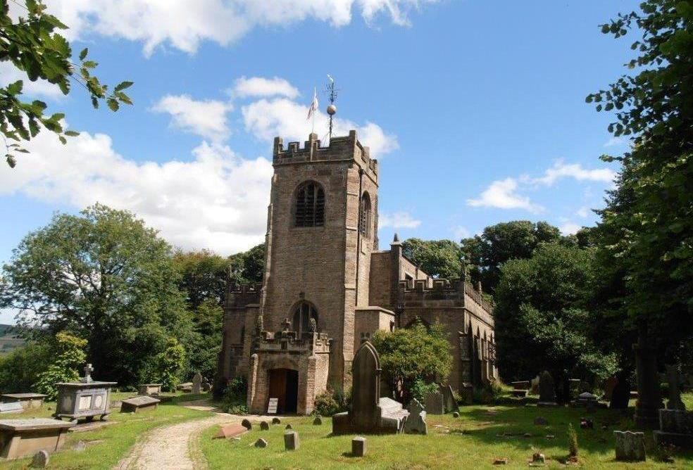
Saint Mary's Parish Church is located at Disley, Cheshire East Unitary Authority ,Cheshire ,England.
-
Saint Mary's Parish Church cemetery's updated grave count on graveviews.com?
0 memorials
-
Where are the coordinates of the Saint Mary's Parish Church?
Latitude: 53.3574410
Longitude: -2.0397980
Nearby Cemetories:
1. Church of the Annunciation St Mary's Catholic
New Mills, High Peak Borough, England
Coordinate: 53.3664315, -2.0050768
2. Mount Pleasant Methodist Free Chapel
New Mills, High Peak Borough, England
Coordinate: 53.3683310, -2.0012190
3. New Mills Wesleyan Cemetery
New Mills, High Peak Borough, England
Coordinate: 53.3693695, -1.9974647
4. St. George's Churchyard
New Mills, High Peak Borough, England
Coordinate: 53.3658550, -1.9940870
5. All Saints Churchyard
Marple, Metropolitan Borough of Stockport, England
Coordinate: 53.3889850, -2.0597220
6. Thornsett Cemetery
New Mills, High Peak Borough, England
Coordinate: 53.3777150, -1.9873620
7. St. Thomas Churchyard
Mellor, Metropolitan Borough of Stockport, England
Coordinate: 53.3970440, -2.0277450
8. St. James Churchyard
Buxworth, High Peak Borough, England
Coordinate: 53.3362500, -1.9688500
9. Primitive Methodist Chapel 1841
Buxworth, High Peak Borough, England
Coordinate: 53.3363378, -1.9667282
10. Buxworth Primitive Methodist Churchyard
Chinley, High Peak Borough, England
Coordinate: 53.3364680, -1.9662910
11. Norbury St Thomas Churchyard
Hazel Grove, Metropolitan Borough of Stockport, England
Coordinate: 53.3761440, -2.1160440
12. St George Churchyard
Poynton, Cheshire East Unitary Authority, England
Coordinate: 53.3490610, -2.1231260
13. St. James Churchyard
Whaley Bridge, High Peak Borough, England
Coordinate: 53.3153270, -1.9918840
14. St. Christopher Churchyard
Pott Shrigley, Cheshire East Unitary Authority, England
Coordinate: 53.3096500, -2.0842900
15. Hayfield Cemetery
Hayfield, High Peak Borough, England
Coordinate: 53.3787660, -1.9527010
16. St. Matthew's Churchyard
Hayfield, High Peak Borough, England
Coordinate: 53.3794310, -1.9461140
17. Saint Chad's Churchyard
Romiley, Metropolitan Borough of Stockport, England
Coordinate: 53.4128520, -2.0896350
18. Fernilee Methodist Church
Fernilee, High Peak Borough, England
Coordinate: 53.3072690, -1.9752940
19. Hatherlow United Reformed Church Cemetery
Romiley, Metropolitan Borough of Stockport, England
Coordinate: 53.4107180, -2.0989830
20. Hatherlow Chapel Cemetery
Bredbury, Metropolitan Borough of Stockport, England
Coordinate: 53.4109259, -2.0992592
21. St John the Baptist Churchyard
Bollington, Cheshire East Unitary Authority, England
Coordinate: 53.2969600, -2.0926100
22. Highfield Cemetery
Bredbury, Metropolitan Borough of Stockport, England
Coordinate: 53.4133310, -2.1111320
23. White Knowle Methodist Chapel
Chinley, High Peak Borough, England
Coordinate: 53.3427389, -1.9242500
24. St. John the Evangelist Churchyard
Cheshire East Unitary Authority, England
Coordinate: 53.2862960, -2.0256440