
| Memorials | : | 0 |
| Location | : | Badger, Shropshire Unitary Authority, England |
| Phone | : | (01952) 750774 |
| Website | : | www.achurchnearyou.com/badger-st-giles/ |
| Coordinate | : | 52.5936507, -2.3438993 |
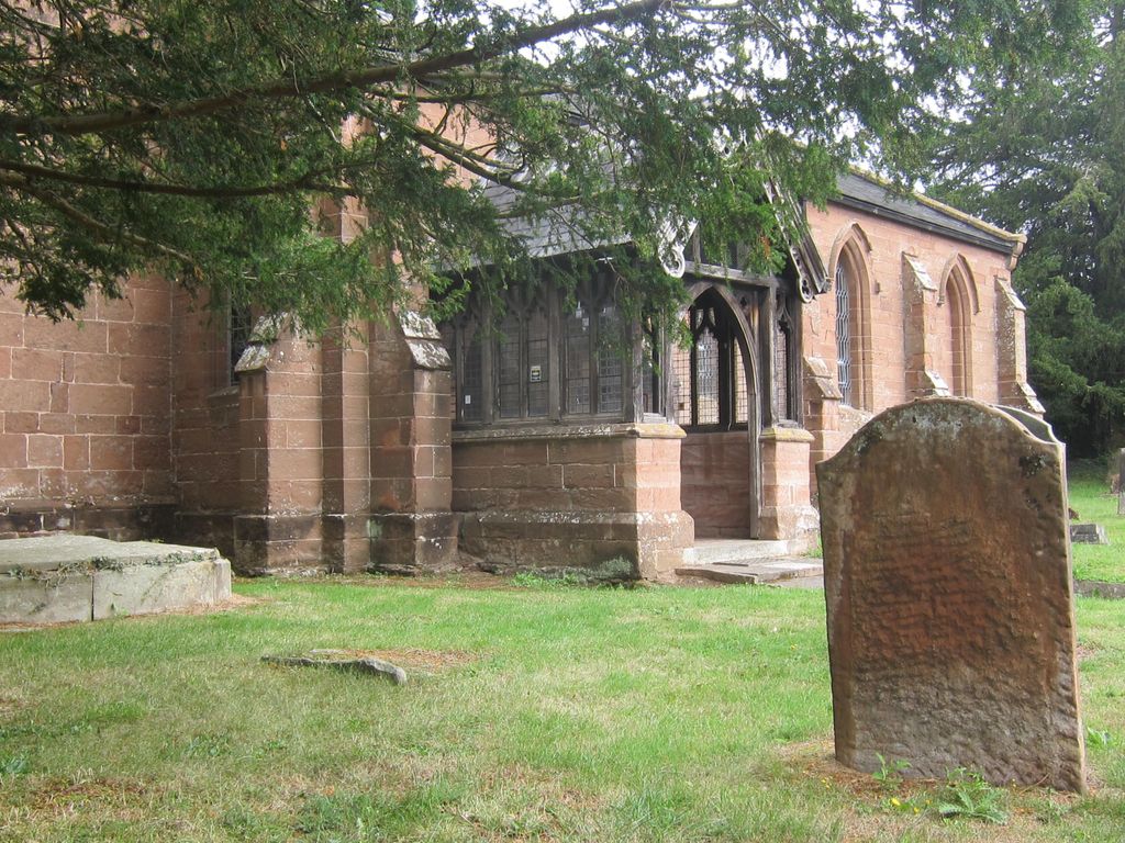
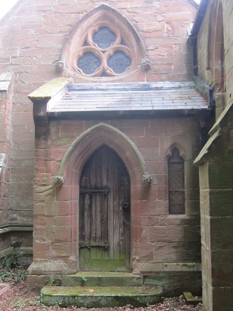
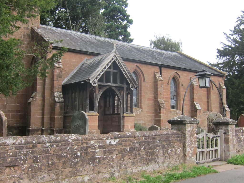
| Description | : | St. Giles Church is located between Badger House and Badger Hall, between the two village ponds. It was founded in the twelfth century, and although the tower is very old, the church was wholly rebuilt in 1833. In the Churchyard stand the steps and shaft of the village cross, which was brought there from its original site, approximately 100 yards away. |
frequently asked questions (FAQ):
-
Where is St. Giles Churchyard?
St. Giles Churchyard is located at Badger, Shropshire Unitary Authority ,Shropshire , WV6 7JREngland.
-
St. Giles Churchyard cemetery's updated grave count on graveviews.com?
0 memorials
-
Where are the coordinates of the St. Giles Churchyard?
Latitude: 52.5936507
Longitude: -2.3438993
Nearby Cemetories:
1. St Milburga's Churchyard
Beckbury, Shropshire Unitary Authority, England
Coordinate: 52.6113140, -2.3481180
2. St Mary Patshull Burnhill Green
Pattingham, South Staffordshire Borough, England
Coordinate: 52.6056540, -2.2916790
3. St. Chad
Boningale, Shropshire Unitary Authority, England
Coordinate: 52.6208330, -2.2795110
4. St Chad Churchyard
Pattingham, South Staffordshire Borough, England
Coordinate: 52.5897150, -2.2656570
5. St Mary Magdalene Churchyard
Albrighton, Shropshire Unitary Authority, England
Coordinate: 52.6373060, -2.2831290
6. St. Cuthbert's Churchyard
Albrighton, Shropshire Unitary Authority, England
Coordinate: 52.6392906, -2.2838705
7. All Saints Churchyard
Claverley, Shropshire Unitary Authority, England
Coordinate: 52.5382800, -2.3069010
8. St. Calixtus Churchyard
Astley Abbotts, Shropshire Unitary Authority, England
Coordinate: 52.5631160, -2.4312720
9. Bridgnorth Cemetery
Bridgnorth, Shropshire Unitary Authority, England
Coordinate: 52.5387350, -2.4078250
10. St Leonard Churchyard
Bridgnorth, Shropshire Unitary Authority, England
Coordinate: 52.5371970, -2.4187683
11. St. Michael's Churchyard
Madeley, Telford and Wrekin Unitary Authority, England
Coordinate: 52.6337300, -2.4503010
12. St Mary Magdelena Churchyard
Bridgnorth, Shropshire Unitary Authority, England
Coordinate: 52.5325220, -2.4187470
13. All Saints Churchyard
Broseley, Shropshire Unitary Authority, England
Coordinate: 52.6105890, -2.4757160
14. The Red Church
Broseley, Shropshire Unitary Authority, England
Coordinate: 52.6205367, -2.4753955
15. St James Churchyard
Stirchley, Telford and Wrekin Unitary Authority, England
Coordinate: 52.6575707, -2.4451542
16. White Ladies Priory
Boscobel, Shropshire Unitary Authority, England
Coordinate: 52.6657000, -2.2584000
17. Broseley Baptist Church
Broseley, Shropshire Unitary Authority, England
Coordinate: 52.6135650, -2.4871190
18. St. Luke's Churchyard
Ironbridge, Telford and Wrekin Unitary Authority, England
Coordinate: 52.6285830, -2.4851180
19. Castle Green Cemetery
Ironbridge, Telford and Wrekin Unitary Authority, England
Coordinate: 52.6346434, -2.4851070
20. Holy Trinity Churchyard
Dawley, Telford and Wrekin Unitary Authority, England
Coordinate: 52.6551528, -2.4637860
21. St. Nicholas' Churchyard
Codsall, South Staffordshire Borough, England
Coordinate: 52.6342500, -2.1992300
22. Holy Trinity Churchyard
Coalbrookdale, Telford and Wrekin Unitary Authority, England
Coordinate: 52.6375300, -2.4894000
23. St. Giles Church Cemetery
Barrow, Shropshire Unitary Authority, England
Coordinate: 52.5969300, -2.5065700
24. Christ Church
Tettenhall Wood, Metropolitan Borough of Wolverhampton, England
Coordinate: 52.5895828, -2.1805506