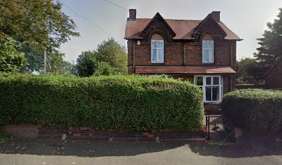
| Memorials | : | 0 |
| Location | : | Wednesbury, Metropolitan Borough of Sandwell, England |
| Coordinate | : | 52.5506170, -2.0184700 |
| Description | : | St John's ecclesiastical parish was formed on 3rd June 1844. Services were initially held in a carpenters shop and then the People's Hall, before the church was built in 1845-6 and consecrated on 13th May 1846. The church, in Lower High Street, was a building of stone in the Early English style, and it consisted of a western chancel, clerestoried nave of six bays, aisles, north porch, and a south-eastern tower with spire containing one bell. The church became disused in 1980 and was demolished in July 1985. |
frequently asked questions (FAQ):
-
Where is St. John's Church?
St. John's Church is located at Lower High St Wednesbury, Metropolitan Borough of Sandwell ,West Midlands , WS10 7AQEngland.
-
St. John's Church cemetery's updated grave count on graveviews.com?
0 memorials
-
Where are the coordinates of the St. John's Church?
Latitude: 52.5506170
Longitude: -2.0184700
Nearby Cemetories:
1. Wood Green Cemetery
Wednesbury, Metropolitan Borough of Sandwell, England
Coordinate: 52.5585990, -2.0081480
2. Fallings Heath Cemetery
Wednesbury, Metropolitan Borough of Sandwell, England
Coordinate: 52.5689100, -2.0182820
3. All Saints Churchyard
Moxley, Metropolitan Borough of Walsall, England
Coordinate: 52.5666000, -2.0350200
4. Heath Lane Cemetery
West Bromwich, Metropolitan Borough of Sandwell, England
Coordinate: 52.5355750, -1.9885610
5. Tipton Cemetery
Tipton, Metropolitan Borough of Sandwell, England
Coordinate: 52.5321870, -2.0465760
6. James Bridge Cemetery
Darlaston, Metropolitan Borough of Walsall, England
Coordinate: 52.5765076, -2.0185659
7. All Saints Churchyard
West Bromwich, Metropolitan Borough of Sandwell, England
Coordinate: 52.5344360, -1.9849140
8. St. Martins Parish Church Pepper Box
Tipton, Metropolitan Borough of Sandwell, England
Coordinate: 52.5281400, -2.0495030
9. Christ Church
West Bromwich, Metropolitan Borough of Sandwell, England
Coordinate: 52.5198729, -2.0004193
10. St. Mary's
Bilston, Metropolitan Borough of Wolverhampton, England
Coordinate: 52.5639000, -2.0681000
11. Queen Street Cemetery
Walsall, Metropolitan Borough of Walsall, England
Coordinate: 52.5797190, -1.9929050
12. Hall Green Cemetery
Bradley, Stafford Borough, England
Coordinate: 52.5525360, -2.0728930
13. St. Peter's Churchyard
West Bromwich, Metropolitan Borough of Sandwell, England
Coordinate: 52.5192880, -1.9998700
14. Wesley Methodist Church
West Bromwich, Metropolitan Borough of Sandwell, England
Coordinate: 52.5197179, -1.9942137
15. Sandwell Valley Crematorium
Sandwell, Metropolitan Borough of Sandwell, England
Coordinate: 52.5352909, -1.9654898
16. St Mary Roman Catholic Churchyard
Walsall, Metropolitan Borough of Walsall, England
Coordinate: 52.5797300, -1.9835900
17. Bentley Cemetery
Willenhall, Metropolitan Borough of Walsall, England
Coordinate: 52.5868880, -2.0299620
18. Christ Churchyard
Coseley, Metropolitan Borough of Dudley, England
Coordinate: 52.5463520, -2.0798570
19. Bath Street Burial Grounds
Walsall, Metropolitan Borough of Walsall, England
Coordinate: 52.5801310, -1.9799960
20. St. Leonard's Churchyard
Bilston, Metropolitan Borough of Wolverhampton, England
Coordinate: 52.5665580, -2.0752470
21. St Giles Church Cemetery
Willenhall, Metropolitan Borough of Walsall, England
Coordinate: 52.5841600, -2.0504000
22. St. Giles Church Cholera Burial Ground
Willenhall, Metropolitan Borough of Coventry, England
Coordinate: 52.5851060, -2.0498580
23. Darkhouse Baptist Chapel Cemetery
Sedgley, Metropolitan Borough of Dudley, England
Coordinate: 52.5495697, -2.0834915
24. Coseley Old Meeting House
Coseley, Metropolitan Borough of Dudley, England
Coordinate: 52.5428589, -2.0827699

