
| Memorials | : | 0 |
| Location | : | Wednesbury, Metropolitan Borough of Sandwell, England |
| Coordinate | : | 52.5585990, -2.0081480 |
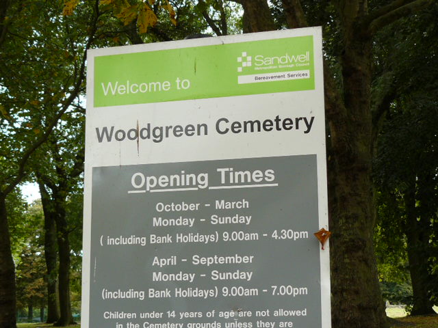
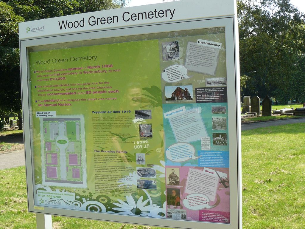
| Description | : | The cemetery lies to the north-east of Wednesbury town centre on the A468, Wood Green Road.The post code shown is the nearest, as the cemetery itself has no post code. The cemetery opened in 1868 and was the first cemetery in Wednesbury. The total cost was 10,000pounds, a very large sum at the time. Originally there was a chapel (now demolished and replaced by green space) which was divided into two parts, one for the established church and one for the free churches, each could hold about eighty people. The chapel was designed by Samuel Horton. ... Read More |
frequently asked questions (FAQ):
-
Where is Wood Green Cemetery?
Wood Green Cemetery is located at off Wood Green Road. Wednesbury, Metropolitan Borough of Sandwell ,West Midlands , WS10 9AXEngland.
-
Wood Green Cemetery cemetery's updated grave count on graveviews.com?
0 memorials
-
Where are the coordinates of the Wood Green Cemetery?
Latitude: 52.5585990
Longitude: -2.0081480

Nearby Cemetories:
1. St. John's Church
Wednesbury, Metropolitan Borough of Sandwell, England
Coordinate: 52.5506170, -2.0184700
2. Fallings Heath Cemetery
Wednesbury, Metropolitan Borough of Sandwell, England
Coordinate: 52.5689100, -2.0182820
3. All Saints Churchyard
Moxley, Metropolitan Borough of Walsall, England
Coordinate: 52.5666000, -2.0350200
4. James Bridge Cemetery
Darlaston, Metropolitan Borough of Walsall, England
Coordinate: 52.5765076, -2.0185659
5. Queen Street Cemetery
Walsall, Metropolitan Borough of Walsall, England
Coordinate: 52.5797190, -1.9929050
6. St Mary Roman Catholic Churchyard
Walsall, Metropolitan Borough of Walsall, England
Coordinate: 52.5797300, -1.9835900
7. Heath Lane Cemetery
West Bromwich, Metropolitan Borough of Sandwell, England
Coordinate: 52.5355750, -1.9885610
8. Bath Street Burial Grounds
Walsall, Metropolitan Borough of Walsall, England
Coordinate: 52.5801310, -1.9799960
9. All Saints Churchyard
West Bromwich, Metropolitan Borough of Sandwell, England
Coordinate: 52.5344360, -1.9849140
10. Bentley Cemetery
Willenhall, Metropolitan Borough of Walsall, England
Coordinate: 52.5868880, -2.0299620
11. Sandwell Valley Crematorium
Sandwell, Metropolitan Borough of Sandwell, England
Coordinate: 52.5352909, -1.9654898
12. Tipton Cemetery
Tipton, Metropolitan Borough of Sandwell, England
Coordinate: 52.5321870, -2.0465760
13. St Giles Church Cemetery
Willenhall, Metropolitan Borough of Walsall, England
Coordinate: 52.5841600, -2.0504000
14. St. Giles Church Cholera Burial Ground
Willenhall, Metropolitan Borough of Coventry, England
Coordinate: 52.5851060, -2.0498580
15. St. Mary's
Bilston, Metropolitan Borough of Wolverhampton, England
Coordinate: 52.5639000, -2.0681000
16. Christ Church
West Bromwich, Metropolitan Borough of Sandwell, England
Coordinate: 52.5198729, -2.0004193
17. Wood Street Cemetery
Willenhall, Metropolitan Borough of Walsall, England
Coordinate: 52.5867500, -2.0528900
18. St. Martins Parish Church Pepper Box
Tipton, Metropolitan Borough of Sandwell, England
Coordinate: 52.5281400, -2.0495030
19. St. Peter's Churchyard
West Bromwich, Metropolitan Borough of Sandwell, England
Coordinate: 52.5192880, -1.9998700
20. Wesley Methodist Church
West Bromwich, Metropolitan Borough of Sandwell, England
Coordinate: 52.5197179, -1.9942137
21. Hall Green Cemetery
Bradley, Stafford Borough, England
Coordinate: 52.5525360, -2.0728930
22. St. Leonard's Churchyard
Bilston, Metropolitan Borough of Wolverhampton, England
Coordinate: 52.5665580, -2.0752470
23. Willenhall Lawn Cemetery
Willenhall, Metropolitan Borough of Walsall, England
Coordinate: 52.6001870, -2.0327110
24. Christ Churchyard
Coseley, Metropolitan Borough of Dudley, England
Coordinate: 52.5463520, -2.0798570