
| Memorials | : | 37 |
| Location | : | Cottered, East Hertfordshire District, England |
| Coordinate | : | 51.9458000, -0.0846000 |
frequently asked questions (FAQ):
-
Where is St John the Baptist Churchyard?
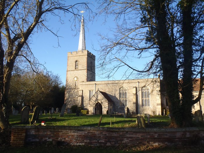
St John the Baptist Churchyard is located at B1037 Cottered, East Hertfordshire District ,Hertfordshire , SG9 9PZEngland.
-
St John the Baptist Churchyard cemetery's updated grave count on graveviews.com?
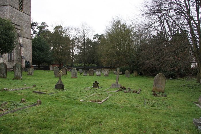
37 memorials
-
Where are the coordinates of the St John the Baptist Churchyard?
Latitude: 51.9458000
Longitude: -0.0846000

Nearby Cemetories:
1. St Lawrence Churchyard
Ardeley, East Hertfordshire District, England
Coordinate: 51.9274000, -0.0989000
2. Holy Trinity Churchyard
Buntingford, East Hertfordshire District, England
Coordinate: 51.9540854, -0.0541753
3. St Mary Churchyard
Rushden, North Hertfordshire District, England
Coordinate: 51.9689930, -0.1012800
4. St. Mary the Virgin Churchyard
Walkern, East Hertfordshire District, England
Coordinate: 51.9226300, -0.1211300
5. St Marys Churchyard
Wallington, North Hertfordshire District, England
Coordinate: 51.9853930, -0.1195640
6. St Bartholomew's Church Churchyard
Buntingford, East Hertfordshire District, England
Coordinate: 51.9525530, -0.0089720
7. All Saints Churchyard
Sandon, North Hertfordshire District, England
Coordinate: 51.9934160, -0.0756170
8. St. Mary the Virgin-Westmill
St Albans, St Albans District, England
Coordinate: 51.9262000, -0.0098000
9. St Peter Churchyard
Benington, East Hertfordshire District, England
Coordinate: 51.8956030, -0.1167310
10. St Andrew Churchyard
Buckland, East Hertfordshire District, England
Coordinate: 51.9866510, -0.0230880
11. St Giles Churchyard
Wyddial, East Hertfordshire District, England
Coordinate: 51.9673270, -0.0010730
12. St. Nicholas' Churchyard
Great Munden, East Hertfordshire District, England
Coordinate: 51.8996010, -0.0316180
13. All Saints Churchyard
Radwell, North Hertfordshire District, England
Coordinate: 51.9747300, -0.1668550
14. St Faiths Churchyard
Kelshall, North Hertfordshire District, England
Coordinate: 52.0084230, -0.0656070
15. Hare Street Benson Grounds
Buntingford, East Hertfordshire District, England
Coordinate: 51.9492640, 0.0221120
16. All Saints Churchyard
Little Munden, East Hertfordshire District, England
Coordinate: 51.8795770, -0.0625920
17. St Mary Churchyard
Reed, North Hertfordshire District, England
Coordinate: 52.0034714, -0.0183250
18. Weston Road Cemetery
Stevenage, Stevenage Borough, England
Coordinate: 51.9217860, -0.1935160
19. St. Mary's Churchyard
Aston, East Hertfordshire District, England
Coordinate: 51.8875600, -0.1536200
20. St Mary the Virgin Churchyard
Therfield, North Hertfordshire District, England
Coordinate: 52.0162060, -0.0568230
21. Little Hormead St Mary Churchyard
Hormead, East Hertfordshire District, England
Coordinate: 51.9428430, 0.0331630
22. Great Hormead St Nicholas Churchyard
Hormead, East Hertfordshire District, England
Coordinate: 51.9469500, 0.0353300
23. St Nicholas Churchyard
Stevenage, Stevenage Borough, England
Coordinate: 51.9201590, -0.1974750
24. Almond Lane Cemetery
Stevenage, Stevenage Borough, England
Coordinate: 51.9161780, -0.1954710