
| Memorials | : | 36 |
| Location | : | Great Munden, East Hertfordshire District, England |
| Coordinate | : | 51.8996010, -0.0316180 |
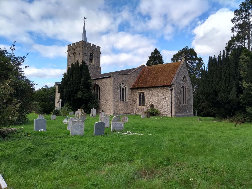
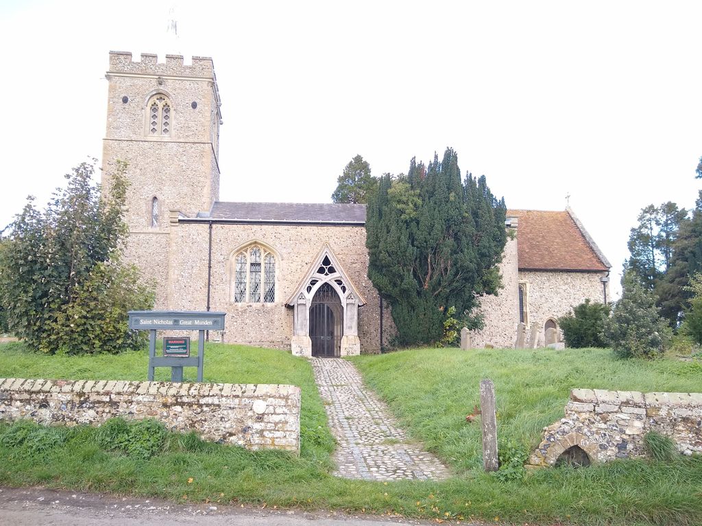
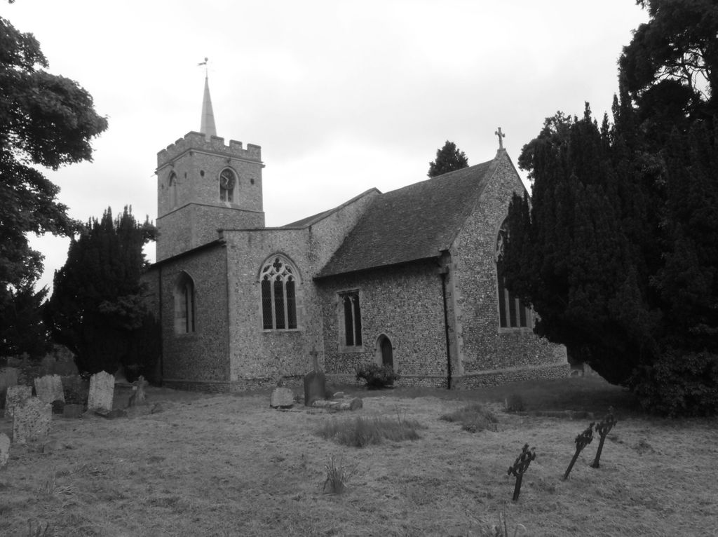
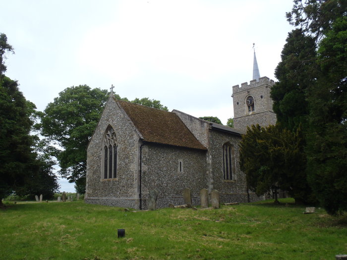
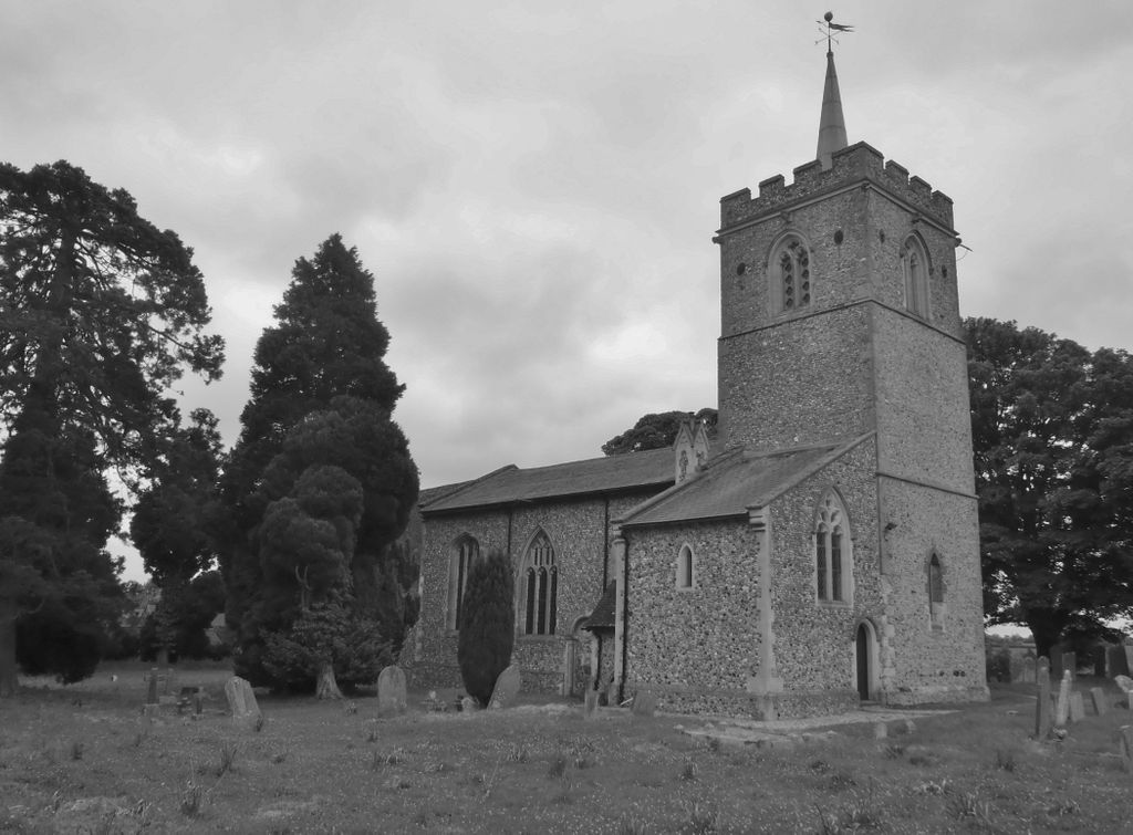
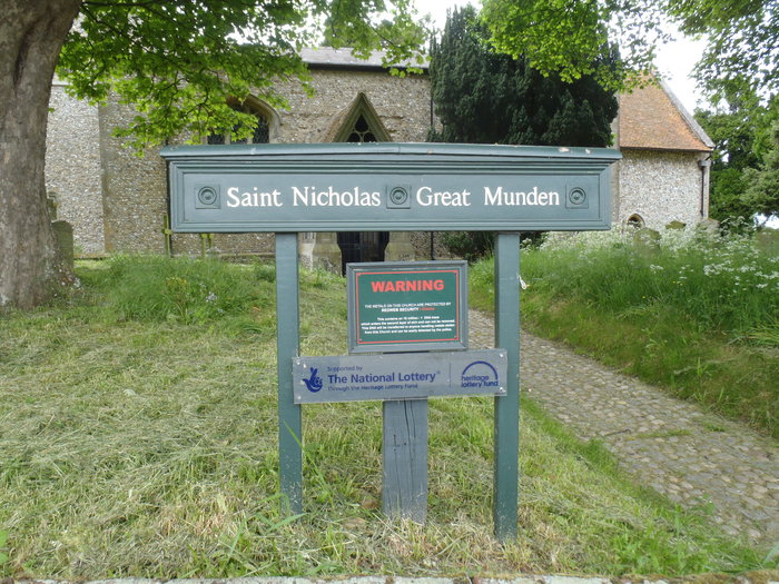
| Description | : | Great Munden is a village and civil parish in Hertfordshire, and is situated 6 miles (9.7 km) north of the town of Ware. The village includes the church of St Nicholas, and a rectory that includes the remains of a moat. Other settlements in the parish include Nasty and Levens Green. A detached portion of Little Munden was added to the parish in 1888. In 1990 the Guard Family bought this redundant church and undertook a ten year restoration, partially with help from a Heritage Lottery grant. They now present operas, concerts and plays, together with Art Exhibitions and local events.... Read More |
frequently asked questions (FAQ):
-
Where is St. Nicholas' Churchyard?
St. Nicholas' Churchyard is located at Mentley Lane Great Munden, East Hertfordshire District ,Hertfordshire , SG11 1HGEngland.
-
St. Nicholas' Churchyard cemetery's updated grave count on graveviews.com?
36 memorials
-
Where are the coordinates of the St. Nicholas' Churchyard?
Latitude: 51.8996010
Longitude: -0.0316180
Nearby Cemetories:
1. St Edmund of Canterbury and the English Martyrs
Old Hall Green, East Hertfordshire District, England
Coordinate: 51.8799220, -0.0110510
2. All Saints Churchyard
Little Munden, East Hertfordshire District, England
Coordinate: 51.8795770, -0.0625920
3. Puckeridge Chapel
Northchurch, Dacorum Borough, England
Coordinate: 51.8890720, 0.0106480
4. St. Mary the Virgin-Westmill
St Albans, St Albans District, England
Coordinate: 51.9262000, -0.0098000
5. St Mary the Virgin Churchyard
Braughing, East Hertfordshire District, England
Coordinate: 51.9078420, 0.0282310
6. St. Mary's Churchyard
Standon, East Hertfordshire District, England
Coordinate: 51.8813515, 0.0273820
7. St Lawrence Churchyard
Ardeley, East Hertfordshire District, England
Coordinate: 51.9274000, -0.0989000
8. St John the Evangelist Churchyard
High Cross, East Hertfordshire District, England
Coordinate: 51.8500010, -0.0213550
9. St Peter Churchyard
Benington, East Hertfordshire District, England
Coordinate: 51.8956030, -0.1167310
10. St Bartholomew's Church Churchyard
Buntingford, East Hertfordshire District, England
Coordinate: 51.9525530, -0.0089720
11. Holy Trinity Churchyard
Buntingford, East Hertfordshire District, England
Coordinate: 51.9540854, -0.0541753
12. St John the Baptist Churchyard
Cottered, East Hertfordshire District, England
Coordinate: 51.9458000, -0.0846000
13. Little Hormead St Mary Churchyard
Hormead, East Hertfordshire District, England
Coordinate: 51.9428430, 0.0331630
14. Hare Street Benson Grounds
Buntingford, East Hertfordshire District, England
Coordinate: 51.9492640, 0.0221120
15. St. Mary the Virgin Churchyard
Walkern, East Hertfordshire District, England
Coordinate: 51.9226300, -0.1211300
16. Thundridge Old Churchyard
Thundridge, East Hertfordshire District, England
Coordinate: 51.8378330, -0.0156530
17. Great Hormead St Nicholas Churchyard
Hormead, East Hertfordshire District, England
Coordinate: 51.9469500, 0.0353300
18. St. Mary Parish Churchyard
Thundridge, East Hertfordshire District, England
Coordinate: 51.8366590, -0.0291820
19. Ss Mary and Andrew Churchyard
Watton-at-Stone, East Hertfordshire District, England
Coordinate: 51.8533290, -0.1102500
20. St Giles Churchyard
Wyddial, East Hertfordshire District, England
Coordinate: 51.9673270, -0.0010730
21. St Mary's Churchyard
Albury, East Hertfordshire District, England
Coordinate: 51.9026500, 0.0852920
22. St. Mary's Churchyard
Aston, East Hertfordshire District, England
Coordinate: 51.8875600, -0.1536200
23. St Mary the Virgin Churchyard
Stapleford, East Hertfordshire District, England
Coordinate: 51.8349710, -0.0973140
24. St Mary the Virgin Churchyard
Furneux Pelham, East Hertfordshire District, England
Coordinate: 51.9316710, 0.0808950