
| Memorials | : | 0 |
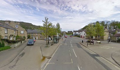
| Location | : | Eyam, Derbyshire Dales District, England |
| Website | : | www.eyam-museum.org.uk/ |
| Coordinate | : | 53.2843748, -1.6717200 |
| Description | : | Eyam village suffered from bubonic plague for fourteen months from September 1665 to November 1666. The plague caused 260 deaths in a village with a population of 700. The churchyard was closed to burials from July 1666 to try and prevent the spread of infection. Families were asked to bury their dead in unconsecrated ground in their own fields and gardens. There were burials scattered throughout the village during this period. |
frequently asked questions (FAQ):
-
Where is Eyam Village?
Eyam Village is located at Eyam, Derbyshire Dales District ,Derbyshire ,England.
-
Eyam Village cemetery's updated grave count on graveviews.com?
0 memorials
-
Where are the coordinates of the Eyam Village?
Latitude: 53.2843748
Longitude: -1.6717200
Nearby Cemetories:
1. St. Lawrence's Churchyard
Eyam, Derbyshire Dales District, England
Coordinate: 53.2842751, -1.6749160
2. Riley Farm
Eyam, Derbyshire Dales District, England
Coordinate: 53.2857957, -1.6636787
3. Riley Graves
Eyam, Derbyshire Dales District, England
Coordinate: 53.2839200, -1.6586665
4. St Martin
Stoney Middleton, Derbyshire Dales District, England
Coordinate: 53.2758020, -1.6542840
5. Hamlet of Bretton
Eyam, Derbyshire Dales District, England
Coordinate: 53.2979962, -1.7008309
6. St. Helen's Churchyard
Grindleford, Derbyshire Dales District, England
Coordinate: 53.2975200, -1.6322900
7. All Saints Churchyard
Calver, Derbyshire Dales District, England
Coordinate: 53.2660740, -1.6303850
8. The Good Shepherd Churchyard
Wardlow, Derbyshire Dales District, England
Coordinate: 53.2693970, -1.7294140
9. Methodist Churchyard
Great Hucklow, Derbyshire Dales District, England
Coordinate: 53.2970009, -1.7330000
10. Trot Lane Private Cemetery
Foolow, Derbyshire Dales District, England
Coordinate: 53.2872651, -1.7434660
11. Saint Giles Churchyard
Great Longstone, Derbyshire Dales District, England
Coordinate: 53.2432100, -1.7009100
12. St. Anne Churchyard
Baslow, Derbyshire Dales District, England
Coordinate: 53.2473740, -1.6241110
13. St Michael and All Angels Churchyard
Hathersage, Derbyshire Dales District, England
Coordinate: 53.3330570, -1.6501020
14. Little Longstone Chapel
Little Longstone, Derbyshire Dales District, England
Coordinate: 53.2413241, -1.7203296
15. Litton Cemetery
Litton, Derbyshire Dales District, England
Coordinate: 53.2654380, -1.7573610
16. Tideswell Parish Council Cemetery
Tideswell, Derbyshire Dales District, England
Coordinate: 53.2846630, -1.7639730
17. St Barnabas Churchyard
Bradwell, Derbyshire Dales District, England
Coordinate: 53.3263560, -1.7387040
18. Methodist Chapel Graveyard
Bradwell, Derbyshire Dales District, England
Coordinate: 53.3264690, -1.7417860
19. Bethlehem Churchyard
Bradwell, Derbyshire Dales District, England
Coordinate: 53.3277120, -1.7417070
20. St John the Baptist Tideswell
Tideswell, Derbyshire Dales District, England
Coordinate: 53.2785640, -1.7728500
21. Immaculate Heart of Mary, Roman Catholic Chapel
Tideswell, Derbyshire Dales District, England
Coordinate: 53.2761640, -1.7741580
22. St. John the Baptist Churchyard
Bamford, High Peak Borough, England
Coordinate: 53.3468590, -1.6896950
23. Holy Trinity Churchyard
Ashford-in-the-Water, Derbyshire Dales District, England
Coordinate: 53.2241640, -1.7093610
24. St. Peter's Churchyard
Edensor, Derbyshire Dales District, England
Coordinate: 53.2255530, -1.6260190