
| Memorials | : | 2 |
| Location | : | Burgess Hill, Mid Sussex District, England |
| Coordinate | : | 50.9570100, -0.1333700 |
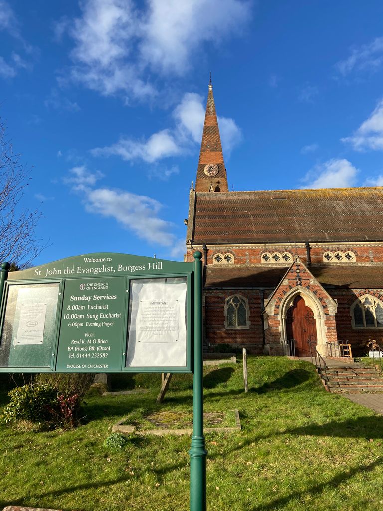
| Description | : | Built in 1863 it was designed by Thomas Talbot Bury of London, the style adopted was Decorated Gothic. The building is located in the St John's Conservation Area and is Grade 2* listed. The Churchyard is in Church Road and the Extension is almost 1 mile to the West, in Royal George Road, opposite Denham Road. There are 4 Commonwealth burials of the 1914-18 war in the Churchyard and 3 more burials of the 1939-45 in the Extension. |
frequently asked questions (FAQ):
-
Where is St. John the Evangelist Churchyard?
St. John the Evangelist Churchyard is located at Lower Church Road Burgess Hill, Mid Sussex District ,West Sussex , RH15 9AAEngland.
-
St. John the Evangelist Churchyard cemetery's updated grave count on graveviews.com?
2 memorials
-
Where are the coordinates of the St. John the Evangelist Churchyard?
Latitude: 50.9570100
Longitude: -0.1333700


Nearby Cemetories:
1. All Saints United Reformed Church
Burgess Hill, Mid Sussex District, England
Coordinate: 50.9537245, -0.1252350
2. St Andrew Churchyard
Burgess Hill, Mid Sussex District, England
Coordinate: 50.9604300, -0.1219500
3. St Edward the Confessor
Burgess Hill, Mid Sussex District, England
Coordinate: 50.9606020, -0.1484840
4. Burgess Hill Burial Ground
Burgess Hill, Mid Sussex District, England
Coordinate: 50.9542794, -0.1583567
5. Bethel Baptist Chapel
Wivelsfield, Lewes District, England
Coordinate: 50.9626990, -0.0952615
6. St. Peter & St. John the Baptist Churchyard
Wivelsfield, Lewes District, England
Coordinate: 50.9708740, -0.0952190
7. St Cosmas and St Damian Churchyard
Hassocks, Mid Sussex District, England
Coordinate: 50.9219800, -0.1305650
8. Holy Trinity Churchyard
Hurstpierpoint, Mid Sussex District, England
Coordinate: 50.9337020, -0.1804460
9. Hurstpierpoint South Avenue Cemetery
Hurstpierpoint, Mid Sussex District, England
Coordinate: 50.9300110, -0.1753150
10. Ditchling Unitarian Chapel Chapelyard
Ditchling, Lewes District, England
Coordinate: 50.9214096, -0.1129916
11. The Browne Burial Ground
Ditchling, Lewes District, England
Coordinate: 50.9213097, -0.1128219
12. Ditchling Cemetery
Ditchling, Lewes District, England
Coordinate: 50.9196160, -0.1050510
13. Clayton Wood Natural Burial Ground
Clayton, Mid Sussex District, England
Coordinate: 50.9160900, -0.1547600
14. St Wilfrid's Churchyard
Haywards Heath, Mid Sussex District, England
Coordinate: 50.9993130, -0.1046570
15. St John the Baptist Churchyard
Clayton, Mid Sussex District, England
Coordinate: 50.9105170, -0.1534370
16. Holy Trinity Churchyard
Cuckfield, Mid Sussex District, England
Coordinate: 51.0048580, -0.1434300
17. Western Road Cemetery
Haywards Heath, Mid Sussex District, England
Coordinate: 50.9987100, -0.0920000
18. Streat Churchyard
Streat, Lewes District, England
Coordinate: 50.9202600, -0.0794500
19. St Peters Churchyard
Twineham, Mid Sussex District, England
Coordinate: 50.9657310, -0.2174410
20. St. Mary Magdalene Churchyard
Bolney, Mid Sussex District, England
Coordinate: 50.9898000, -0.2035200
21. St Martin Churchyard
Westmeston, Lewes District, England
Coordinate: 50.9066840, -0.0971980
22. Church of the Transfiguration Churchyard
Pyecombe, Mid Sussex District, England
Coordinate: 50.8984590, -0.1642370
23. East Chiltington Churchyard
East Chiltington, Lewes District, England
Coordinate: 50.9192280, -0.0526570
24. St Michael and All Angels Churchyard
Plumpton, Lewes District, England
Coordinate: 50.9050700, -0.0717450