
| Memorials | : | 1 |
| Location | : | Capel, Mole Valley District, England |
| Website | : | www.capelandockleychurch.org.uk/ |
| Coordinate | : | 51.1539730, -0.3201980 |
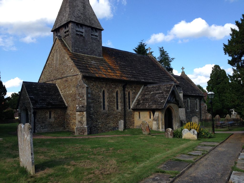
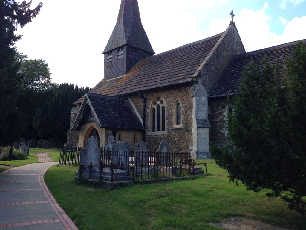
| Description | : | The chief part of the present building was erected in the thirteenth century, probably about 1240, and although there have been alterations and additions it still retains much of the original work. This includes the west and south walls of the Nave, the east and south walls of the Chancel, the piscina in the south wall, and the roof throughout; the west porch, with its unusual semi-circular rafters, the west and south doors with the dog-tooth mouldings and the fine stone buttress outside the south-east angle of the Nave. The only old windows are those in the south wall of the... Read More |
frequently asked questions (FAQ):
-
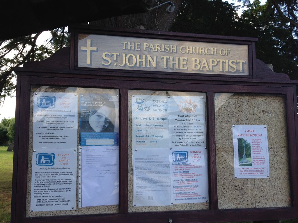
Where is St. John the Baptist Churchyard?
St. John the Baptist Churchyard is located at The Street Capel, Mole Valley District ,Surrey ,England.
-
St. John the Baptist Churchyard cemetery's updated grave count on graveviews.com?
0 memorials
-
Where are the coordinates of the St. John the Baptist Churchyard?
Latitude: 51.1539730
Longitude: -0.3201980

Nearby Cemetories:
1. Capel Friends Burial Ground #2
Capel, Mole Valley District, England
Coordinate: 51.1513970, -0.3219210
2. Pleystowe in Capel Friends Grounds
Capel, Mole Valley District, England
Coordinate: 51.1411900, -0.3161300
3. St Margaret Churchyard
Ockley, Mole Valley District, England
Coordinate: 51.1534880, -0.3473790
4. St Peter Churchyard
Newdigate, Mole Valley District, England
Coordinate: 51.1652200, -0.2884860
5. Ockley Cemetery
Ockley, Mole Valley District, England
Coordinate: 51.1473610, -0.3654400
6. Christ Church Churchyard
Coldharbour, Mole Valley District, England
Coordinate: 51.1807050, -0.3576190
7. St Mary Magdalene Churchyard
South Holmwood, Mole Valley District, England
Coordinate: 51.1904660, -0.3243540
8. Saint Mary Magdalene Churchyard
Rusper, Horsham District, England
Coordinate: 51.1227750, -0.2789080
9. Okewood St John the Baptist Churchyard
Ewhurst, Waverley Borough, England
Coordinate: 51.1303800, -0.3895000
10. St John the Baptist Churchyard
Oakwoodhill, Mole Valley District, England
Coordinate: 51.1304600, -0.3895700
11. Charlwood Friends Burial Ground
Charlwood, Mole Valley District, England
Coordinate: 51.1553700, -0.2305800
12. St. Margaret Churchyard
Warnham, Horsham District, England
Coordinate: 51.0903160, -0.3462410
13. St Mary the Virgin Churchyard
Holmbury St Mary, Mole Valley District, England
Coordinate: 51.1882600, -0.4130600
14. Felday Chapel
Holmbury St Mary, Mole Valley District, England
Coordinate: 51.1900360, -0.4129370
15. St Margaret of Antioch Churchyard
Ifield, Crawley Borough, England
Coordinate: 51.1238700, -0.2194760
16. St. Bartholomew's Churchyard
Leigh, Mole Valley District, England
Coordinate: 51.2085790, -0.2483520
17. St James Churchyard
Abinger, Mole Valley District, England
Coordinate: 51.2017820, -0.4056060
18. Friends Meeting House
Ifield, Crawley Borough, England
Coordinate: 51.1263400, -0.2120200
19. St Peter & St Paul Churchyard
Ewhurst, Waverley Borough, England
Coordinate: 51.1530910, -0.4409600
20. Holy Trinity Churchyard, Westcott
Dorking, Mole Valley District, England
Coordinate: 51.2236075, -0.3694870
21. Deepdene Mausoleum
Dorking, Mole Valley District, England
Coordinate: 51.2307590, -0.3206630
22. Roffey Cemetery
Horsham, Horsham District, England
Coordinate: 51.0769320, -0.2930890
23. St John the Evangelist Churchyard
Wotton, Mole Valley District, England
Coordinate: 51.2198770, -0.3895890
24. St Martin Churchyard
Dorking, Mole Valley District, England
Coordinate: 51.2326360, -0.3320140