
| Memorials | : | 8 |
| Location | : | Ockley, Mole Valley District, England |
| Coordinate | : | 51.1534880, -0.3473790 |
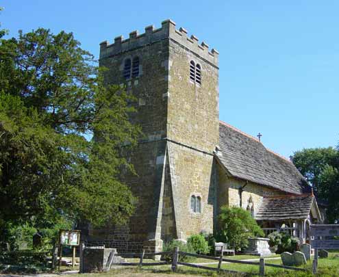
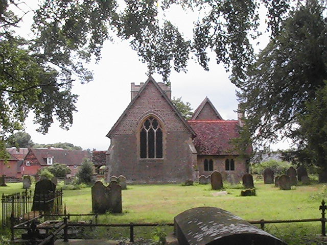
| Description | : | St Margaret's church, dedicated to St Margaret of Antioch, is believed to date from 1291. The original construction was simply a single aisle and sanctuary, of which probably only the south wall still remains. The porch was added around the 16th Century and the tower, despite its Norman appearance was added in 1700. The peal of six bells was hung in 1701. A replica of the tenor bell was shipped to America in 1752, and is now called ‘The Liberty Bell' because it was rung to proclaim the Declaration of Independence. |
frequently asked questions (FAQ):
-
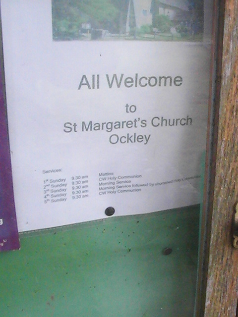
Where is St Margaret Churchyard?
St Margaret Churchyard is located at Coles Lane Ockley, Mole Valley District ,Surrey , RH5 5LSEngland.
-
St Margaret Churchyard cemetery's updated grave count on graveviews.com?
6 memorials
-
Where are the coordinates of the St Margaret Churchyard?
Latitude: 51.1534880
Longitude: -0.3473790
Nearby Cemetories:
1. Ockley Cemetery
Ockley, Mole Valley District, England
Coordinate: 51.1473610, -0.3654400
2. Capel Friends Burial Ground #2
Capel, Mole Valley District, England
Coordinate: 51.1513970, -0.3219210
3. St. John the Baptist Churchyard
Capel, Mole Valley District, England
Coordinate: 51.1539730, -0.3201980
4. Pleystowe in Capel Friends Grounds
Capel, Mole Valley District, England
Coordinate: 51.1411900, -0.3161300
5. Christ Church Churchyard
Coldharbour, Mole Valley District, England
Coordinate: 51.1807050, -0.3576190
6. St John the Baptist Churchyard
Oakwoodhill, Mole Valley District, England
Coordinate: 51.1304600, -0.3895700
7. Okewood St John the Baptist Churchyard
Ewhurst, Waverley Borough, England
Coordinate: 51.1303800, -0.3895000
8. St Peter Churchyard
Newdigate, Mole Valley District, England
Coordinate: 51.1652200, -0.2884860
9. St Mary Magdalene Churchyard
South Holmwood, Mole Valley District, England
Coordinate: 51.1904660, -0.3243540
10. Saint Mary Magdalene Churchyard
Rusper, Horsham District, England
Coordinate: 51.1227750, -0.2789080
11. St Mary the Virgin Churchyard
Holmbury St Mary, Mole Valley District, England
Coordinate: 51.1882600, -0.4130600
12. Felday Chapel
Holmbury St Mary, Mole Valley District, England
Coordinate: 51.1900360, -0.4129370
13. St Peter & St Paul Churchyard
Ewhurst, Waverley Borough, England
Coordinate: 51.1530910, -0.4409600
14. St James Churchyard
Abinger, Mole Valley District, England
Coordinate: 51.2017820, -0.4056060
15. St. Margaret Churchyard
Warnham, Horsham District, England
Coordinate: 51.0903160, -0.3462410
16. St John the Evangelist Churchyard
Wotton, Mole Valley District, England
Coordinate: 51.2198770, -0.3895890
17. Holy Trinity Churchyard, Westcott
Dorking, Mole Valley District, England
Coordinate: 51.2236075, -0.3694870
18. Charlwood Friends Burial Ground
Charlwood, Mole Valley District, England
Coordinate: 51.1553700, -0.2305800
19. Deepdene Mausoleum
Dorking, Mole Valley District, England
Coordinate: 51.2307590, -0.3206630
20. St Martin Churchyard
Dorking, Mole Valley District, England
Coordinate: 51.2326360, -0.3320140
21. Holy Trinity Churchyard
Rudgwick, Horsham District, England
Coordinate: 51.0973900, -0.4442800
22. St. Bartholomew's Churchyard
Leigh, Mole Valley District, England
Coordinate: 51.2085790, -0.2483520
23. Roffey Cemetery
Horsham, Horsham District, England
Coordinate: 51.0769320, -0.2930890
24. Dorking Cemetery
Dorking, Mole Valley District, England
Coordinate: 51.2365646, -0.3189580