
| Memorials | : | 7 |
| Location | : | Little Parndon, Harlow District, England |
| Coordinate | : | 51.7792683, 0.0840760 |
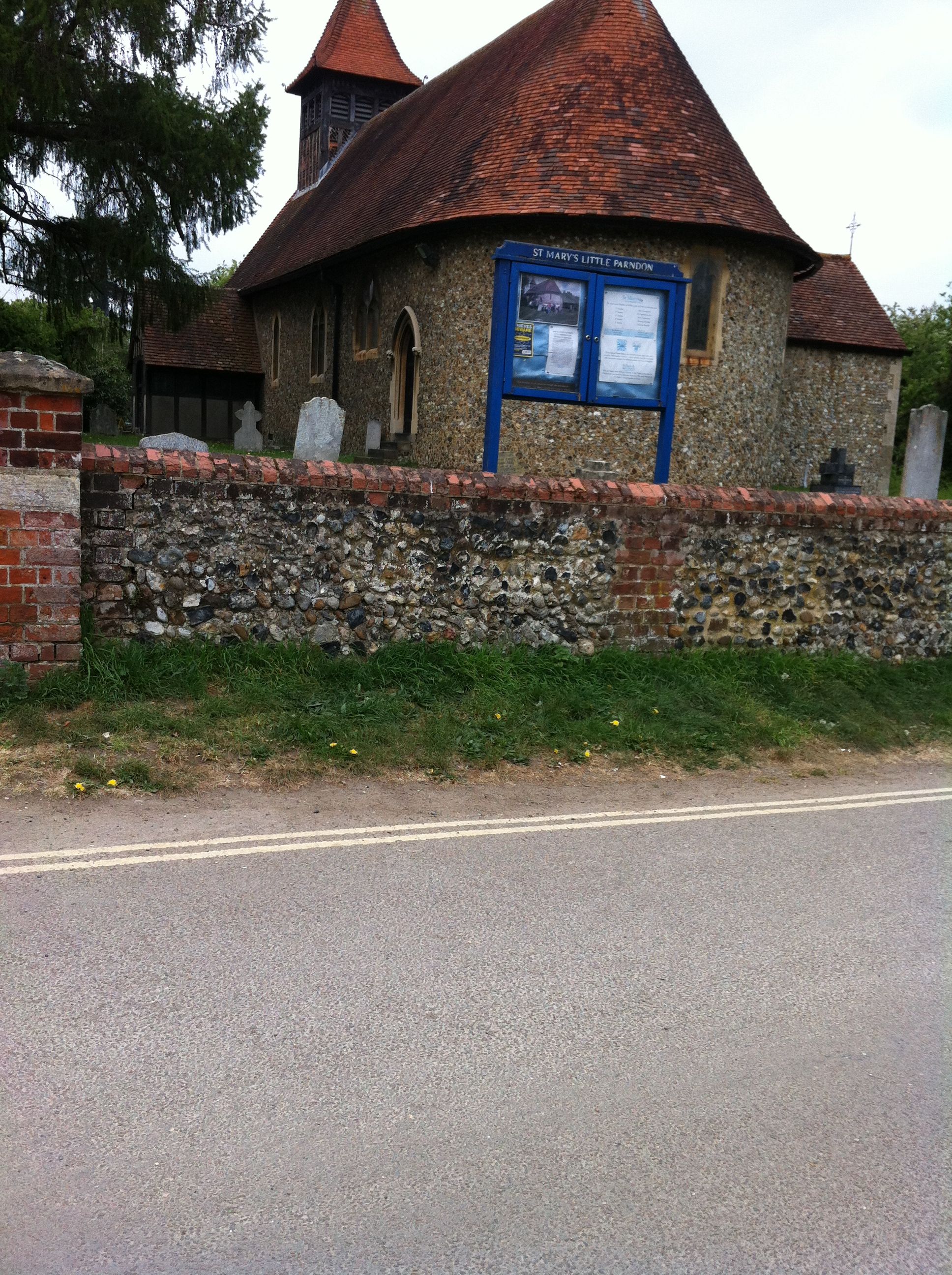
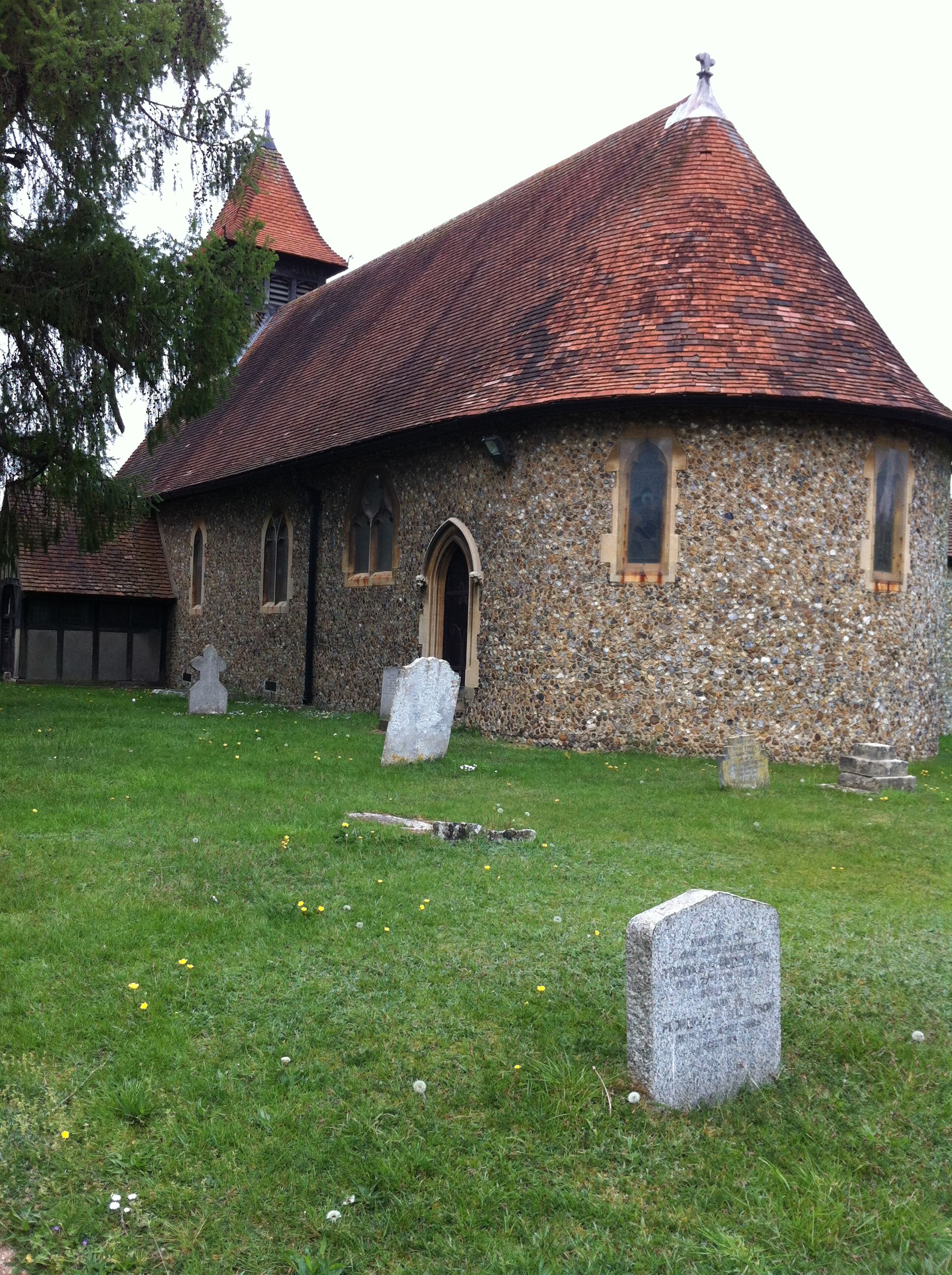
| Description | : | Tucked away down a narrow lane and hemmed in by a new housing development (April 2020), the railway line and an industrial area sits the tranquil parish church of Little Parndon in the urban sprawl of Harlow. A church had been founded there in 1254, but the current church was rebuilt in 1868. It is close to Parndon Mill and the River Stort and is commonly bound together with it's larger neighbour Great Parndon, also swallowed up by Harlow New Town development in the late 1940s. In 1741 Edward Parson a sugar planter from Montserrat left the West Indies with... Read More |
frequently asked questions (FAQ):
-
Where is St. Mary's Churchyard?
St. Mary's Churchyard is located at Parndon Mill Lane, Harlow, Essex Little Parndon, Harlow District ,Essex , CM20 2JBEngland.
-
St. Mary's Churchyard cemetery's updated grave count on graveviews.com?
7 memorials
-
Where are the coordinates of the St. Mary's Churchyard?
Latitude: 51.7792683
Longitude: 0.0840760
Nearby Cemetories:
1. St Botolph Church
Eastwick, East Hertfordshire District, England
Coordinate: 51.7851000, 0.0776000
2. St Mary the Virgin Churchyard
Great Parndon, Harlow District, England
Coordinate: 51.7605100, 0.0739860
3. St Andrew Churchyard
Netteswell, Harlow District, England
Coordinate: 51.7640460, 0.1085500
4. St Mary's Churchyard
Gilston, East Hertfordshire District, England
Coordinate: 51.8016340, 0.0855550
5. St Mary-at-Latton Churchyard
Latton, Harlow District, England
Coordinate: 51.7774500, 0.1206750
6. St. Dunstan Churchyard
Hunsdon, East Hertfordshire District, England
Coordinate: 51.7951000, 0.0548190
7. Roydon United Reform Churchyard
Roydon, Epping Forest District, England
Coordinate: 51.7714050, 0.0460240
8. St James' Churchyard
Stanstead Abbotts, East Hertfordshire District, England
Coordinate: 51.7806920, 0.0275950
9. Saint James the Great Churchyard
Sawbridgeworth, East Hertfordshire District, England
Coordinate: 51.8066600, 0.1213100
10. Parndon Wood Crematorium and Cemetery
Harlow, Harlow District, England
Coordinate: 51.7430160, 0.0898420
11. Potter Street Baptist Churchyard
Harlow, Harlow District, England
Coordinate: 51.7575040, 0.1326510
12. St. Mary Magdalene Churchyard
Potter Street, Harlow District, England
Coordinate: 51.7558200, 0.1315900
13. St Mary and St Hugh Churchyard
Old Harlow, Harlow District, England
Coordinate: 51.7822500, 0.1486600
14. All Saints Churchyard
Nazeing, Epping Forest District, England
Coordinate: 51.7436140, 0.0464100
15. St. John the Baptist Churchyard
Widford, East Hertfordshire District, England
Coordinate: 51.8228370, 0.0491000
16. Harlow Baptist Burial Ground
Harlow, Harlow District, England
Coordinate: 51.7619700, 0.1584330
17. St. Margaret's Parish Churchyard
Stanstead St Margarets, East Hertfordshire District, England
Coordinate: 51.7857570, -0.0002631
18. Great St. Mary Churchyard
Sawbridgeworth, East Hertfordshire District, England
Coordinate: 51.8123290, 0.1527570
19. Holy Trinity Churchyard
Wareside, East Hertfordshire District, England
Coordinate: 51.8212430, 0.0221440
20. All Saints Churchyard
Epping Upland, Epping Forest District, England
Coordinate: 51.7207440, 0.0888980
21. St John the Baptist Churchyard
Great Amwell, East Hertfordshire District, England
Coordinate: 51.7944320, -0.0123740
22. St Catherine and St Paul's Churchyard
Hoddesdon, Broxbourne Borough, England
Coordinate: 51.7625830, -0.0120670
23. Hoddesdon Cemetery
Hoddesdon, Broxbourne Borough, England
Coordinate: 51.7711490, -0.0156822
24. St. Thomas' Churchyard
Perry Green, East Hertfordshire District, England
Coordinate: 51.8419070, 0.0835140