
| Memorials | : | 2 |
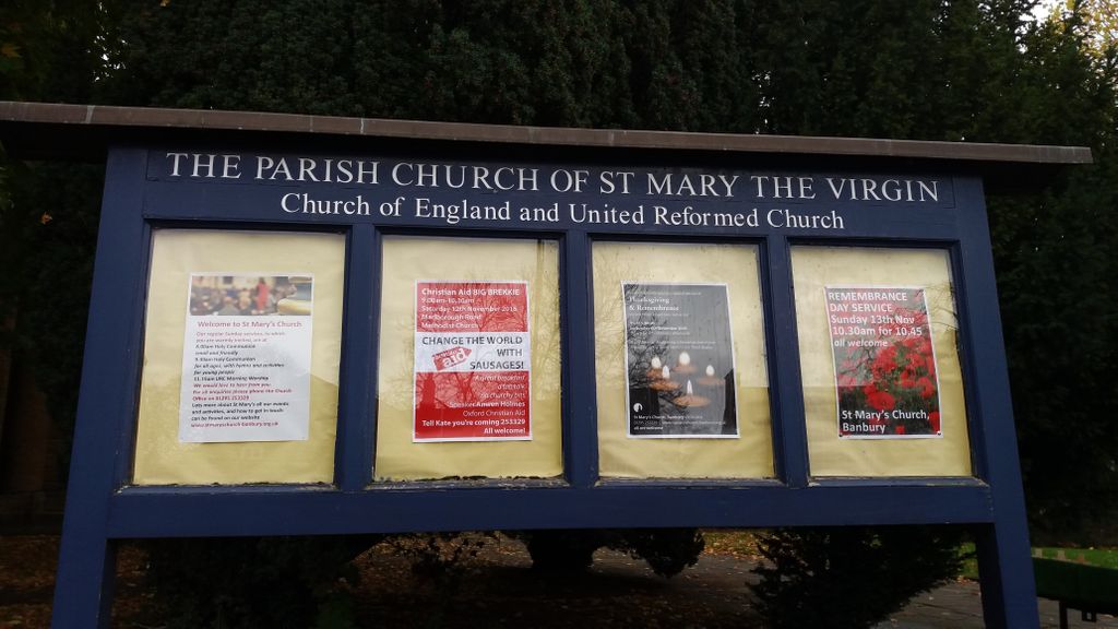
| Location | : | Banbury, Cherwell District, England |
| Phone | : | 01295 253329 |
| Coordinate | : | 52.0614620, -1.3391870 |
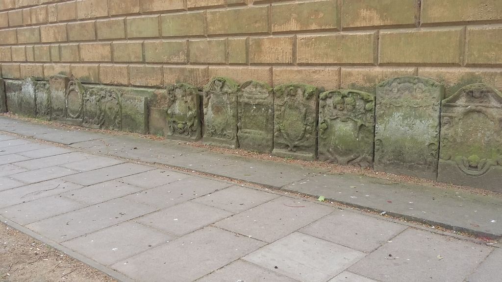
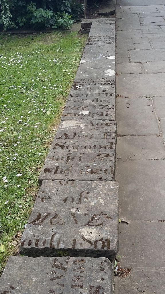
| Description | : | Please be aware that all the original headstones that were in this graveyard have either been used as paving slabs around the church or cut up and used as wall material (see photos attached to the church entry). Those that have been used to create the paths are now too worn and are illegible. The oldest headstones that remained from the 16th/17th century have been propped against the church and are also no longer legible. There are a handful of tombs that are in the churchyard which remain intact although some are now too worn or the... Read More |
frequently asked questions (FAQ):
-
Where is St. Mary the Virgin Churchyard?
St. Mary the Virgin Churchyard is located at Horsefair Banbury, Cherwell District ,Oxfordshire , OX16 0AAEngland.
-
St. Mary the Virgin Churchyard cemetery's updated grave count on graveviews.com?
2 memorials
-
Where are the coordinates of the St. Mary the Virgin Churchyard?
Latitude: 52.0614620
Longitude: -1.3391870
Nearby Cemetories:
1. St. John the Evangelist Churchyard
Banbury, Cherwell District, England
Coordinate: 52.0598790, -1.3400100
2. Southam Road Cemetery
Banbury, Cherwell District, England
Coordinate: 52.0679120, -1.3405760
3. Bodicote Cemetery
Bodicote, Cherwell District, England
Coordinate: 52.0391710, -1.3397380
4. St Peter's Churchyard
Drayton, Cherwell District, England
Coordinate: 52.0707360, -1.3764670
5. Hardwick Hill Cemetery
Banbury, Cherwell District, England
Coordinate: 52.0864530, -1.3381430
6. Banbury Crematorium
Banbury, Cherwell District, England
Coordinate: 52.0865540, -1.3406860
7. Saint John the Baptist Churchyard
Bodicote, Cherwell District, England
Coordinate: 52.0356100, -1.3305700
8. St Mary Church
Warkworth, South Northamptonshire Borough, England
Coordinate: 52.0627000, -1.2917000
9. St. Peters Churchyard
Hanwell, Cherwell District, England
Coordinate: 52.0887920, -1.3657000
10. All Saints Churchyard
Wroxton, Cherwell District, England
Coordinate: 52.0726220, -1.3925790
11. St Mary the Virgin Churchyard
Broughton, Cherwell District, England
Coordinate: 52.0417020, -1.3912030
12. All Saints Churchyard
Middleton Cheney, South Northamptonshire Borough, England
Coordinate: 52.0741984, -1.2740247
13. All Saints' Church Great Bourton
Bourton, Cherwell District, England
Coordinate: 52.1062460, -1.3349970
14. Middleton Cheney Cemetery
Middleton Cheney, South Northamptonshire Borough, England
Coordinate: 52.0745100, -1.2692900
15. St. Peter and St. Paul Churchyard
Chacombe, South Northamptonshire Borough, England
Coordinate: 52.0916900, -1.2850100
16. St Etheldreda Churchyard
Horley, Cherwell District, England
Coordinate: 52.0924610, -1.3930320
17. Adderbury Parish Cemetery
Adderbury, Cherwell District, England
Coordinate: 52.0139537, -1.3246874
18. St Mary's Churchyard
Bloxham, Cherwell District, England
Coordinate: 52.0181100, -1.3748900
19. St Mary the Virgin Churchyard
Adderbury, Cherwell District, England
Coordinate: 52.0148420, -1.3152270
20. St John the Evangelist
Milton, Cherwell District, England
Coordinate: 52.0117900, -1.3452510
21. St. Laurence Churchyard
Shotteswell, Stratford-on-Avon District, England
Coordinate: 52.1061720, -1.3787950
22. Ss Peter and Paul Churchyard
Kings Sutton, South Northamptonshire Borough, England
Coordinate: 52.0212000, -1.2763560
23. St. Mary the Virgin Churchyard
Cropredy, Cherwell District, England
Coordinate: 52.1163600, -1.3165570
24. St Mary the Virgin Churchyard
Thenford, South Northamptonshire Borough, England
Coordinate: 52.0697510, -1.2442930