
| Memorials | : | 0 |
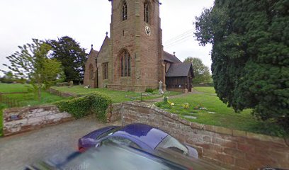
| Location | : | Childs Ercall, Shropshire Unitary Authority, England |
| Website | : | www.lichfield.anglican.org/acny/church/122/ |
| Coordinate | : | 52.8222524, -2.4975524 |
frequently asked questions (FAQ):
-
Where is St Michael & All Angels?
St Michael & All Angels is located at Childs Ercall, Shropshire Unitary Authority ,Shropshire , TF9 2BZEngland.
-
St Michael & All Angels cemetery's updated grave count on graveviews.com?
0 memorials
-
Where are the coordinates of the St Michael & All Angels?
Latitude: 52.8222524
Longitude: -2.4975524
Nearby Cemetories:
1. St Oswald's Church Burial Ground
Hinstock, Shropshire Unitary Authority, England
Coordinate: 52.8346100, -2.4577700
2. Tibberton All Saints
Tibberton, Telford and Wrekin Unitary Authority, England
Coordinate: 52.7800660, -2.4741020
3. St Luke's Churchyard
Hodnet, Shropshire Unitary Authority, England
Coordinate: 52.8536780, -2.5772160
4. St Michael Churchyard
Waters Upton, Telford and Wrekin Unitary Authority, England
Coordinate: 52.7713210, -2.5439270
5. St. Swithun's Churchyard
Cheswardine, Shropshire Unitary Authority, England
Coordinate: 52.8660400, -2.4187700
6. Saint Michael and All Angels
Chetwynd, Telford and Wrekin Unitary Authority, England
Coordinate: 52.7887300, -2.3935160
7. Chetwynd Churchyard
Newport, Telford and Wrekin Unitary Authority, England
Coordinate: 52.7905280, -2.3916390
8. St. Peter Church
Edgmond, Telford and Wrekin Unitary Authority, England
Coordinate: 52.7699680, -2.4159730
9. Talbot Chapel
Longford, Telford and Wrekin Unitary Authority, England
Coordinate: 52.7627400, -2.4081500
10. Forton All Saints Churchyard
Newport, Telford and Wrekin Unitary Authority, England
Coordinate: 52.7876210, -2.3640430
11. St. Nicholas Churchyard
Newport, Telford and Wrekin Unitary Authority, England
Coordinate: 52.7696720, -2.3793420
12. St Michael and All Angels Churchyard
Adbaston, Stafford Borough, England
Coordinate: 52.8482630, -2.3545010
13. St. Mary's Churchyard
Hales, Shropshire Unitary Authority, England
Coordinate: 52.9024580, -2.4274470
14. Saint Catherine Churchyard
Eyton upon the Weald Moors, Telford and Wrekin Unitary Authority, England
Coordinate: 52.7299800, -2.5182200
15. St. Michael & All Angels Churchyard
High Ercall, Telford and Wrekin Unitary Authority, England
Coordinate: 52.7521000, -2.6026400
16. St Andrews Churchyard
Church Aston, Telford and Wrekin Unitary Authority, England
Coordinate: 52.7577930, -2.3815770
17. Newport General Cemetery
Newport, Telford and Wrekin Unitary Authority, England
Coordinate: 52.7656260, -2.3655840
18. St Michael and All Angels Churchyard
Lilleshall, Telford and Wrekin Unitary Authority, England
Coordinate: 52.7345610, -2.4032770
19. Church of St Peter
Norbury, Stafford Borough, England
Coordinate: 52.8084000, -2.3184000
20. Hadley Cemetery
Leegomery, Telford and Wrekin Unitary Authority, England
Coordinate: 52.7097110, -2.4893660
21. St. Matthew's Churchyard
Donnington Wood, Telford and Wrekin Unitary Authority, England
Coordinate: 52.7148135, -2.4308853
22. Holy Trinity Church
Wrockwardine, Telford and Wrekin Unitary Authority, England
Coordinate: 52.7105800, -2.4476600
23. Lilleshall Abbey
Lilleshall, Telford and Wrekin Unitary Authority, England
Coordinate: 52.7247000, -2.3898000
24. Rodington Cemetery
Rodington, Telford and Wrekin Unitary Authority, England
Coordinate: 52.7273200, -2.6148100