
| Memorials | : | 0 |
| Location | : | Northchapel, Chichester District, England |
| Coordinate | : | 51.0561371, -0.6426890 |
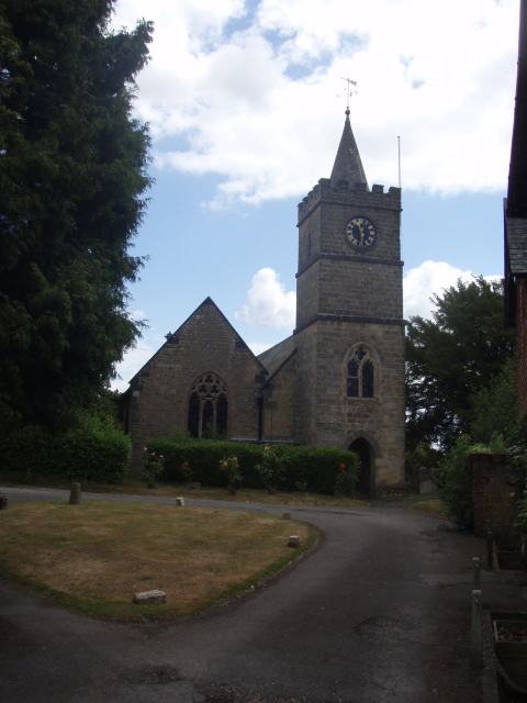
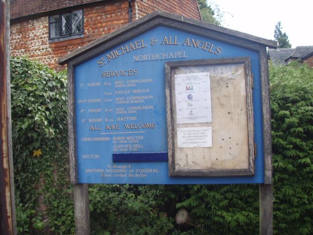
| Description | : | The village of Northchapel is situated in the north-western corner of Sussex, one mile to the south of the Surrey-Sussex county border. Northchapel is so named because its church was once a chapelry to the north of Petworth, but it became a separate parish in its own right in 1691.The parish church of St Michael's lies tucked behind houses on the east side of the village. (Text by Wertypop) |
frequently asked questions (FAQ):
-
Where is St Michael Churchyard?
St Michael Churchyard is located at Northchapel, Chichester District ,West Sussex ,England.
-
St Michael Churchyard cemetery's updated grave count on graveviews.com?
0 memorials
-
Where are the coordinates of the St Michael Churchyard?
Latitude: 51.0561371
Longitude: -0.6426890


Nearby Cemetories:
1. St Laurence Churchyard
Lurgashall, Chichester District, England
Coordinate: 51.0372620, -0.6634070
2. Ebernoe Holy Trinity Churchyard
Ebernoe, Chichester District, England
Coordinate: 51.0415420, -0.6099770
3. Fernhurst Burial Ground
Fernhurst, Chichester District, England
Coordinate: 51.0486080, -0.7220610
4. St. Mary's Churchyard
Chiddingfold, Waverley Borough, England
Coordinate: 51.1097750, -0.6300990
5. Weycombe Road Cemetery
Haslemere, Waverley Borough, England
Coordinate: 51.0946726, -0.7090732
6. Saint Bartholmew's Churchyard
Haslemere, Waverley Borough, England
Coordinate: 51.0915420, -0.7161500
7. St Peter Churchyard
Lodsworth, Chichester District, England
Coordinate: 50.9968230, -0.6746850
8. Hampers Green Cemetery
Petworth, Chichester District, England
Coordinate: 50.9963280, -0.6101350
9. St John The Baptist Churchyard
Kirdford, Chichester District, England
Coordinate: 51.0287710, -0.5494880
10. Pitshill Garden of Rest
Tillington, Chichester District, England
Coordinate: 50.9893710, -0.6320950
11. All Hallows Churchyard Extension
Tillington, Chichester District, England
Coordinate: 50.9893231, -0.6313783
12. All Hallows Churchyard
Tillington, Chichester District, England
Coordinate: 50.9893180, -0.6291640
13. Horsham Road Cemetery
Petworth, Chichester District, England
Coordinate: 50.9920830, -0.6066060
14. St Mary the Virgin Churchyard
Petworth, Chichester District, England
Coordinate: 50.9879345, -0.6096756
15. Bartons Lane Cemetery
Petworth, Chichester District, England
Coordinate: 50.9870920, -0.6073540
16. Lynchmere Burial Ground
Linchmere, Chichester District, England
Coordinate: 51.0832644, -0.7513318
17. St Mary & All Saints Churchyard
Dunsfold, Waverley Borough, England
Coordinate: 51.1175460, -0.5753870
18. Sunvale Cemetery
Haslemere, Waverley Borough, England
Coordinate: 51.0871100, -0.7513700
19. Easebourne Priory
Easebourne, Chichester District, England
Coordinate: 50.9950335, -0.7258487
20. St. John the Baptist Churchyard
Loxwood, Chichester District, England
Coordinate: 51.0688200, -0.5154400
21. St. Luke's Churchyard
Linch, Chichester District, England
Coordinate: 51.0404840, -0.7720810
22. Alfold Cemetery
Alfold, Waverley Borough, England
Coordinate: 51.0956860, -0.5212090
23. St. Nicholas' Churchyard
Alfold, Waverley Borough, England
Coordinate: 51.0956240, -0.5199940
24. St Luke's Churchyard
Grayshott, East Hampshire District, England
Coordinate: 51.1110060, -0.7551490