
| Memorials | : | 0 |
| Location | : | Kirdford, Chichester District, England |
| Coordinate | : | 51.0287710, -0.5494880 |
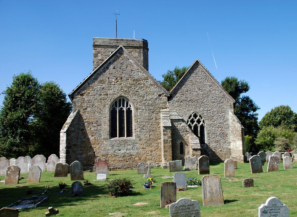
| Description | : | Kirdford church was constructed to the north of the ford over the river on an area of raised land above flood level. It is a Grade 1 listed building and falls in the Kirdford Conservation Area, which is the oldest part of the village of Kirdford. According to 16th century wills the church was originally dedicated to Our Lady. The church is surrounded by a large churchyard which is still in use for burials. The walls are constructed of sandstone, probably from quarries at nearby Fittleworth, and the roof is mainly of Horsham stone slabs. This includes the churchyard extension... Read More |
frequently asked questions (FAQ):
-
Where is St John The Baptist Churchyard?
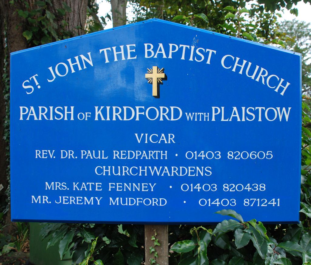
St John The Baptist Churchyard is located at Glasshouse Lane Kirdford, Chichester District ,West Sussex , RH14 0LTEngland.
-
St John The Baptist Churchyard cemetery's updated grave count on graveviews.com?
0 memorials
-
Where are the coordinates of the St John The Baptist Churchyard?
Latitude: 51.0287710
Longitude: -0.5494880


Nearby Cemetories:
1. St. Peter ad Vincula Churchyard
Wisborough Green, Chichester District, England
Coordinate: 51.0223710, -0.5017390
2. Ebernoe Holy Trinity Churchyard
Ebernoe, Chichester District, England
Coordinate: 51.0415420, -0.6099770
3. St. John the Baptist Churchyard
Loxwood, Chichester District, England
Coordinate: 51.0688200, -0.5154400
4. Hampers Green Cemetery
Petworth, Chichester District, England
Coordinate: 50.9963280, -0.6101350
5. Horsham Road Cemetery
Petworth, Chichester District, England
Coordinate: 50.9920830, -0.6066060
6. Bartons Lane Cemetery
Petworth, Chichester District, England
Coordinate: 50.9870920, -0.6073540
7. St Mary the Virgin Churchyard
Petworth, Chichester District, England
Coordinate: 50.9879345, -0.6096756
8. St Bartholomew Churchyard
Egdean, Chichester District, England
Coordinate: 50.9716740, -0.5819790
9. Billingshurst Trinity United Reformed Churchyard
Billingshurst, Horsham District, England
Coordinate: 51.0208352, -0.4530985
10. St Mary Churchyard
Billingshurst, Horsham District, England
Coordinate: 51.0223920, -0.4507020
11. All Hallows Churchyard
Tillington, Chichester District, England
Coordinate: 50.9893180, -0.6291640
12. St Michael Churchyard
Northchapel, Chichester District, England
Coordinate: 51.0561371, -0.6426890
13. All Hallows Churchyard Extension
Tillington, Chichester District, England
Coordinate: 50.9893231, -0.6313783
14. Pitshill Garden of Rest
Tillington, Chichester District, England
Coordinate: 50.9893710, -0.6320950
15. St Mary the Virgin Churchyard
Fittleworth, Chichester District, England
Coordinate: 50.9641190, -0.5641100
16. St Mary the Virgin Churchyard
Stopham, Chichester District, England
Coordinate: 50.9607210, -0.5397030
17. Alfold Cemetery
Alfold, Waverley Borough, England
Coordinate: 51.0956860, -0.5212090
18. St. Nicholas' Churchyard
Alfold, Waverley Borough, England
Coordinate: 51.0956240, -0.5199940
19. St Laurence Churchyard
Lurgashall, Chichester District, England
Coordinate: 51.0372620, -0.6634070
20. St. Mary’s Churchyard
Pulborough, Horsham District, England
Coordinate: 50.9588300, -0.5101400
21. St. Botolph's Churchyard
Pulborough, Horsham District, England
Coordinate: 50.9486804, -0.5228765
22. St Botolph Churchyard
Hardham, Horsham District, England
Coordinate: 50.9485730, -0.5226740
23. Blue Idol Quaker Burying Ground
Thakeham, Horsham District, England
Coordinate: 50.9986257, -0.4249232
24. St Peter Churchyard
Lodsworth, Chichester District, England
Coordinate: 50.9968230, -0.6746850