
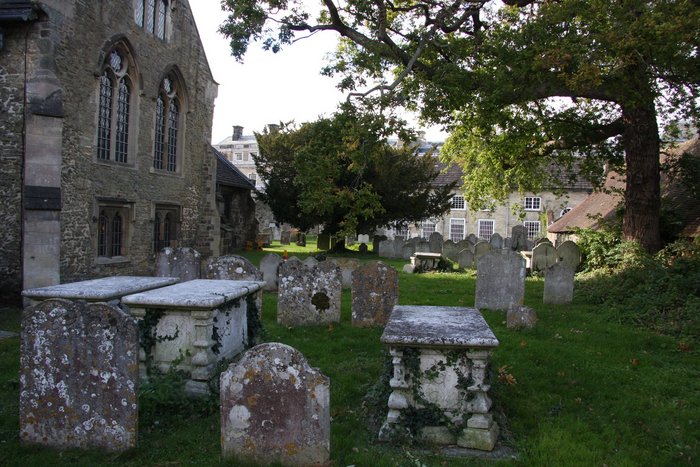
| Memorials | : | 0 |
| Location | : | Petworth, Chichester District, England |
| Coordinate | : | 50.9879345, -0.6096756 |
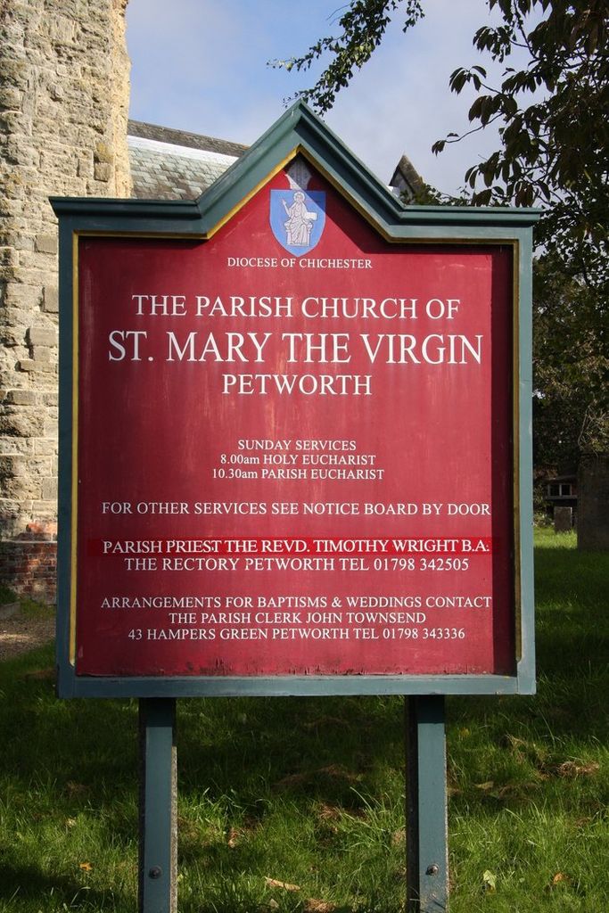
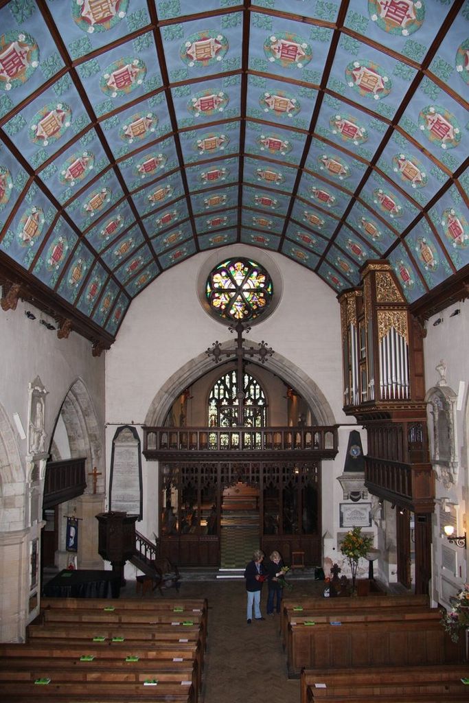
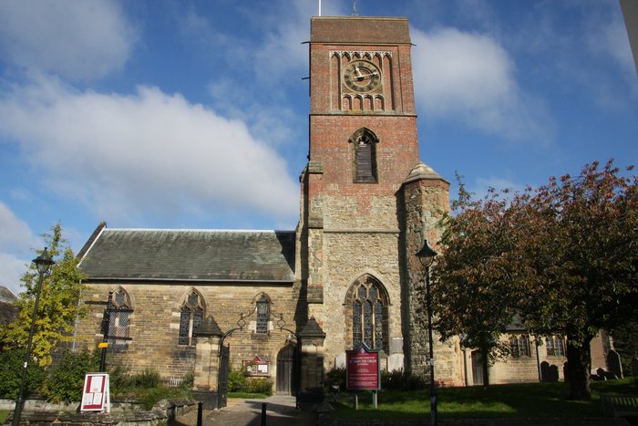
| Description | : | The church of St Mary the Virgin lies just east of Petworth House in West Sussex. There was a church recorded here in the Domesday Book of 1086, but nothing of that early building remains. The oldest part of the current church is the 13th century chancel. The north aisle and base of the tower are 14th century, with a 15th century north chapel. Many of the most interesting historical monuments in the church are located in the St Thomas Chapel. This is thought to be one of seven chapels erected by Henry II as penance for the... Read More |
frequently asked questions (FAQ):
-
Where is St Mary the Virgin Churchyard?
St Mary the Virgin Churchyard is located at Petworth, Chichester District ,West Sussex , GU28 0AEEngland.
-
St Mary the Virgin Churchyard cemetery's updated grave count on graveviews.com?
0 memorials
-
Where are the coordinates of the St Mary the Virgin Churchyard?
Latitude: 50.9879345
Longitude: -0.6096756
Nearby Cemetories:
1. Bartons Lane Cemetery
Petworth, Chichester District, England
Coordinate: 50.9870920, -0.6073540
2. Horsham Road Cemetery
Petworth, Chichester District, England
Coordinate: 50.9920830, -0.6066060
3. Hampers Green Cemetery
Petworth, Chichester District, England
Coordinate: 50.9963280, -0.6101350
4. All Hallows Churchyard
Tillington, Chichester District, England
Coordinate: 50.9893180, -0.6291640
5. All Hallows Churchyard Extension
Tillington, Chichester District, England
Coordinate: 50.9893231, -0.6313783
6. Pitshill Garden of Rest
Tillington, Chichester District, England
Coordinate: 50.9893710, -0.6320950
7. St Bartholomew Churchyard
Egdean, Chichester District, England
Coordinate: 50.9716740, -0.5819790
8. St Mary the Virgin Churchyard
Fittleworth, Chichester District, England
Coordinate: 50.9641190, -0.5641100
9. St Richard's Church
Duncton, Chichester District, England
Coordinate: 50.9486600, -0.6230000
10. Holy Trinity Churchyard
Duncton, Chichester District, England
Coordinate: 50.9491400, -0.6337740
11. St Peter Churchyard
Lodsworth, Chichester District, England
Coordinate: 50.9968230, -0.6746850
12. St Mary the Virgin Churchyard
Stopham, Chichester District, England
Coordinate: 50.9607210, -0.5397030
13. Ebernoe Holy Trinity Churchyard
Ebernoe, Chichester District, England
Coordinate: 51.0415420, -0.6099770
14. St John The Baptist Churchyard
Kirdford, Chichester District, England
Coordinate: 51.0287710, -0.5494880
15. St. John The Baptist Churchyard Cemetery
Sutton, Chichester District, England
Coordinate: 50.9316638, -0.6080123
16. St Peters Churchyard
East Lavington, Chichester District, England
Coordinate: 50.9379250, -0.6550920
17. St Laurence Churchyard
Lurgashall, Chichester District, England
Coordinate: 51.0372620, -0.6634070
18. St. Botolph's Churchyard
Pulborough, Horsham District, England
Coordinate: 50.9486804, -0.5228765
19. St Botolph Churchyard
Hardham, Horsham District, England
Coordinate: 50.9485730, -0.5226740
20. St. Mary’s Churchyard
Pulborough, Horsham District, England
Coordinate: 50.9588300, -0.5101400
21. St Michael Churchyard
Northchapel, Chichester District, England
Coordinate: 51.0561371, -0.6426890
22. Easebourne Priory
Easebourne, Chichester District, England
Coordinate: 50.9950335, -0.7258487
23. St. Peter ad Vincula Churchyard
Wisborough Green, Chichester District, England
Coordinate: 51.0223710, -0.5017390
24. St Mary Magdelene Churchyard
West Lavington, Chichester District, England
Coordinate: 50.9773640, -0.7311840