
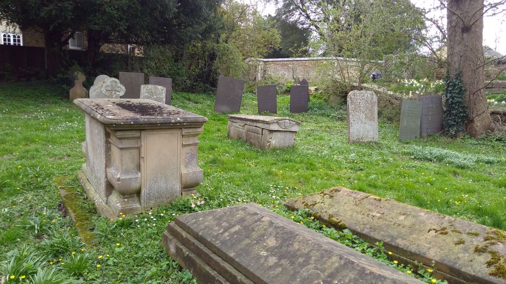
| Memorials | : | 45 |
| Location | : | Barkston, South Kesteven District, England |
| Coordinate | : | 52.9629960, -0.6129380 |
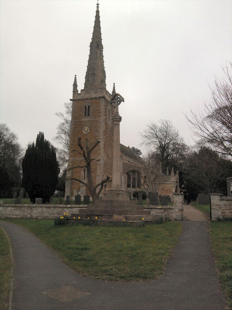
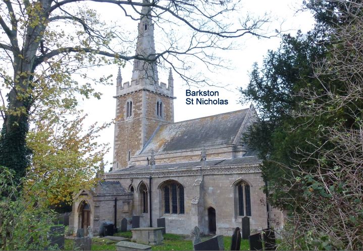
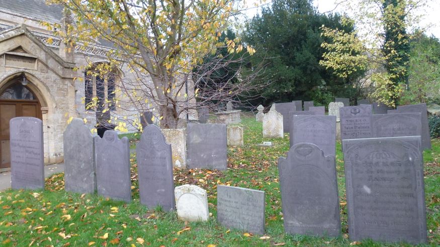
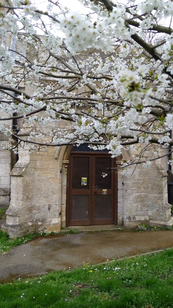
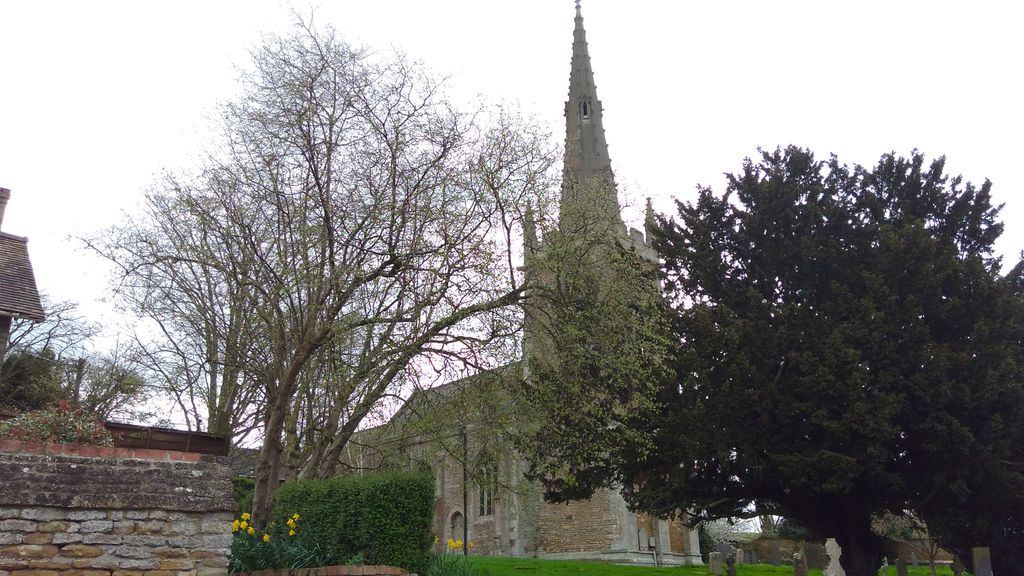
| Description | : | There has been a church on this site for over 700 years, the Ironstone tower was added in the 13th century but the lower courses may be of Anglo Saxon origin. The spire was added in the 15th century and is of stone from the nearby village of Ancaster. There is a considerable burial ground around the church and nearby a newer cemetery. |
frequently asked questions (FAQ):
-
Where is St Nicholas Churchyard?
St Nicholas Churchyard is located at Barkston, South Kesteven District ,Lincolnshire ,England.
-
St Nicholas Churchyard cemetery's updated grave count on graveviews.com?
45 memorials
-
Where are the coordinates of the St Nicholas Churchyard?
Latitude: 52.9629960
Longitude: -0.6129380
Nearby Cemetories:
1. St Marys Churchyard
Syston, South Kesteven District, England
Coordinate: 52.9578420, -0.6172940
2. St. Peter and St. Paul's Churchyard
Belton, South Kesteven District, England
Coordinate: 52.9451000, -0.6177000
3. St. Wilfrid Churchyard
Honington, South Kesteven District, England
Coordinate: 52.9795600, -0.5965700
4. St. Nicholas Churchyard
Carlton Scroop, South Kesteven District, England
Coordinate: 52.9940290, -0.5895960
5. St John the Evangelist Churchyard
Manthorpe, South Kesteven District, England
Coordinate: 52.9306320, -0.6323160
6. St John the Baptist Churchyard
Londonthorpe, South Kesteven District, England
Coordinate: 52.9312060, -0.5837350
7. St Sebastian Churchyard
Great Gonerby, South Kesteven District, England
Coordinate: 52.9329260, -0.6657700
8. All Saints Churchyard
Hough-on-the-Hill, South Kesteven District, England
Coordinate: 53.0069700, -0.6255100
9. St Nicholas Churchyard
Normanton, South Kesteven District, England
Coordinate: 53.0051390, -0.5874570
10. All Saints Churchyard
Hougham, South Kesteven District, England
Coordinate: 52.9878240, -0.6806910
11. Ancaster Cemetery
Ancaster, South Kesteven District, England
Coordinate: 52.9814450, -0.5387892
12. St. Martin Churchyard
Ancaster, South Kesteven District, England
Coordinate: 52.9804810, -0.5377820
13. Manthorpe Road Old Cemetery
Grantham, South Kesteven District, England
Coordinate: 52.9173900, -0.6409900
14. St. Wulfram Churchyard
Grantham, South Kesteven District, England
Coordinate: 52.9148180, -0.6408520
15. Grantham Cemetery and Crematorium
Grantham, South Kesteven District, England
Coordinate: 52.9095320, -0.6326120
16. St. Vincent Churchyard
Caythorpe, South Kesteven District, England
Coordinate: 53.0261420, -0.6015930
17. St Andrew Churchyard
Kelby, North Kesteven District, England
Coordinate: 52.9608000, -0.5074000
18. St. Andrew's Churchyard
South Kesteven District, England
Coordinate: 52.9608000, -0.5074000
19. All Saints Churchyard
Barrowby, South Kesteven District, England
Coordinate: 52.9186420, -0.6946810
20. St Peter Churchyard
Foston, South Kesteven District, England
Coordinate: 52.9771630, -0.7227360
21. St. Mary's Churchyard
Wilsford, North Kesteven District, England
Coordinate: 52.9751600, -0.5023700
22. St James Churchyard
Allington, South Kesteven District, England
Coordinate: 52.9525695, -0.7245301
23. St. Michael's and All Angels Churchyard
Heydour, South Kesteven District, England
Coordinate: 52.9444900, -0.4987800
24. Saint Michael Churchyard
Heydour, South Kesteven District, England
Coordinate: 52.9443700, -0.4987000