
| Memorials | : | 91 |
| Location | : | Normanton, South Kesteven District, England |
| Coordinate | : | 53.0051390, -0.5874570 |
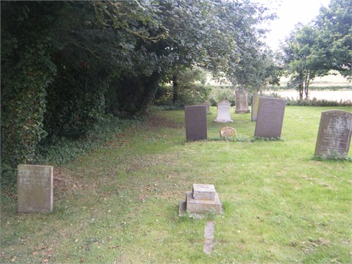
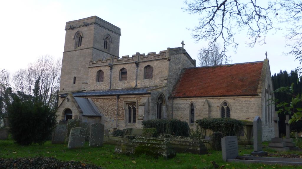
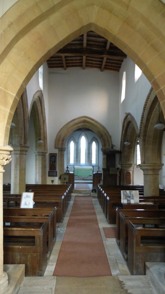
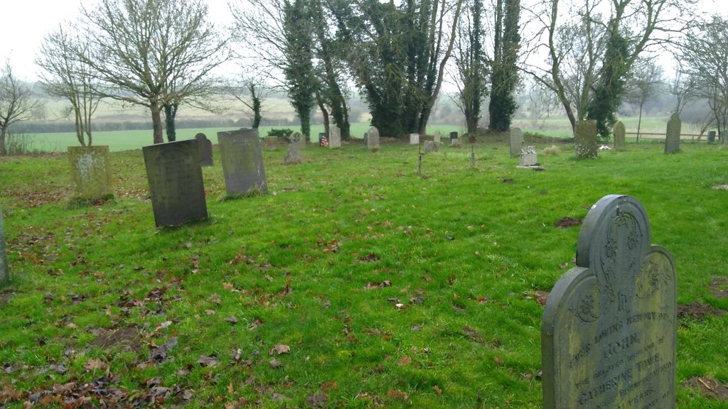
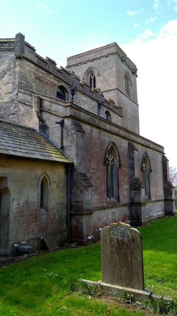
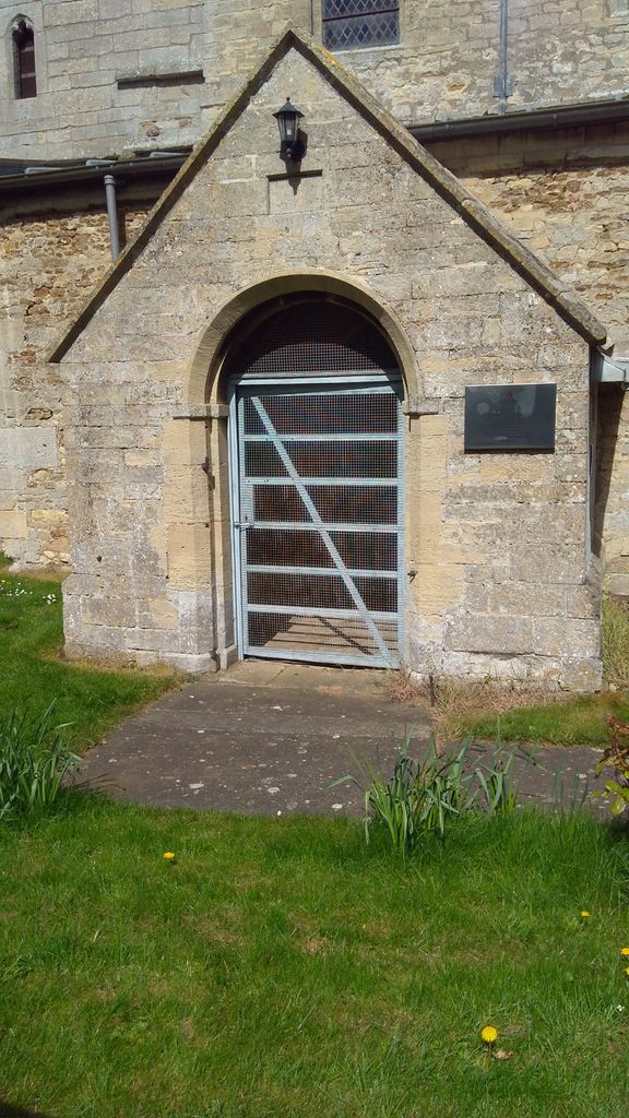
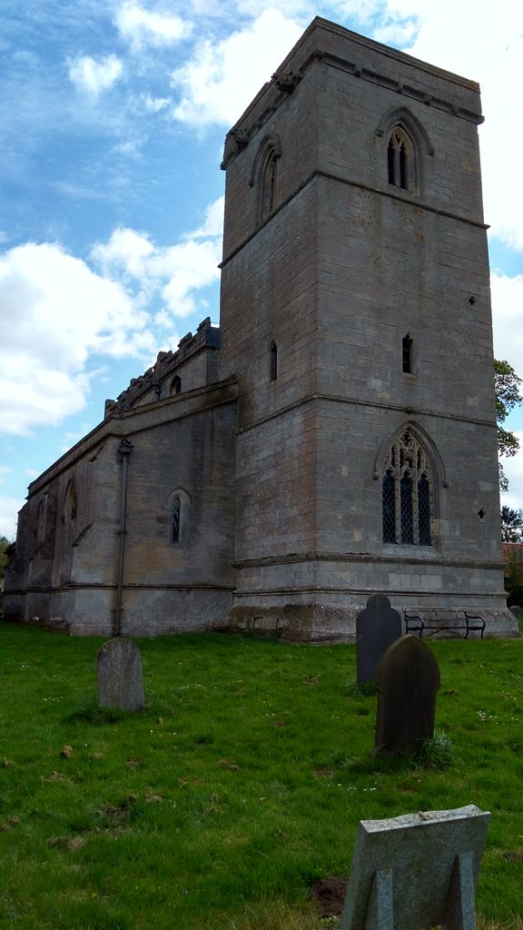
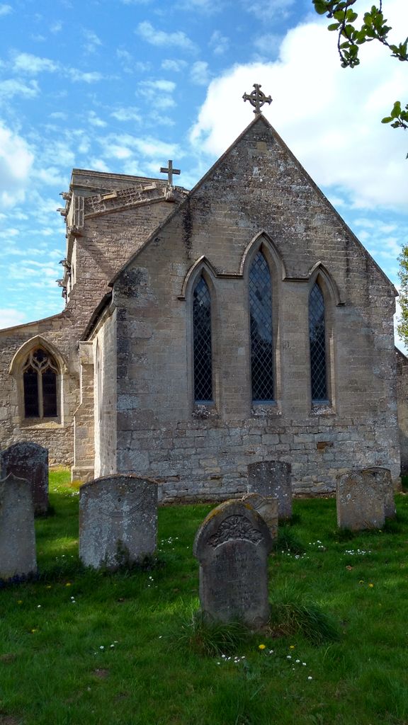
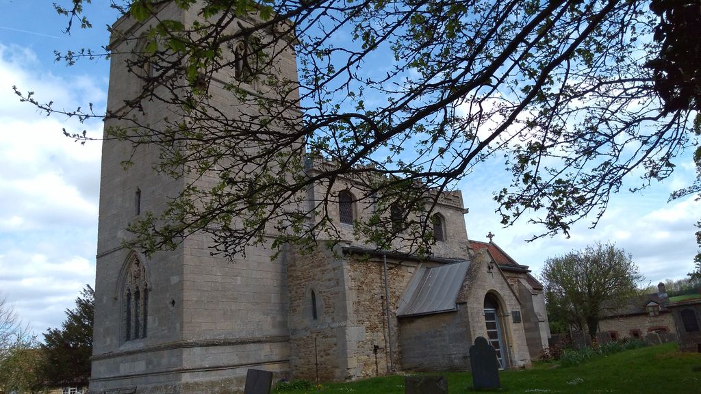
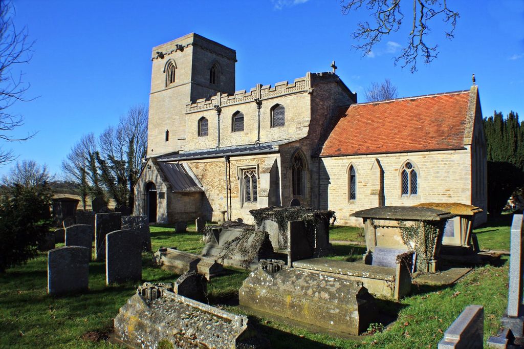
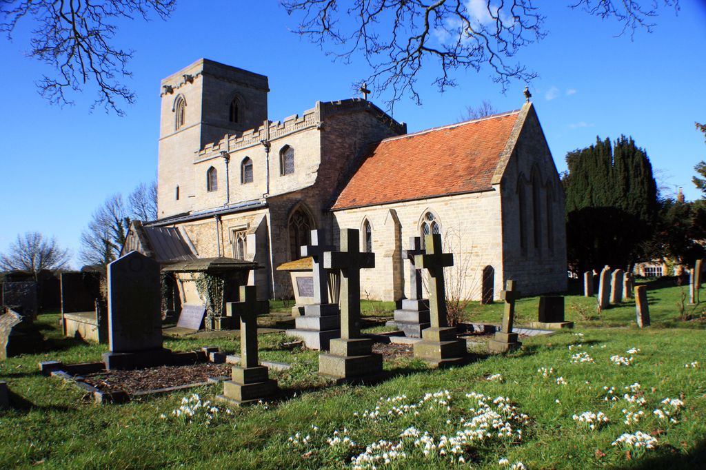
| Description | : | St Nicholas, Normanton Lincolnshire The Anglican parish church at Normanton-on-Cliffe whilst appearing Victorian has much earlier origins. The Norman arches of the south arcade are 12th century, the north arcade maybe a century younger. The tower is 14th century and has a fine contemporary door and wooden chest. A clerestory was added in the 15th century. Much of the mediaeval carving remains, together with a 17th century pulpit and Royal Arms of 1820 |
frequently asked questions (FAQ):
-
Where is St Nicholas Churchyard?
St Nicholas Churchyard is located at Main Street Normanton, South Kesteven District ,Lincolnshire ,England.
-
St Nicholas Churchyard cemetery's updated grave count on graveviews.com?
91 memorials
-
Where are the coordinates of the St Nicholas Churchyard?
Latitude: 53.0051390
Longitude: -0.5874570
Nearby Cemetories:
1. St. Nicholas Churchyard
Carlton Scroop, South Kesteven District, England
Coordinate: 52.9940290, -0.5895960
2. St. Vincent Churchyard
Caythorpe, South Kesteven District, England
Coordinate: 53.0261420, -0.6015930
3. All Saints Churchyard
Hough-on-the-Hill, South Kesteven District, England
Coordinate: 53.0069700, -0.6255100
4. St. Wilfrid Churchyard
Honington, South Kesteven District, England
Coordinate: 52.9795600, -0.5965700
5. St. Nicholas Churchyard
Fulbeck, South Kesteven District, England
Coordinate: 53.0426840, -0.5871030
6. Ancaster Cemetery
Ancaster, South Kesteven District, England
Coordinate: 52.9814450, -0.5387892
7. St. Martin Churchyard
Ancaster, South Kesteven District, England
Coordinate: 52.9804810, -0.5377820
8. St Nicholas Churchyard
Barkston, South Kesteven District, England
Coordinate: 52.9629960, -0.6129380
9. St Swithun Churchyard
Leadenham, North Kesteven District, England
Coordinate: 53.0545070, -0.5835610
10. St Marys Churchyard
Syston, South Kesteven District, England
Coordinate: 52.9578420, -0.6172940
11. All Saints Churchyard
Hougham, South Kesteven District, England
Coordinate: 52.9878240, -0.6806910
12. St. Mary's Churchyard
Wilsford, North Kesteven District, England
Coordinate: 52.9751600, -0.5023700
13. St. Peter and St. Paul's Churchyard
Belton, South Kesteven District, England
Coordinate: 52.9451000, -0.6177000
14. St Michael Churchyard
Stragglethorpe, North Kesteven District, England
Coordinate: 53.0609600, -0.6382370
15. St Peter's Churchyard
North Rauceby, North Kesteven District, England
Coordinate: 53.0056400, -0.4796500
16. St Andrew Churchyard
Kelby, North Kesteven District, England
Coordinate: 52.9608000, -0.5074000
17. St. Andrew's Churchyard
South Kesteven District, England
Coordinate: 52.9608000, -0.5074000
18. St John the Baptist Churchyard
Londonthorpe, South Kesteven District, England
Coordinate: 52.9312060, -0.5837350
19. All Saints Churchyard
Fenton, South Kesteven District, England
Coordinate: 53.0462300, -0.6910100
20. St Helen's Churchyard
Brant Broughton, North Kesteven District, England
Coordinate: 53.0744850, -0.6351690
21. St. Chad's Churchyard
Welbourn, North Kesteven District, England
Coordinate: 53.0790350, -0.5554450
22. St John the Evangelist Churchyard
Manthorpe, South Kesteven District, England
Coordinate: 52.9306320, -0.6323160
23. St. Michael's and All Angels Churchyard
Heydour, South Kesteven District, England
Coordinate: 52.9444900, -0.4987800
24. Saint Michael Churchyard
Heydour, South Kesteven District, England
Coordinate: 52.9443700, -0.4987000