| Memorials | : | 1 |
| Location | : | Ashbourne, Derbyshire Dales District, England |
| Coordinate | : | 53.0149220, -1.7386720 |
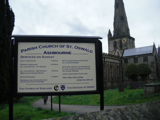
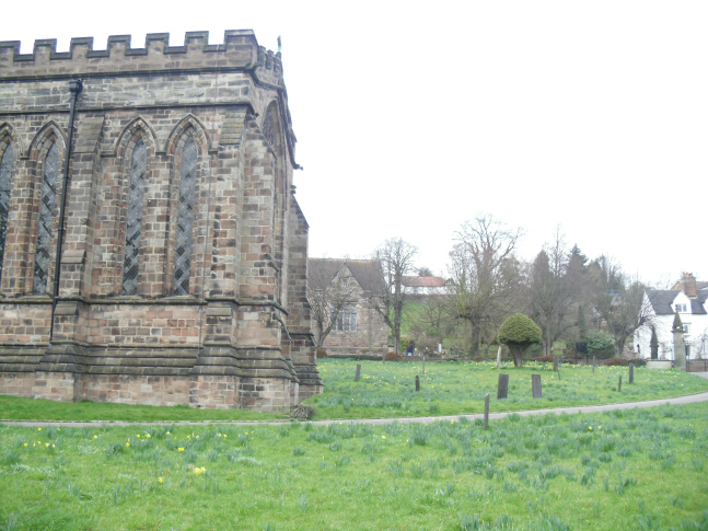
| Description | : | St Oswald's Church, Ashbourne, is one of the grandest churches in Derbyshire. The most noticable feature is its very tall spire - 212 feet (65 metres) - which dominates the area even though the church lies in the bottom of the valley. There was certainly a church here in Saxon times and the current church has a Norman crypt, but the present building was constructed in the 13th and early 14th centuries and is the finest local example of the Early English style. The Chancel was complete by 1241 and the Nave and transepts were added in the later part of... Read More |
frequently asked questions (FAQ):
-
Where is St Oswald Churchyard?
St Oswald Churchyard is located at Mayfield Road Ashbourne, Derbyshire Dales District ,Derbyshire ,England.
-
St Oswald Churchyard cemetery's updated grave count on graveviews.com?
1 memorials
-
Where are the coordinates of the St Oswald Churchyard?
Latitude: 53.0149220
Longitude: -1.7386720
Nearby Cemetories:
1. Ashbourne Cemetery
Ashbourne, Derbyshire Dales District, England
Coordinate: 53.0109900, -1.7482450
2. St. Mary's Churchyard
Mappleton, Derbyshire Dales District, England
Coordinate: 53.0294920, -1.7542220
3. Mapleton, St Mary
Ashbourne, Derbyshire Dales District, England
Coordinate: 53.0294190, -1.7544910
4. Holy Trinity Churchyard
Clifton, Derbyshire Dales District, England
Coordinate: 53.0002710, -1.7545890
5. All Saints Church
Okeover, East Staffordshire Borough, England
Coordinate: 53.0302050, -1.7650989
6. St. John the Baptist Churchyard
Mayfield, East Staffordshire Borough, England
Coordinate: 52.9998700, -1.7716970
7. St. Martin Churchyard
Osmaston, Derbyshire Dales District, England
Coordinate: 52.9930270, -1.7042370
8. St. Peter's Churchyard
Snelston, Derbyshire Dales District, England
Coordinate: 52.9871570, -1.7700260
9. St. Edmund King and Martyr Churchyard
Fenny Bentley, Derbyshire Dales District, England
Coordinate: 53.0486820, -1.7411430
10. St. James' Churchyard
Edlaston, Derbyshire Dales District, England
Coordinate: 52.9811080, -1.7316130
11. St. Leonard's Churchyard
Thorpe, Derbyshire Dales District, England
Coordinate: 53.0485290, -1.7682900
12. All Saints Churchyard
Bradley, Derbyshire Dales District, England
Coordinate: 53.0105800, -1.6682420
13. Saint Bartholomew Churchyard
Blore, Staffordshire Moorlands District, England
Coordinate: 53.0411100, -1.7963100
14. St. Bartholomew's Churchyard
Blore, Derbyshire Dales District, England
Coordinate: 53.0408190, -1.7967020
15. St. Mary's Churchyard
Stanton, East Staffordshire Borough, England
Coordinate: 53.0109590, -1.8136560
16. St. Michael & All Angels Churchyard
Kniveton, Derbyshire Dales District, England
Coordinate: 53.0503980, -1.6881340
17. Holy Cross Churchyard
Ilam, Staffordshire Moorlands District, England
Coordinate: 53.0533440, -1.8034640
18. St. Michael's Churchyard
Shirley, Derbyshire Dales District, England
Coordinate: 52.9718160, -1.6755680
19. St. Mary and St. Barlock Churchyard
Norbury, Derbyshire Dales District, England
Coordinate: 52.9787350, -1.8146430
20. Saint Peter's Cemetery
Ellastone, East Staffordshire Borough, England
Coordinate: 52.9882900, -1.8275000
21. Yeaveley Cemetery
Yeaveley, Derbyshire Dales District, England
Coordinate: 52.9552050, -1.7250170
22. All Saints Churchyard
Bradbourne, Derbyshire Dales District, England
Coordinate: 53.0716940, -1.6909330
23. Christ Church Churchyard
Hulland, Derbyshire Dales District, England
Coordinate: 53.0235790, -1.6295860
24. St. John's Churchyard
Alkmonton, Derbyshire Dales District, England
Coordinate: 52.9438800, -1.7229970


