
| Memorials | : | 0 |
| Location | : | Ferrybridge, Metropolitan Borough of Wakefield, England |
| Coordinate | : | 53.7193380, -1.2748540 |
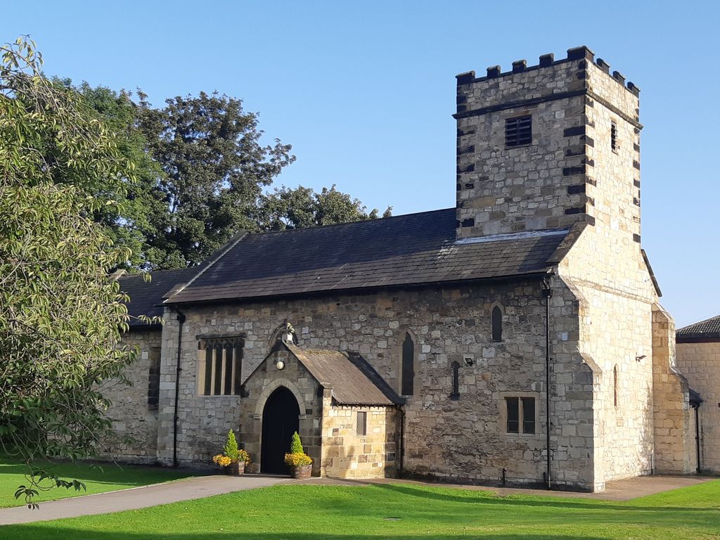
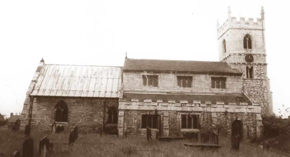
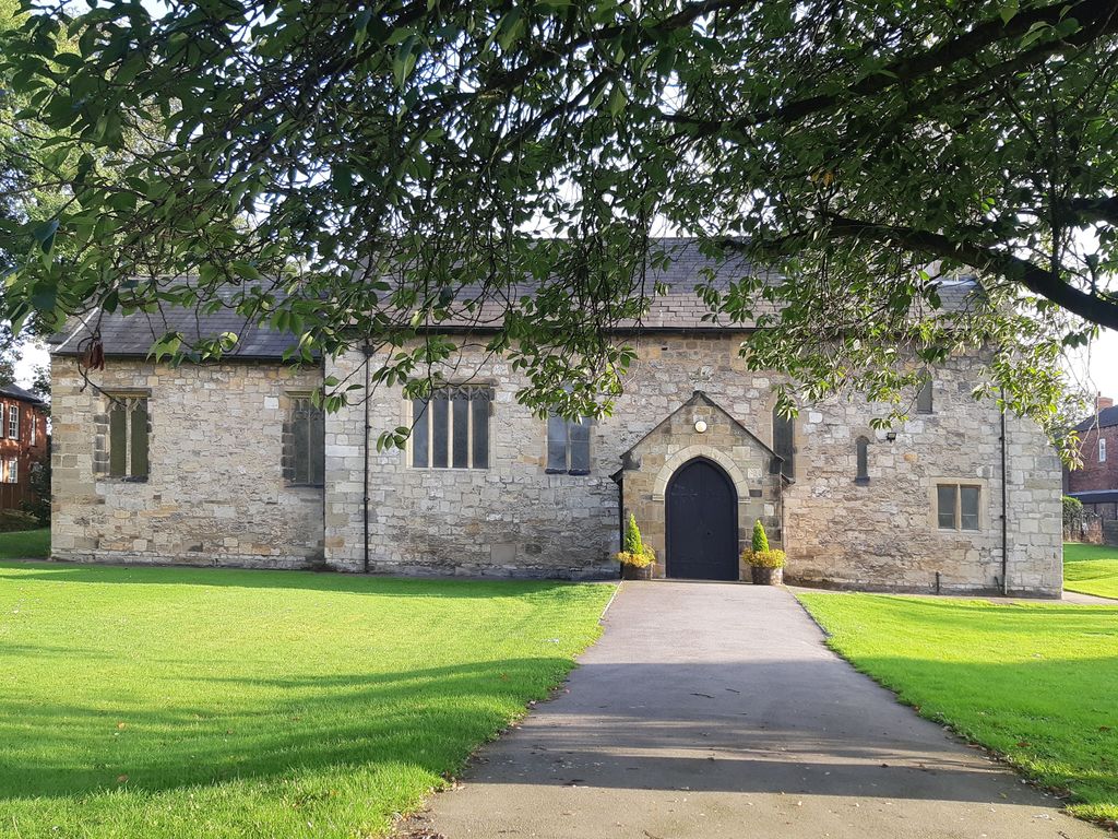
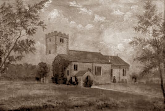
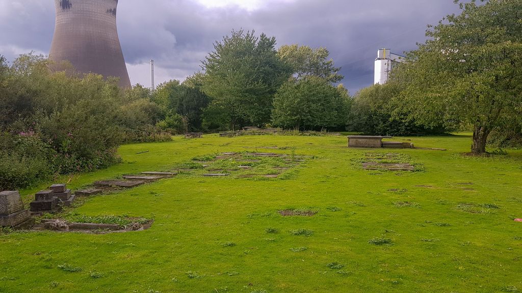
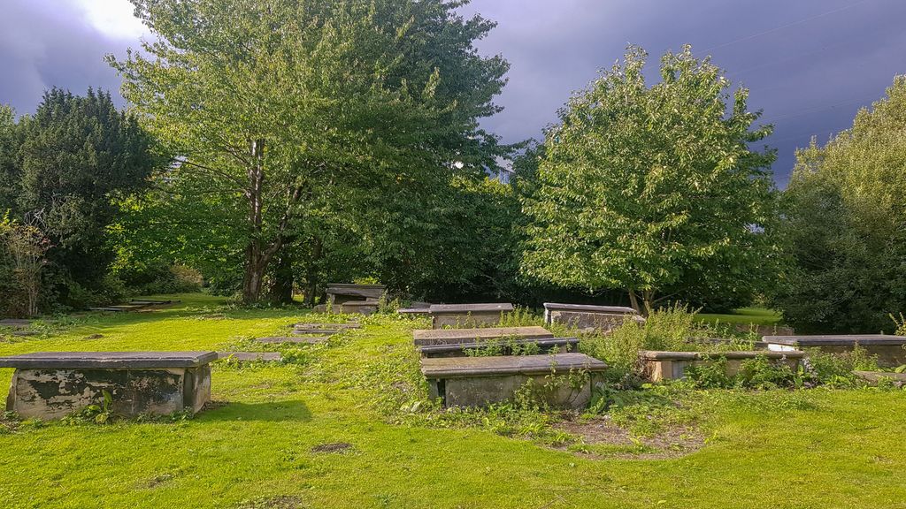
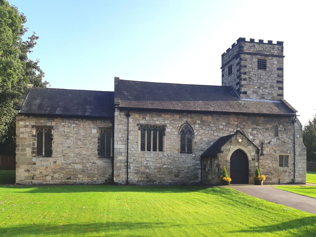
| Description | : | This churchyard is located in the fomer parish of Ferry Fryston, and is immediately east of the cooling towers for the Ferrybridge power station. The church building on this site was dismantled in 1951-53. The building materials where then used to construct the current St Andrew Church on Pontefract Road in Ferrybridge. The burial registers for the St Andrew Old Churchyard at Ferry Fryston cover the period 1674 to 1949 and are held at the West Yorkshire Archive Service, Newstead Road Wakefield WF1 2DE. Bishop’s Transcripts of the register dating from 1600 are held at the Borthwick Institute for Archives,... Read More |
frequently asked questions (FAQ):
-
Where is St. Andrew's Old Churchyard?
St. Andrew's Old Churchyard is located at Kirkhaw Lane Ferry Fryston Ferrybridge, Metropolitan Borough of Wakefield ,West Yorkshire , WF11 8RDEngland.
-
St. Andrew's Old Churchyard cemetery's updated grave count on graveviews.com?
0 memorials
-
Where are the coordinates of the St. Andrew's Old Churchyard?
Latitude: 53.7193380
Longitude: -1.2748540
Nearby Cemetories:
1. St Edward the Confessor Churchyard
Brotherton, Selby District, England
Coordinate: 53.7259200, -1.2709600
2. Brotherton United Reformed Church
Brotherton, Selby District, England
Coordinate: 53.7277104, -1.2698131
3. Ferrybridge Cemetery
Ferrybridge, Metropolitan Borough of Wakefield, England
Coordinate: 53.7102530, -1.2795200
4. St. Botolph Churchyard
Knottingley, Metropolitan Borough of Wakefield, England
Coordinate: 53.7108080, -1.2441680
5. Ropewalk Methodist Church Burial Ground
Knottingley, Metropolitan Borough of Wakefield, England
Coordinate: 53.7092850, -1.2408320
6. United Reformed Churchyard
Knottingley, Metropolitan Borough of Wakefield, England
Coordinate: 53.7104820, -1.2397270
7. St James Churchyard
Fairburn, Selby District, England
Coordinate: 53.7426700, -1.2841000
8. St John's Priory of Pontefract
Pontefract, Metropolitan Borough of Wakefield, England
Coordinate: 53.6978050, -1.2987420
9. All Saints Churchyard
Pontefract, Metropolitan Borough of Wakefield, England
Coordinate: 53.6960100, -1.3010400
10. Knottingley Cemetery
Knottingley, Metropolitan Borough of Wakefield, England
Coordinate: 53.7018600, -1.2363390
11. St. Peter's Churchyard
Fryston, Metropolitan Borough of Wakefield, England
Coordinate: 53.7355400, -1.3151100
12. Friends Burial Ground
Pontefract, Metropolitan Borough of Wakefield, England
Coordinate: 53.6924940, -1.3061380
13. Pontefract Cemetery
Pontefract, Metropolitan Borough of Wakefield, England
Coordinate: 53.6945160, -1.3108810
14. St Giles with St Mary Church
Pontefract, Metropolitan Borough of Wakefield, England
Coordinate: 53.6915100, -1.3118300
15. Castleford New Cemetery
Castleford, Metropolitan Borough of Wakefield, England
Coordinate: 53.7259920, -1.3380580
16. Castleford Old Cemetery
Castleford, Metropolitan Borough of Wakefield, England
Coordinate: 53.7269200, -1.3390300
17. Castleford New Extension Cemetery
Castleford, Metropolitan Borough of Wakefield, England
Coordinate: 53.7277600, -1.3391000
18. Black Friars Pontefract
Pontefract, Metropolitan Borough of Wakefield, England
Coordinate: 53.6876090, -1.3152690
19. St. Luke and All Saints Churchyard
Darrington, Metropolitan Borough of Wakefield, England
Coordinate: 53.6756540, -1.2673490
20. St Michael the Archangel Churchyard
Carleton, Metropolitan Borough of Wakefield, England
Coordinate: 53.6762860, -1.2934180
21. St Michael the Archangel Church Cemetery
Carleton, Metropolitan Borough of Wakefield, England
Coordinate: 53.6740180, -1.2951080
22. St Mary Churchyard
Birkin, Selby District, England
Coordinate: 53.7325000, -1.1979000
23. All Saints Churchyard
Ledsham, Metropolitan Borough of Leeds, England
Coordinate: 53.7622160, -1.3091920
24. St Wilfrid’s Churchyard
Monk Fryston, Selby District, England
Coordinate: 53.7618300, -1.2349700