
| Memorials | : | 0 |
| Location | : | Chatteris, Fenland District, England |
| Coordinate | : | 52.4547000, 0.0510900 |
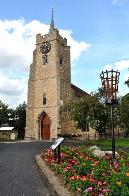
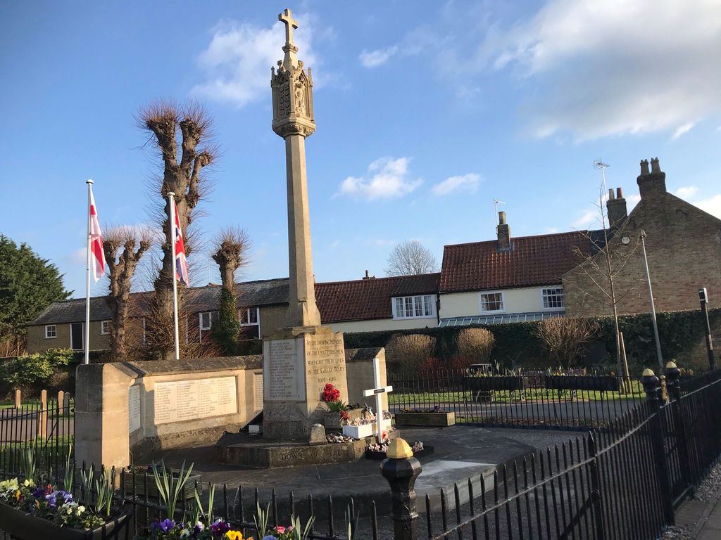
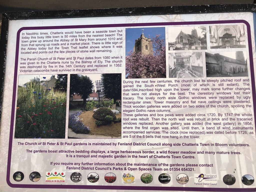
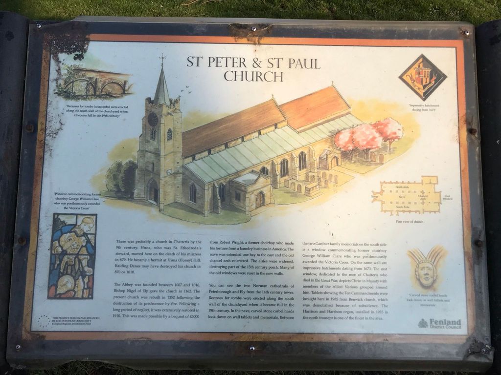
| Description | : | The parish church of St Peter & St Paul is situated in the centre of the town. A church has been on the site since at least 1162, although the current tower dates from 1352. The building had fallen into disrepair during the 19th century, and the majority of the building is the result of an intensive restoration in 1910. This included restoring a pitched roof and adding new aisles, although the nave arches are original. In 1935, a new two manual Harrison & Harrison organ was installed, a fine example of a pneumatic action instrument. Recent years have seen the... Read More |
frequently asked questions (FAQ):
-
Where is St. Peter & St. Paul Churchyard?
St. Peter & St. Paul Churchyard is located at Market Hill Chatteris, Fenland District ,Cambridgeshire , PE16 6BAEngland.
-
St. Peter & St. Paul Churchyard cemetery's updated grave count on graveviews.com?
0 memorials
-
Where are the coordinates of the St. Peter & St. Paul Churchyard?
Latitude: 52.4547000
Longitude: 0.0510900

Nearby Cemetories:
1. Meeks Cemetery
Chatteris, Fenland District, England
Coordinate: 52.4579050, 0.0530000
2. Parochial Cemetery
Chatteris, Fenland District, England
Coordinate: 52.4571990, 0.0582040
3. St Mary Churchyard
Doddington, Fenland District, England
Coordinate: 52.4949320, 0.0609840
4. St. Mary's Churchyard
Ramsey Saint Marys, Huntingdonshire District, England
Coordinate: 52.4688020, -0.0153334
5. St Peter Churchyard
Wimblington, Fenland District, England
Coordinate: 52.5081000, 0.0851900
6. St. Mary Churchyard
Mepal, East Cambridgeshire District, England
Coordinate: 52.4087700, 0.1159990
7. Benwick Cemetery
Benwick, Fenland District, England
Coordinate: 52.4967300, -0.0259400
8. St. Andrew's Churchyard
Sutton, East Cambridgeshire District, England
Coordinate: 52.3899851, 0.1261606
9. Witcham Village Cemetery
Witcham, East Cambridgeshire District, England
Coordinate: 52.4015837, 0.1476457
10. St. Nicholas' Churchyard
Manea, Fenland District, England
Coordinate: 52.4813910, 0.1737894
11. St. Wendreda's Churchyard
March, Fenland District, England
Coordinate: 52.5364880, 0.0849940
12. Wood Lane Cemetery
Ramsey, Huntingdonshire District, England
Coordinate: 52.4525800, -0.0994800
13. St. Peter ad Vincula Churchyard
Coveney, East Cambridgeshire District, England
Coordinate: 52.4173217, 0.1889106
14. All Saints Churchyard
Pidley, Huntingdonshire District, England
Coordinate: 52.3863792, -0.0513670
15. Eastwood Cemetery
March, Fenland District, England
Coordinate: 52.5433080, 0.0954320
16. Graveyard of St. Helen's Old Church
Colne, Huntingdonshire District, England
Coordinate: 52.3661989, 0.0058234
17. Ramsey Abbey
Ramsey, Huntingdonshire District, England
Coordinate: 52.4483330, -0.1008330
18. Warboys Grace Baptist Churchyard
Warboys, Huntingdonshire District, England
Coordinate: 52.4043400, -0.0774800
19. St Mary Magdalene Churchyard
Warboys, Huntingdonshire District, England
Coordinate: 52.4012820, -0.0867350
20. Warboys Church Cemetery
Warboys, Huntingdonshire District, England
Coordinate: 52.3983080, -0.0875820
21. St. Peter's Churchyard
Wentworth, East Cambridgeshire District, England
Coordinate: 52.3851271, 0.1741611
22. Station Road Cemetery
March, Fenland District, England
Coordinate: 52.5565100, 0.0920400
23. Baptist Church Cemetery
Bluntisham, Huntingdonshire District, England
Coordinate: 52.3525450, 0.0075530
24. St. Mary's Churchyard
Bluntisham, Huntingdonshire District, England
Coordinate: 52.3510300, 0.0135590