
| Memorials | : | 0 |
| Location | : | Benwick, Fenland District, England |
| Coordinate | : | 52.4967300, -0.0259400 |
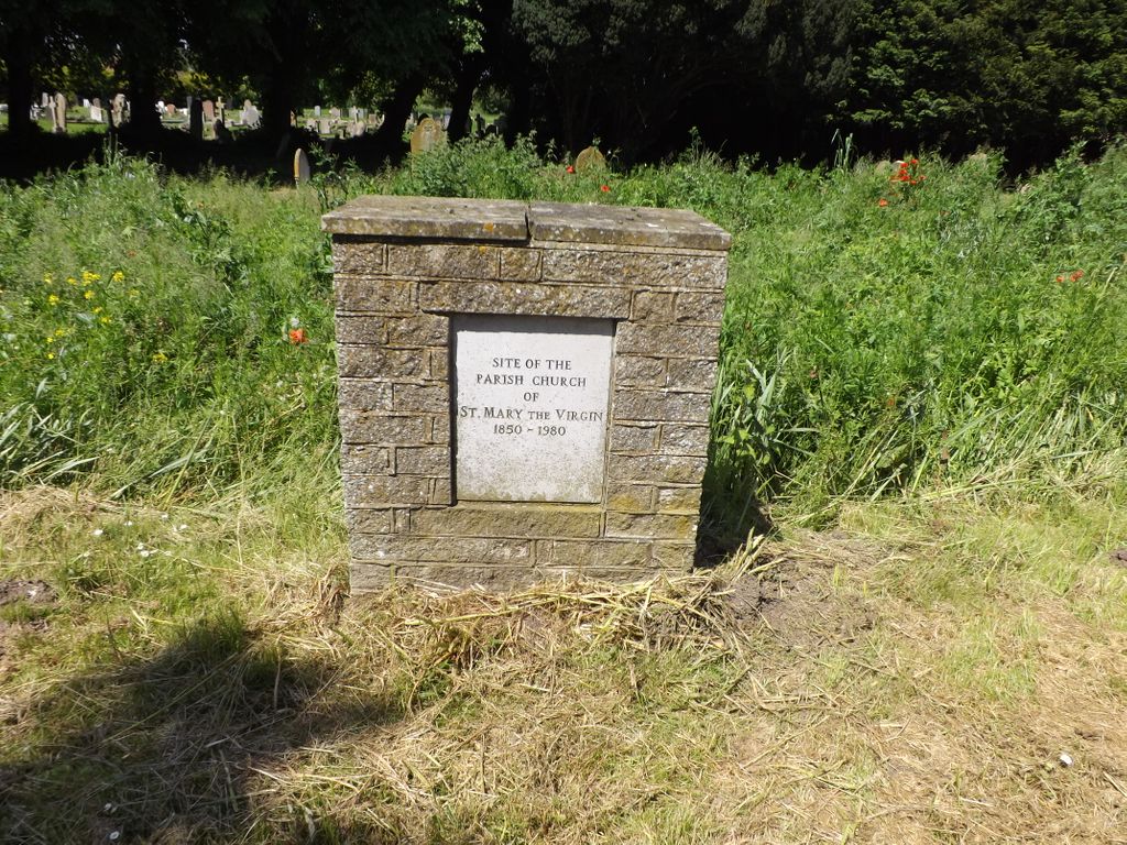
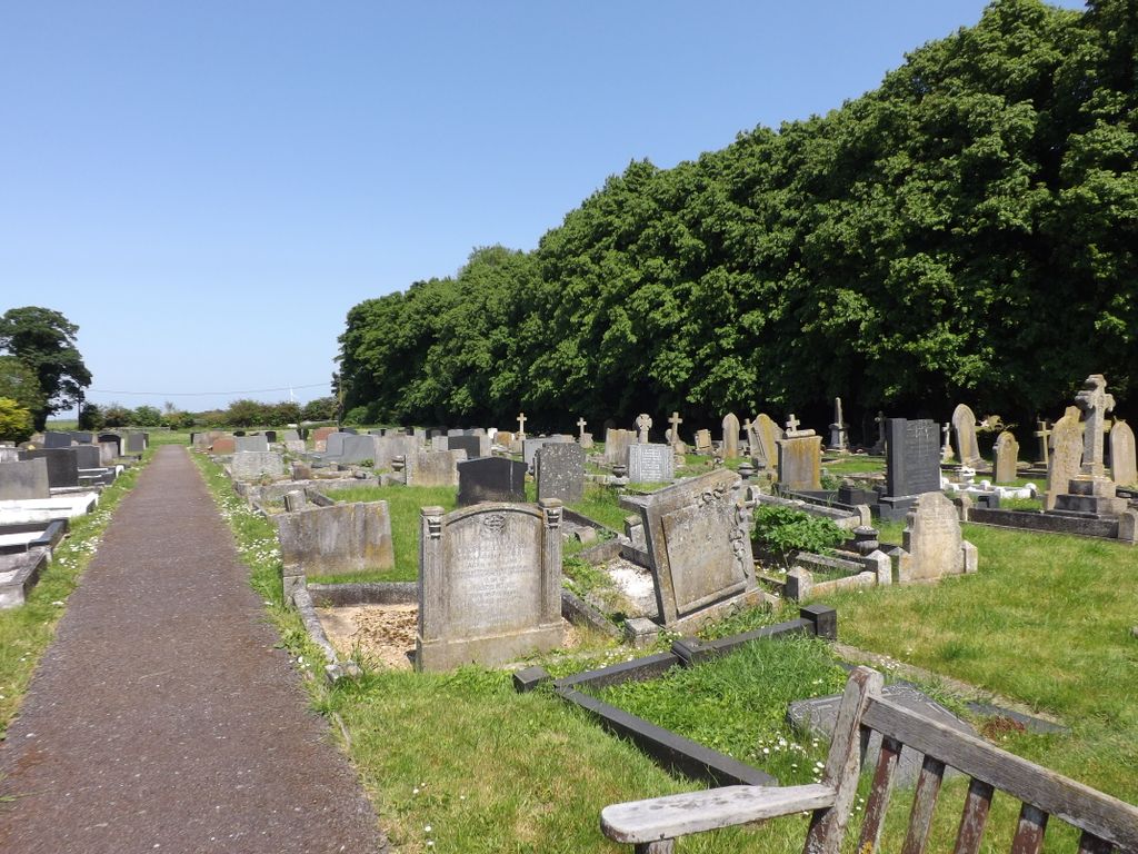
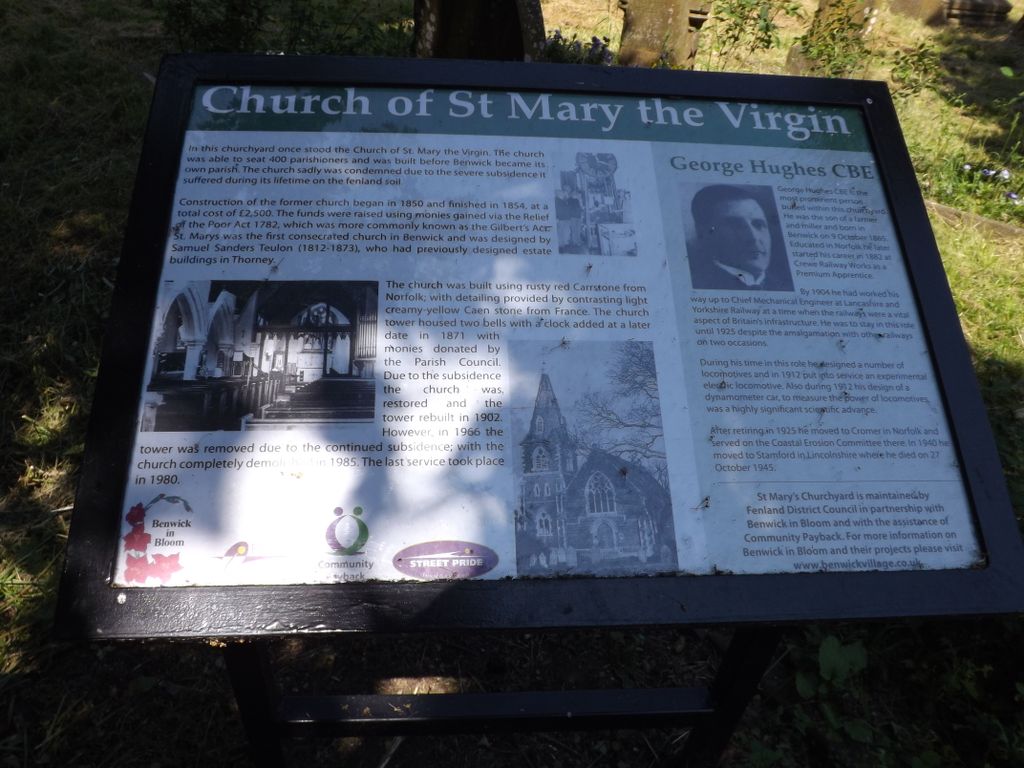
| Description | : | Benwick is a village and civil parish in the Fenland district of Cambridgeshire, approximately 15 miles from Peterborough and 30 miles from Cambridge. The cemetery belongs to the Parish Council, and adjoins the site of the demolished St. Mary's Churchyard. The settlement's name is derived from the Old English bean or beam, and wic, meaning "farm where beans are grown" or "farm by a tree-trunk." Benwick's High Street is built on a roddon; the silt banks of the old West Water river. The earliest records of village refer to a garrison built in Benwick by Geoffrey de Mandeville in 1143. Records exist of... Read More |
frequently asked questions (FAQ):
-
Where is Benwick Cemetery?
Benwick Cemetery is located at Benwick, Fenland District ,Cambridgeshire ,England.
-
Benwick Cemetery cemetery's updated grave count on graveviews.com?
0 memorials
-
Where are the coordinates of the Benwick Cemetery?
Latitude: 52.4967300
Longitude: -0.0259400
Nearby Cemetories:
1. St. Mary's Churchyard
Ramsey Saint Marys, Huntingdonshire District, England
Coordinate: 52.4688020, -0.0153334
2. St Mary Churchyard
Doddington, Fenland District, England
Coordinate: 52.4949320, 0.0609840
3. Meeks Cemetery
Chatteris, Fenland District, England
Coordinate: 52.4579050, 0.0530000
4. Wood Lane Cemetery
Ramsey, Huntingdonshire District, England
Coordinate: 52.4525800, -0.0994800
5. St. Peter & St. Paul Churchyard
Chatteris, Fenland District, England
Coordinate: 52.4547000, 0.0510900
6. Parochial Cemetery
Chatteris, Fenland District, England
Coordinate: 52.4571990, 0.0582040
7. Ramsey Abbey
Ramsey, Huntingdonshire District, England
Coordinate: 52.4483330, -0.1008330
8. St Peter Churchyard
Wimblington, Fenland District, England
Coordinate: 52.5081000, 0.0851900
9. St. Thomas Churchyard
Pondersbridge, Fenland District, England
Coordinate: 52.5107400, -0.1427800
10. Holy Trinity Churchyard
Coates, Fenland District, England
Coordinate: 52.5626500, -0.0756700
11. St. Wendreda's Churchyard
March, Fenland District, England
Coordinate: 52.5364880, 0.0849940
12. Whittlesey Cemetery
Whittlesey, Fenland District, England
Coordinate: 52.5583700, -0.1232450
13. Saint Mary's Churchyard
Whittlesey, Fenland District, England
Coordinate: 52.5556600, -0.1278000
14. St. Mary's Churchyard
March, Fenland District, England
Coordinate: 52.5648400, 0.0632100
15. Eastwood Cemetery
March, Fenland District, England
Coordinate: 52.5433080, 0.0954320
16. St. Andrew's Churchyard
Whittlesey, Fenland District, England
Coordinate: 52.5558673, -0.1330800
17. Station Road Cemetery
March, Fenland District, England
Coordinate: 52.5565100, 0.0920400
18. Warboys Grace Baptist Churchyard
Warboys, Huntingdonshire District, England
Coordinate: 52.4043400, -0.0774800
19. St Mary Magdalene Churchyard
Warboys, Huntingdonshire District, England
Coordinate: 52.4012820, -0.0867350
20. St. John the Baptist Churchyard
Wistow, Huntingdonshire District, England
Coordinate: 52.4117600, -0.1214880
21. Warboys Church Cemetery
Warboys, Huntingdonshire District, England
Coordinate: 52.3983080, -0.0875820
22. Upwood Cemetery
Upwood, Huntingdonshire District, England
Coordinate: 52.4240800, -0.1525400
23. All Saints Churchyard
Pidley, Huntingdonshire District, England
Coordinate: 52.3863792, -0.0513670
24. St. Nicholas' Churchyard
Manea, Fenland District, England
Coordinate: 52.4813910, 0.1737894