
| Memorials | : | 6 |
| Location | : | Danby, Scarborough Borough, England |
| Coordinate | : | 54.4290000, -0.9282700 |
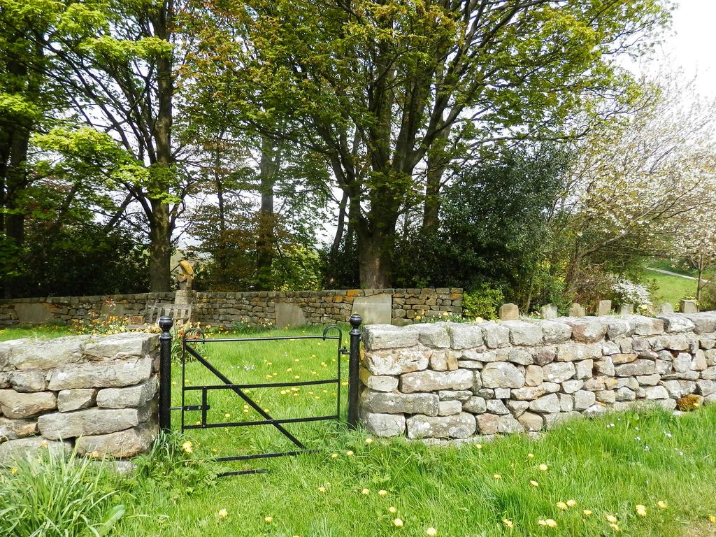
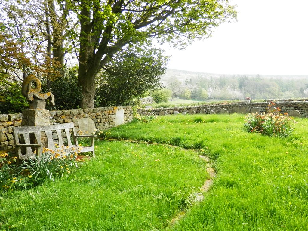
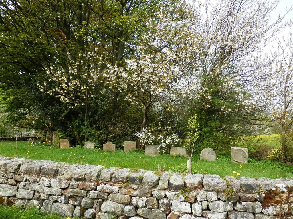
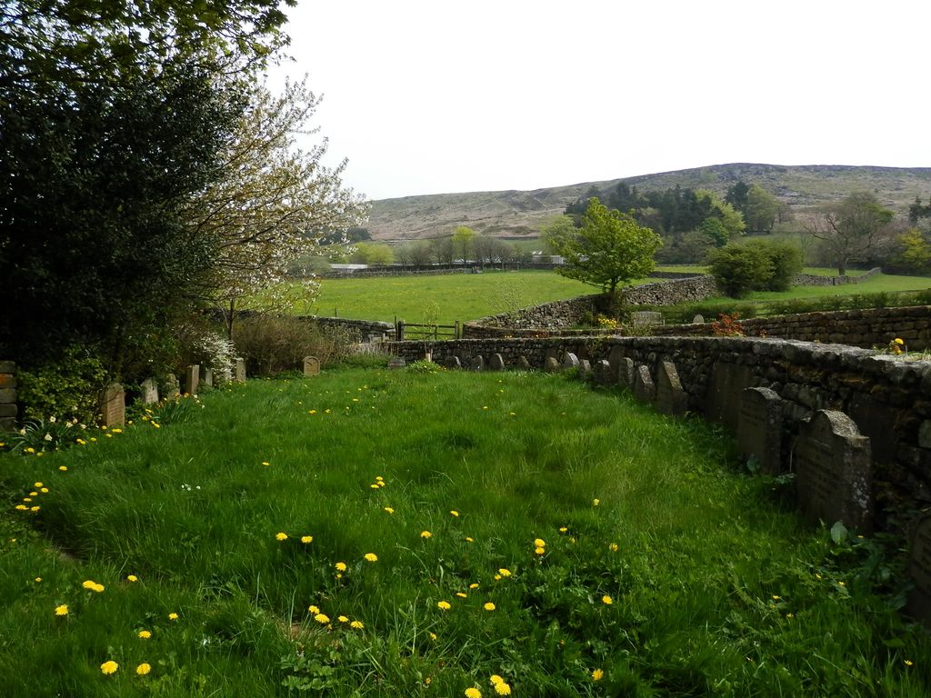
| Description | : | The First Camphill centre created to offer opportunities to adults with learning disabilities and other special needs, Botton Village has grown to become the largest Camphill community today. Botton is a small village, 3½ miles from Danby, within the North York Moors National Park in North Yorkshire, England, which is home to over 230 people including around 100 with learning disabilities. Many people who live there, live in shared family-style homes together with co-workers, others are supported in shared accommodation with friends or live independently. There are five biodynamic farms located around the village. The community works together on these farms, each... Read More |
frequently asked questions (FAQ):
-
Where is Botton Village Cemetery?
Botton Village Cemetery is located at Botton Village Danby, Scarborough Borough ,North Yorkshire , YO21 2NJEngland.
-
Botton Village Cemetery cemetery's updated grave count on graveviews.com?
6 memorials
-
Where are the coordinates of the Botton Village Cemetery?
Latitude: 54.4290000
Longitude: -0.9282700
Nearby Cemetories:
1. St Hilda Churchyard
Danby, Scarborough Borough, England
Coordinate: 54.4475240, -0.9281480
2. Westerdale Green Burial Ground
Westerdale, Scarborough Borough, England
Coordinate: 54.4409040, -0.9555864
3. Christ Church Churchyard Westerdale
Westerdale, Scarborough Borough, England
Coordinate: 54.4450870, -0.9781360
4. Quakers Burial Ground
Castleton, Scarborough Borough, England
Coordinate: 54.4614010, -0.9478360
5. Glaisdale Head Methodist Church
Glaisdale, Scarborough Borough, England
Coordinate: 54.4294940, -0.8331749
6. St Mary Churchyard
Farndale East, Ryedale District, England
Coordinate: 54.3693000, -0.9663000
7. St Peter Churchyard
Commondale, Scarborough Borough, England
Coordinate: 54.4863700, -0.9766200
8. Quaker Burial Ground
Lealholm, Scarborough Borough, England
Coordinate: 54.4575270, -0.8285030
9. St James the Greater Churchyard
Lealholm, Scarborough Borough, England
Coordinate: 54.4586200, -0.8240300
10. Our Lady of Sacred Heart Roman Catholic Churchyard
Lealholm, Scarborough Borough, England
Coordinate: 54.4592200, -0.8234600
11. St Thomas Churchyard
Glaisdale, Scarborough Borough, England
Coordinate: 54.4373700, -0.8083400
12. St Mary and St Laurence Churchyard
Rosedale Abbey, Ryedale District, England
Coordinate: 54.3537300, -0.8872700
13. St. Nicholas' Churchyard
Bransdale, Ryedale District, England
Coordinate: 54.3777000, -1.0464000
14. St Mary Churchyard
Moorsholm, Redcar and Cleveland Unitary Authority, England
Coordinate: 54.5207800, -0.9375800
15. Egton Cemetery
Egton, Scarborough Borough, England
Coordinate: 54.4482300, -0.7690700
16. St Cuthbert Churchyard
Kildale, Hambleton District, England
Coordinate: 54.4779100, -1.0689200
17. St Hilda Churchyard
Egton, Scarborough Borough, England
Coordinate: 54.4414240, -0.7535720
18. St. Andrew's Churchyard
Ingleby Greenhow, Hambleton District, England
Coordinate: 54.4487300, -1.1051300
19. St. Michael Churchyard
Liverton, Redcar and Cleveland Unitary Authority, England
Coordinate: 54.5370370, -0.9025160
20. Christ Church Churchyard
Ugthorpe, Scarborough Borough, England
Coordinate: 54.4892300, -0.7672700
21. Emerson Family Mausoleum
Easby, Hambleton District, England
Coordinate: 54.4702280, -1.1098760
22. St Aidan Churchyard
Boosbeck, Redcar and Cleveland Unitary Authority, England
Coordinate: 54.5428560, -0.9786800
23. Boosbeck Cemetery
Boosbeck, Redcar and Cleveland Unitary Authority, England
Coordinate: 54.5434900, -0.9779200
24. St Matthew Churchyard
Grosmont, Scarborough Borough, England
Coordinate: 54.4348410, -0.7243950