
| Memorials | : | 0 |
| Location | : | Mitchell, Wheeler County, USA |
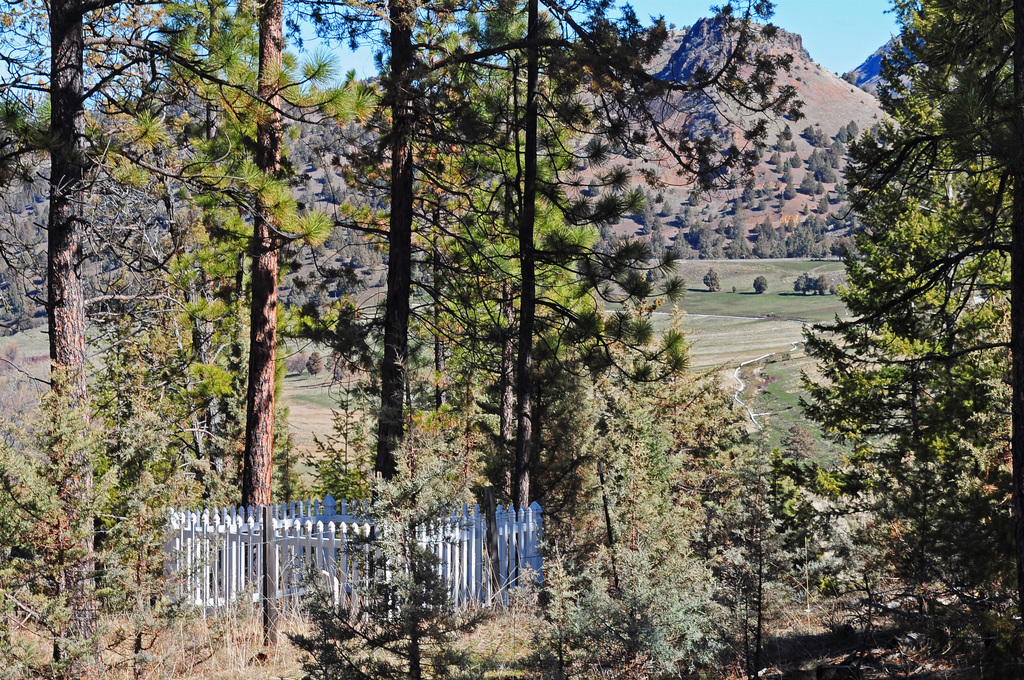
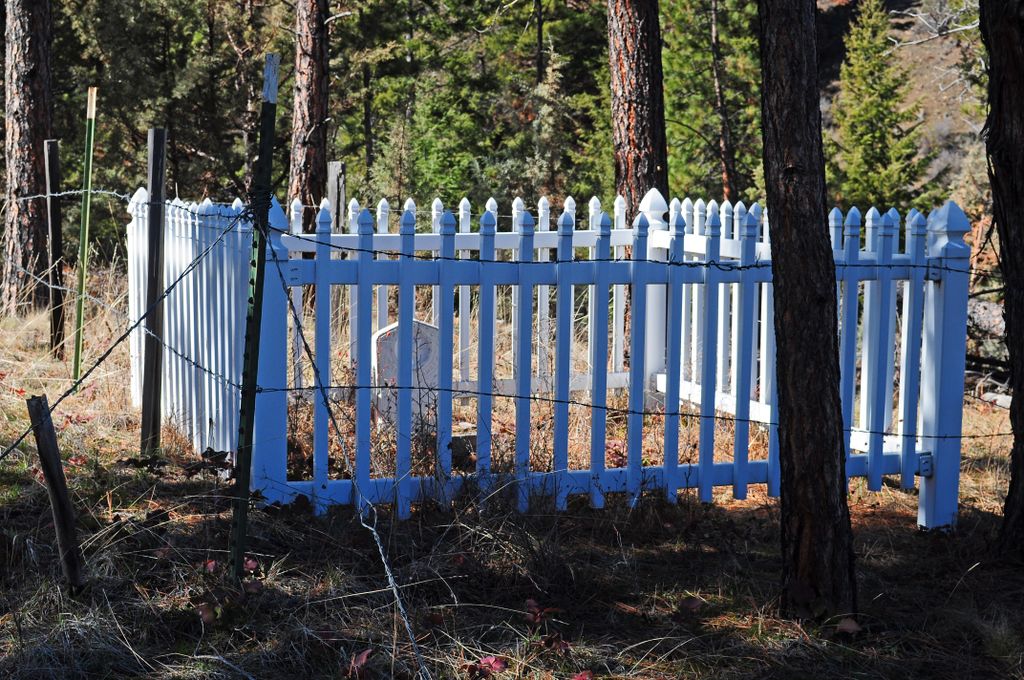
| Description | : | From the Ochoco Highway turn onto West Branch Road near MP 57 and drive about 2.7 miles + 50 feet down West Branch Road (just past the turnoff for the West Branch Cemetery). There is a wire gate on the right side of WB Road on private property. You must get permission to enter this property. After entering the gate, walk about 1/4 mile uphill to a picket fence built by the Mitchell Lion's Club in August 2004 and inside are the 2 Taylor children's graves Central Oregonian, Prineville, Crook, Oregon September 24, 2004: "For about 30 years, the deteriorating... Read More |
frequently asked questions (FAQ):
-
Where is Taylor Family Cemetery?
Taylor Family Cemetery is located at No GPS information available Add GPSWest Branch Road Mitchell, Wheeler County ,Oregon ,USA.
-
Taylor Family Cemetery cemetery's updated grave count on graveviews.com?
0 memorials
Nearby Cemetories:
1. Spray Cemetery
Spray, Wheeler County, USA
Coordinate: 44.7675820, -120.1990560
2. Buckhorn Cemetery
Mitchell, Wheeler County, USA
Coordinate: 44.4740700, -119.8121100
3. Burnt Ranch Cemetery
Mitchell, Wheeler County, USA
Coordinate: 44.8800011, -119.7352982
4. Caleb Cemetery
Mitchell, Wheeler County, USA
Coordinate: 44.7311096, -119.9911118
5. Camp Watson Cemetery
Mitchell, Wheeler County, USA
6. Carroll Cemetery
Mitchell, Wheeler County, USA
Coordinate: 44.9124985, -119.8985977
7. Foppiano Family Cemetery
Mitchell, Wheeler County, USA
8. Lower Mitchell Cemetery
Mitchell, Wheeler County, USA
Coordinate: 44.9925003, -120.2125015
9. Mary Waterman Burial Site
Mitchell, Wheeler County, USA
Coordinate: 45.0325000, -120.1861000
10. Mitchell Cemetery Upper
Mitchell, Wheeler County, USA
Coordinate: 45.0069008, -120.2055969
11. Toney Cemetery
Mitchell, Wheeler County, USA
Coordinate: 44.5341988, -120.3080978
12. Spanish Gulch Cemetery
Wheeler County, USA
Coordinate: 44.7296982, -120.0105972
13. Twickenham Cemetery
Twickenham, Wheeler County, USA
Coordinate: 44.7675820, -120.1990560
14. Frederic Arnecke Burial Site
Wheeler County, USA
Coordinate: 44.4740700, -119.8121100
15. Haystack Cemetery
Wheeler County, USA
Coordinate: 44.8800011, -119.7352982
16. Richmond Cemetery
Richmond, Wheeler County, USA
Coordinate: 44.7311096, -119.9911118
17. Hunt Family Cemetery
Winlock, Wheeler County, USA
18. Winlock Cemetery
Winlock, Wheeler County, USA
Coordinate: 44.9124985, -119.8985977
19. Doctor Stanley McGough Gravesite
Fossil, Wheeler County, USA
20. Fossil IOOF Cemetery
Fossil, Wheeler County, USA
Coordinate: 44.9925003, -120.2125015
21. James W. Chambers Burial Site
Fossil, Wheeler County, USA
Coordinate: 45.0325000, -120.1861000
22. Masonic Cemetery
Fossil, Wheeler County, USA
Coordinate: 45.0069008, -120.2055969
23. West Branch Cemetery
Wheeler County, USA
Coordinate: 44.5341988, -120.3080978
24. Richmond Cemetery
Wheeler County, USA
Coordinate: 44.7296982, -120.0105972