
| Memorials | : | 0 |
| Location | : | Oost-Vlieland, Vlieland Municipality, Netherlands |
| Coordinate | : | 53.2960300, 5.0649200 |
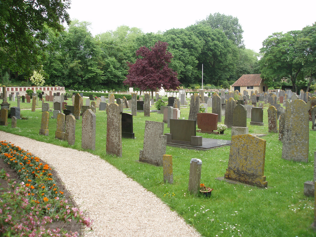
| Description | : | This cemetery can be accessed from the Kerkplein [Church Square], which is located just off the Dorpsstraat, behind the Noordwester Visitor Centre and the Public Library. The entrance is located to the right of the Church (St Nicolaas Kerk) |
frequently asked questions (FAQ):
-
Where is Vlieland General Cemetery?
Vlieland General Cemetery is located at Oost-Vlieland, Vlieland Municipality ,Friesland ,Netherlands.
-
Vlieland General Cemetery cemetery's updated grave count on graveviews.com?
0 memorials
-
Where are the coordinates of the Vlieland General Cemetery?
Latitude: 53.2960300
Longitude: 5.0649200
Nearby Cemetories:
1. West-Terschelling General Cemetery
West-Terschelling, Terschelling Municipality, Netherlands
Coordinate: 53.3609500, 5.2146400
2. Stryper kerkhof
Midsland, Terschelling Municipality, Netherlands
Coordinate: 53.3794384, 5.2837765
3. Kerkhof Midsland
Midsland, Terschelling Municipality, Netherlands
Coordinate: 53.3829927, 5.2850016
4. Harlingen General Cemetery
Harlingen, Harlingen Municipality, Netherlands
Coordinate: 53.1780100, 5.4245900
5. Harlingen Roman Catholic cemetery
Harlingen, Harlingen Municipality, Netherlands
Coordinate: 53.1720500, 5.4299800
6. Kerkhof Waalder Kerk
De Waal, Texel Municipality, Netherlands
Coordinate: 53.0726535, 4.8207108
7. Kimswerd Protestant Churchyard
Kimswerd, Sudwest Fryslan Municipality, Netherlands
Coordinate: 53.1412800, 5.4385400
8. Oosterbierum Kerkhof
Oosterbierum, Franekeradeel Municipality, Netherlands
Coordinate: 53.2340554, 5.5108091
9. Nederlands hervormde Kerk Herbaijum
Herbaijum, Franekeradeel Municipality, Netherlands
Coordinate: 53.1849700, 5.4952100
10. Den Burg Algemene Begraafplaats
Den Burg, Texel Municipality, Netherlands
Coordinate: 53.0580700, 4.7935200
11. Kerkhof Sint Martinuskerk
Tzummarum, Franekeradeel Municipality, Netherlands
Coordinate: 53.2365670, 5.5436750
12. Den Burg Rooms Katholiek Kerkhof
Den Burg, Texel Municipality, Netherlands
Coordinate: 53.0517800, 4.7913800
13. Georgische Begraafplaats Texel
Den Burg, Texel Municipality, Netherlands
Coordinate: 53.0410013, 4.8143195
14. Tsjerkhôf Furdgum
Firdgum, Franekeradeel Municipality, Netherlands
Coordinate: 53.2484501, 5.5596364
15. Franeker General Cemetery
Franeker, Franekeradeel Municipality, Netherlands
Coordinate: 53.1845100, 5.5330800
16. Witmarsum Protestant Churchyard
Witmarsum, Sudwest Fryslan Municipality, Netherlands
Coordinate: 53.1021800, 5.4661900
17. Doniakerk Kerkhof
Makkum, Sudwest Fryslan Municipality, Netherlands
Coordinate: 53.0597550, 5.3992650
18. Makkum Protestant Churchyard
Makkum, Sudwest Fryslan Municipality, Netherlands
Coordinate: 53.0595500, 5.3997500
19. Minnertsga Kerkhof
Minnertsga, Het Bildt Municipality, Netherlands
Coordinate: 53.2512016, 5.5942001
20. Walburgatsjerke
Ried, Franekeradeel Municipality, Netherlands
Coordinate: 53.2231866, 5.5900183
21. Sint Jacobiparochie General Cemetery
Sint Jacobiparochie, Het Bildt Municipality, Netherlands
Coordinate: 53.2684100, 5.6041100
22. Johanneskerk - Protestantse Gemeente Tzum
Tzum, Franekeradeel Municipality, Netherlands
Coordinate: 53.1589801, 5.5629124
23. Idsegahuizum Kerkhof
Idsegahuizum, Sudwest Fryslan Municipality, Netherlands
Coordinate: 53.0433420, 5.4180270
24. Sint Gertrudistsjerke
Peins, Franekeradeel Municipality, Netherlands
Coordinate: 53.2059212, 5.5950833