
| Memorials | : | 0 |
| Location | : | Vlijmen, Heusden Municipality, Netherlands |
| Coordinate | : | 51.6969200, 5.2231100 |
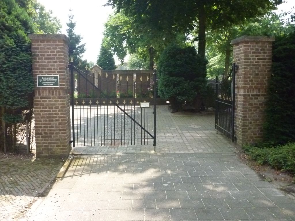
| Description | : | Vlijmen is a village on the main 'S-Hertogenbosch Waalwijk road, about 3 kilometres west of 'S-Hertogenbosch. The churchyard is around the village church, which is in the centre of Vlijmen. |
frequently asked questions (FAQ):
-
Where is Vlijmen Roman Catholic Churchyard?
Vlijmen Roman Catholic Churchyard is located at Vlijmen, Heusden Municipality ,Noord-Brabant ,Netherlands.
-
Vlijmen Roman Catholic Churchyard cemetery's updated grave count on graveviews.com?
0 memorials
-
Where are the coordinates of the Vlijmen Roman Catholic Churchyard?
Latitude: 51.6969200
Longitude: 5.2231100
Nearby Cemetories:
1. Haarsteeg Roman Catholic Cemetery
Haarsteeg, Heusden Municipality, Netherlands
Coordinate: 51.7107300, 5.1983600
2. Nieuwkuijk Algemene Begraafplaats Onsenoort
Nieuwkuijk, Heusden Municipality, Netherlands
Coordinate: 51.6974300, 5.1895300
3. Cromvoirt Sint-Lambertus Roman Catholic Cemetery
Cromvoirt, Vught Municipality, Netherlands
Coordinate: 51.6615300, 5.2309800
4. Engelen General Cemetery
Engelen, 's-Hertogenbosch Municipality, Netherlands
Coordinate: 51.7157900, 5.2753500
5. Begraafplaats Orthen
Orthen, 's-Hertogenbosch Municipality, Netherlands
Coordinate: 51.7032070, 5.3076970
6. Vught O-L-V Middelares Roman Catholic Cemetery
Vught, Vught Municipality, Netherlands
Coordinate: 51.6656300, 5.2919800
7. Elshout Roman Catholic Churchyard
Elshout, Heusden Municipality, Netherlands
Coordinate: 51.7004700, 5.1364900
8. Israëlitische begraafplaats
Vught, Vught Municipality, Netherlands
Coordinate: 51.6549100, 5.2793800
9. Heusden Buytenhove Algemene Begraafplaats
Heusden, Heusden Municipality, Netherlands
Coordinate: 51.7323600, 5.1485200
10. Drunen Roman Catholic Cemetery
Drunen, Heusden Municipality, Netherlands
Coordinate: 51.6885800, 5.1295700
11. Vught General Cemetery
Vught, Vught Municipality, Netherlands
Coordinate: 51.6539100, 5.2940900
12. Sint-Nicolaaskerk
Helvoirt, Haaren Municipality, Netherlands
Coordinate: 51.6342300, 5.2295500
13. Heusden Oudheusden Protestant Cemetery
Heusden, Heusden Municipality, Netherlands
Coordinate: 51.7279100, 5.1348900
14. Oud-Empel Roman Catholic Churchyard
Oud-Empel, 's-Hertogenbosch Municipality, Netherlands
Coordinate: 51.7362500, 5.3046800
15. Joodse Begraafplaats
Heesbeen, Heusden Municipality, Netherlands
Coordinate: 51.7358060, 5.1302780
16. Heesbeen Protestant Churchyard
Heesbeen, Heusden Municipality, Netherlands
Coordinate: 51.7297500, 5.1197600
17. Biezenmortel Roman Catholic Cemetery
Biezenmortel, Haaren Municipality, Netherlands
Coordinate: 51.6241100, 5.1786400
18. Begraafplaats Bruchem
Bruchem, Zaltbommel Municipality, Netherlands
Coordinate: 51.7833840, 5.2255020
19. Veld-Driel Roman Catholic Churchyard
Velddriel, Maasdriel Municipality, Netherlands
Coordinate: 51.7698800, 5.3047100
20. Kerkhof St Lambertus
Rosmalen, 's-Hertogenbosch Municipality, Netherlands
Coordinate: 51.7184878, 5.3635487
21. Wijk-en-Aalburg General Cemetery
Wijk en Aalburg, Aalburg Municipality, Netherlands
Coordinate: 51.7587900, 5.1168100
22. St. Johannes Roman Catholic Churchyard
Waalwijk, Waalwijk Municipality, Netherlands
Coordinate: 51.6894300, 5.0676600
23. Sint-Michielsgestel Catholic & Protestant Cemetery
Sint-Michielsgestel, Sint-Michielsgestel Municipality, Netherlands
Coordinate: 51.6425300, 5.3527600
24. Udenhout Roman Catholic Churchyard
Udenhout, Tilburg Municipality, Netherlands
Coordinate: 51.6106700, 5.1412200