
| Memorials | : | 47 |
| Location | : | Yellow Springs, Decatur County, USA |
| Coordinate | : | 35.8115110, -88.1233210 |
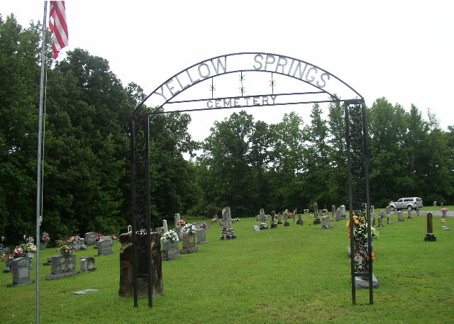
| Description | : | This well-maintained church cemetery is located in northwestern Decatur County at the intersection of Yellow Springs Road and Pugh Road. It is indicated on the U.S.G.S. Sugar Tree quadrangle (1986) near its western edge, just south of I-40. David Donahue recorded this cemetery in 1997 and checked and updated it in 2002. Alexander and Tuten recorded this cemetery in 1978. They noted "at least 8 unmarked graves." |
frequently asked questions (FAQ):
-
Where is Yellow Springs Church Cemetery?
Yellow Springs Church Cemetery is located at Yellow Spring Road Yellow Springs, Decatur County ,Tennessee , 38341USA.
-
Yellow Springs Church Cemetery cemetery's updated grave count on graveviews.com?
45 memorials
-
Where are the coordinates of the Yellow Springs Church Cemetery?
Latitude: 35.8115110
Longitude: -88.1233210
Nearby Cemetories:
1. Spence Cemetery
Yellow Springs, Decatur County, USA
Coordinate: 35.8249340, -88.0892620
2. Smith Cemetery
Yellow Springs, Decatur County, USA
Coordinate: 35.8425780, -88.1406500
3. Cox-Wilson Cemetery
Decatur County, USA
Coordinate: 35.8299300, -88.0791600
4. Bawcum Cemetery
Akins Chapel, Decatur County, USA
Coordinate: 35.7823020, -88.0856120
5. Flatwoods Baptist Cemetery
Benton County, USA
Coordinate: 35.8486450, -88.0877350
6. Bawcum Cemetery
Cozette, Decatur County, USA
Coordinate: 35.7696770, -88.0826580
7. Stills Cemetery
Yellow Springs, Decatur County, USA
Coordinate: 35.7577960, -88.1301680
8. New Prospect Church Cemetery
Decatur County, USA
Coordinate: 35.7777990, -88.1764780
9. Gibson Cemetery
Yellow Springs, Decatur County, USA
Coordinate: 35.7585700, -88.1412850
10. Morgan Cemetery
Henderson County, USA
Coordinate: 35.7988790, -88.1917640
11. Suttles Chapel Cemetery
Parsons, Decatur County, USA
Coordinate: 35.7562710, -88.1063310
12. Baber Cemetery
Benton County, USA
Coordinate: 35.8541985, -88.1707993
13. Brewer Cemetery
Bible Hill, Decatur County, USA
Coordinate: 35.7726410, -88.1772180
14. Holladay Community Cemetery
Holladay, Benton County, USA
Coordinate: 35.8688950, -88.1513880
15. Flowers Family Cemetery
Holladay, Benton County, USA
Coordinate: 35.8689100, -88.1517430
16. McIllwain Cemetery
McIllwain, Benton County, USA
Coordinate: 35.8634900, -88.0819700
17. Cub Creek Hall Cemetery
Parsons, Decatur County, USA
Coordinate: 35.7529410, -88.1492770
18. Thornton Cemetery
Holladay, Benton County, USA
Coordinate: 35.8634810, -88.0791180
19. Brinkley Cemetery
Carroll County, USA
Coordinate: 35.8213997, -88.2005997
20. Mathews Cemetery
Chaseville, Benton County, USA
Coordinate: 35.8783000, -88.1178750
21. Shiloh Cemetery
Westport, Carroll County, USA
Coordinate: 35.8344002, -88.2031021
22. Beasley Cemetery
Henderson County, USA
Coordinate: 35.7873240, -88.2031060
23. Oak Grove Church Cemetery
Sugar Tree, Decatur County, USA
Coordinate: 35.7592360, -88.0661490
24. Lewis Family Cemetery
Jeannette, Decatur County, USA
Coordinate: 35.7422500, -88.1117700