
| Memorials | : | 76 |
| Location | : | Cozette, Decatur County, USA |
| Coordinate | : | 35.7696770, -88.0826580 |
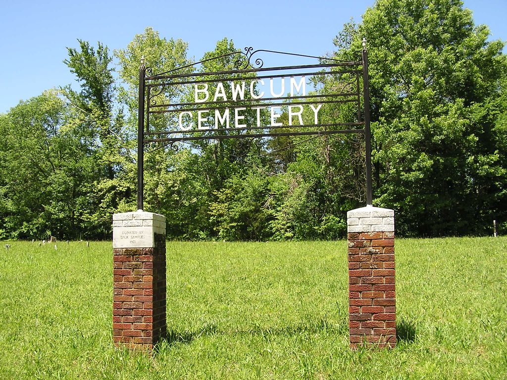
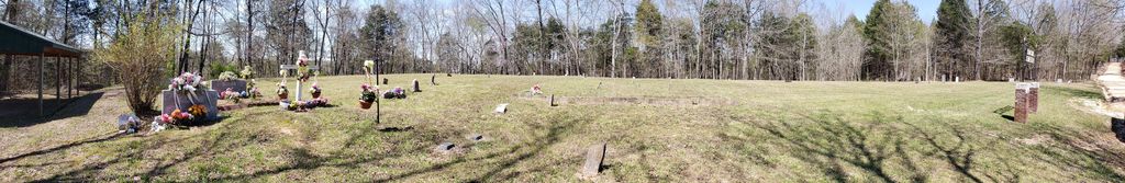
| Description | : | This is an old cemetery just off the east side of U.S. 641 about 1½ miles north of Jeanette. It is the southern most and larger of the two Bawcum cemeteries indicated on the U.S.G.S. Sugar Tree quadrangle (1986). The cemetery is well maintained. It may be full but is still in use. Fieldstone removal and ground leveling make estimating the total number of unmarked graves difficult. A large portion of the inscribed markers here are much newer than the death dates they report. |
frequently asked questions (FAQ):
-
Where is Bawcum Cemetery?
Bawcum Cemetery is located at Bawcum Cemetery Road Cozette, Decatur County ,Tennessee , 38380USA.
-
Bawcum Cemetery cemetery's updated grave count on graveviews.com?
76 memorials
-
Where are the coordinates of the Bawcum Cemetery?
Latitude: 35.7696770
Longitude: -88.0826580
Nearby Cemetories:
1. Bawcum Cemetery
Akins Chapel, Decatur County, USA
Coordinate: 35.7823020, -88.0856120
2. Oak Grove Church Cemetery
Sugar Tree, Decatur County, USA
Coordinate: 35.7592360, -88.0661490
3. Suttles Chapel Cemetery
Parsons, Decatur County, USA
Coordinate: 35.7562710, -88.1063310
4. Jeanette Cemetery
Jeannette, Decatur County, USA
Coordinate: 35.7378370, -88.1004330
5. Lewis Family Cemetery
Jeannette, Decatur County, USA
Coordinate: 35.7422500, -88.1117700
6. Stills Cemetery
Yellow Springs, Decatur County, USA
Coordinate: 35.7577960, -88.1301680
7. Baker Cemetery
Decatur County, USA
Coordinate: 35.7536011, -88.0369034
8. Haynes Cemetery
Sugar Tree, Decatur County, USA
Coordinate: 35.7670210, -88.0320540
9. Hendrix Cemetery
Decatur County, USA
Coordinate: 35.7481003, -88.0391998
10. Hendrix Cemetery
Cozette, Decatur County, USA
Coordinate: 35.7481130, -88.0387250
11. Moore Chapel Cemetery
Jeannette, Decatur County, USA
Coordinate: 35.7302250, -88.1059110
12. Bowman Cemetery
Jeannette, Decatur County, USA
Coordinate: 35.7317350, -88.1147700
13. Miller Cemetery
Decatur County, USA
Coordinate: 35.7321990, -88.0489400
14. Gibson Cemetery
Yellow Springs, Decatur County, USA
Coordinate: 35.7585700, -88.1412850
15. Yellow Springs Church Cemetery
Yellow Springs, Decatur County, USA
Coordinate: 35.8115110, -88.1233210
16. Jennings Cemetery
Parsons, Decatur County, USA
Coordinate: 35.7191020, -88.1053980
17. Cheney Cemetery
Sugar Tree, Decatur County, USA
Coordinate: 35.7538986, -88.0177994
18. Hartley Cemetery
Sugar Tree, Decatur County, USA
Coordinate: 35.7896470, -88.0195500
19. Spence Cemetery
Yellow Springs, Decatur County, USA
Coordinate: 35.8249340, -88.0892620
20. Walker Cemetery
Decatur County, USA
Coordinate: 35.7153015, -88.0658035
21. Cub Creek Hall Cemetery
Parsons, Decatur County, USA
Coordinate: 35.7529410, -88.1492770
22. Cheney Cemetery
Parsons, Decatur County, USA
Coordinate: 35.7219840, -88.1262170
23. Cox-Wilson Cemetery
Decatur County, USA
Coordinate: 35.8299300, -88.0791600
24. Walker Cemetery
Parsons, Decatur County, USA
Coordinate: 35.7120360, -88.1066540