
| Memorials | : | 268 |
| Location | : | Napoleon, Henry County, USA |
| Coordinate | : | 41.4414170, -84.2495930 |
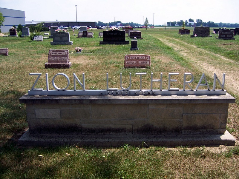
| Description | : | The cemetery is located on the northwest side of County Road 10 / County Road X at its intersection with Ridge Drive. The cemetery is located in Ridgeville Township, Henry County, Ohio, and is # 13610 (Zion Lutheran Church Cemetery / Zion Cemetery) in “Ohio Cemeteries 1803-2003”, compiled by the Ohio Genealogical Society. The U.S. Geological Survey (USGS) Geographic Names Information System (GNIS) feature ID for the cemetery is 1806071 (Zion Cemetery). |
frequently asked questions (FAQ):
-
Where is Zion Lutheran Church Cemetery?
Zion Lutheran Church Cemetery is located at County Road 10 / County Road X Napoleon, Henry County ,Ohio , 43502USA.
-
Zion Lutheran Church Cemetery cemetery's updated grave count on graveviews.com?
268 memorials
-
Where are the coordinates of the Zion Lutheran Church Cemetery?
Latitude: 41.4414170
Longitude: -84.2495930
Nearby Cemetories:
1. Saint Peter Lutheran Cemetery
Ridgeville Township, Henry County, USA
Coordinate: 41.4389000, -84.2549973
2. Locust Grove Cemetery
Ridgeville Corners, Henry County, USA
Coordinate: 41.4389650, -84.2558060
3. Bethlehem Lutheran Cemetery
Defiance County, USA
Coordinate: 41.4050120, -84.2608930
4. Saint Pauls Cemetery
Napoleon, Henry County, USA
Coordinate: 41.4063290, -84.2163380
5. Saint John Lutheran Church Cemetery
Ridgeville Township, Henry County, USA
Coordinate: 41.4425410, -84.3084650
6. Freedom Township Cemetery
Freedom Township, Henry County, USA
Coordinate: 41.4752970, -84.2069960
7. Union Chapel Cemetery
Napoleon, Henry County, USA
Coordinate: 41.4166985, -84.1877975
8. Saint Pauls Lutheran Cemetery
Napoleon, Henry County, USA
Coordinate: 41.4061060, -84.1900350
9. Saint Johns Cemetery
Freedom Township, Henry County, USA
Coordinate: 41.4491997, -84.1727982
10. Battenburg Cemetery
Defiance County, USA
Coordinate: 41.3840010, -84.2748520
11. Bremer Cemetery
Okolona, Henry County, USA
Coordinate: 41.3863980, -84.2093960
12. Saint Marks Lutheran Cemetery
Defiance, Defiance County, USA
Coordinate: 41.4129240, -84.3257920
13. Bethlehem Lutheran Cemetery
Defiance County, USA
Coordinate: 41.3702100, -84.2291200
14. Archbold Cemetery
Archbold, Fulton County, USA
Coordinate: 41.5028000, -84.3058014
15. Rupp Cemetery
Archbold, Fulton County, USA
Coordinate: 41.5140110, -84.2771370
16. Reform Cemetery
Archbold, Fulton County, USA
Coordinate: 41.5039790, -84.3061070
17. Aeschliman Cemetery
Pettisville, Fulton County, USA
Coordinate: 41.5147018, -84.2192001
18. Henry County Home Cemetery
Henry County, USA
Coordinate: 41.4212830, -84.1506900
19. Metz-Tittle Cemetery
Defiance County, USA
Coordinate: 41.3669014, -84.2857971
20. Domersville Cemetery
Defiance, Defiance County, USA
Coordinate: 41.3821983, -84.3244019
21. Zion Cemetery
Williams County, USA
Coordinate: 41.4417000, -84.3628006
22. Poplar Ridge Cemetery
Defiance, Defiance County, USA
Coordinate: 41.3596992, -84.2947006
23. Saint Michaels Catholic Cemetery
Adams Ridge, Defiance County, USA
Coordinate: 41.3631060, -84.3060610
24. Pettisville Union Cemetery
Pettisville, Fulton County, USA
Coordinate: 41.5294190, -84.2258910