
| Memorials | : | 1016 |
| Location | : | Archbold, Fulton County, USA |
| Coordinate | : | 41.5028000, -84.3058014 |
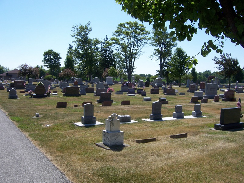
| Description | : | The Archbold Cemetery is located at the south edge of Archbold, on the east side of SR 66 (S. Defiance Street), and north of Township Road B. The burial ground occupies land deeded to R. McConnell in 1840. Early records for the cemetery have not survived but is it believed the burial ground was established in 1872. In 1875 and subsequent years, additional land was purchased to bring the cemetery to its present size. The village of Archbold obtained control of the cemetery in 1882. Adjoining the Archbold cemetery on the north is the older St. John's Burial ground. ... Read More |
frequently asked questions (FAQ):
-
Where is Archbold Cemetery?
Archbold Cemetery is located at S Defiance Street (Ohio State Route 66) Archbold, Fulton County ,Ohio , 43502USA.
-
Archbold Cemetery cemetery's updated grave count on graveviews.com?
197 memorials
-
Where are the coordinates of the Archbold Cemetery?
Latitude: 41.5028000
Longitude: -84.3058014


Nearby Cemetories:
1. Reform Cemetery
Archbold, Fulton County, USA
Coordinate: 41.5039790, -84.3061070
2. Rupp Cemetery
Archbold, Fulton County, USA
Coordinate: 41.5140110, -84.2771370
3. Saint Peters Cemetery
Archbold, Fulton County, USA
Coordinate: 41.5428009, -84.2882996
4. Saint James Lutheran Cemetery
Burlington, Fulton County, USA
Coordinate: 41.5428009, -84.2630997
5. Saint John Lutheran Church Cemetery
Ridgeville Township, Henry County, USA
Coordinate: 41.4425410, -84.3084650
6. Pettisville Union Cemetery
Pettisville, Fulton County, USA
Coordinate: 41.5294190, -84.2258910
7. Pettisville Cemetery
Pettisville, Fulton County, USA
Coordinate: 41.5302620, -84.2258690
8. Aeschliman Cemetery
Pettisville, Fulton County, USA
Coordinate: 41.5147018, -84.2192001
9. Wyse Cemetery
Fulton County, USA
Coordinate: 41.5647820, -84.2686700
10. Pettisville Lutheran Cemetery
Pettisville, Fulton County, USA
Coordinate: 41.5321900, -84.2237400
11. Beck Cemetery
Fulton County, USA
Coordinate: 41.5648620, -84.2682880
12. Goll Cemetery
Archbold, Fulton County, USA
Coordinate: 41.5558014, -84.3677979
13. Locust Grove Cemetery
Ridgeville Corners, Henry County, USA
Coordinate: 41.4389650, -84.2558060
14. Saint Peter Lutheran Cemetery
Ridgeville Township, Henry County, USA
Coordinate: 41.4389000, -84.2549973
15. Zion Lutheran Church Cemetery
Napoleon, Henry County, USA
Coordinate: 41.4414170, -84.2495930
16. Zion Cemetery
Williams County, USA
Coordinate: 41.4417000, -84.3628006
17. Eckley Cemetery
Eckley, Fulton County, USA
Coordinate: 41.5641600, -84.2491200
18. Lauber Hill Cemetery
Fulton County, USA
Coordinate: 41.5742410, -84.2681490
19. Lockport Cemetery
Stryker, Williams County, USA
Coordinate: 41.5466690, -84.3927765
20. Johnson Cemetery
Burlington, Fulton County, USA
Coordinate: 41.5791230, -84.3308020
21. Freedom Township Cemetery
Freedom Township, Henry County, USA
Coordinate: 41.4752970, -84.2069960
22. Saint Marks Lutheran Cemetery
Defiance, Defiance County, USA
Coordinate: 41.4129240, -84.3257920
23. Oakwood Cemetery
Stryker, Williams County, USA
Coordinate: 41.4978900, -84.4274700
24. North Pettisville Cemetery
Wauseon, Fulton County, USA
Coordinate: 41.5728190, -84.2200180