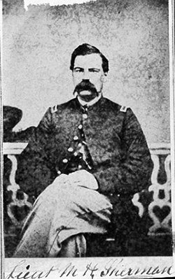
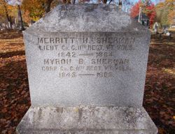
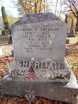
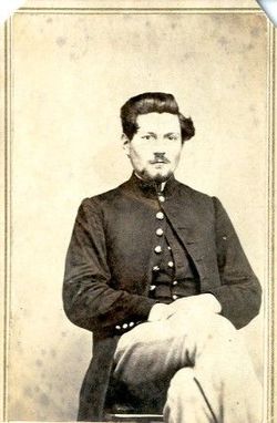
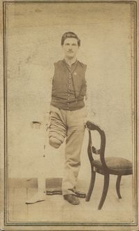
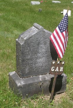
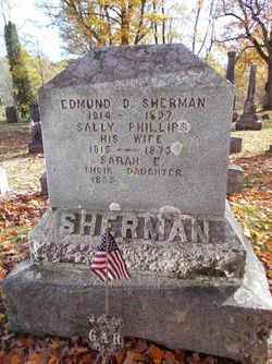
2LT Merritt Hoag Sherman
| Birth | : | 3 Jun 1842 Danby, Rutland County, Vermont, USA |
| Death | : | 23 Jun 1864 Petersburg, Fauquier County, Virginia, USA |
| Burial | : | Croston Cemetery, Croston, Chorley Borough, England |
| Coordinate | : | 53.6586700, -2.7733100 |
| Plot | : | Section 1, Row 5 |
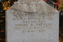
| Inscription | : | Lieut., Co. C., 11th Regt. Vt. Vols. |
| Description | : | Born in Danby, Rutland County, Vermont, on June 3rd, 1842, at the family home, just like his other siblings. We know very little about his life before the war, and what we do know is inferences based upon meager records of the family's activities and records from the general period. The first record including his name which was not from the census or church, would be his enlistment on August 5th, 1862, as a Sergeant in the Union Army. On September 1, 1862 Merritt was mustered into Company C of the 11th Vermont Infantry Regiment, which would... Read More |
frequently asked questions (FAQ):
-
Where is 2LT Merritt Hoag Sherman's memorial?
2LT Merritt Hoag Sherman's memorial is located at: Croston Cemetery, Croston, Chorley Borough, England.
-
When did 2LT Merritt Hoag Sherman death?
2LT Merritt Hoag Sherman death on 23 Jun 1864 in Petersburg, Fauquier County, Virginia, USA
-
Where are the coordinates of the 2LT Merritt Hoag Sherman's memorial?
Latitude: 53.6586700
Longitude: -2.7733100
Family Members:
Parent
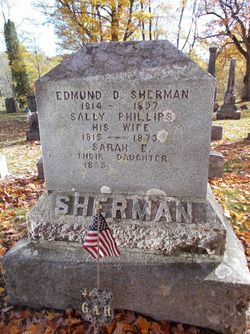
Siblings
Flowers:
Nearby Cemetories:
1. Croston Cemetery
Croston, Chorley Borough, England
Coordinate: 53.6586700, -2.7733100
2. St. John the Baptist Churchyard
Bretherton, Chorley Borough, England
Coordinate: 53.6776300, -2.7952200
3. St Mary the Virgin Churchyard
Eccleston, Chorley Borough, England
Coordinate: 53.6528800, -2.7331920
4. Congregational Church
Bretherton, Chorley Borough, England
Coordinate: 53.6780260, -2.7986920
5. St. Mary the Virgin Churchyard
Rufford, West Lancashire District, England
Coordinate: 53.6349960, -2.8126410
6. St. Mary's Churchyard
Tarleton, West Lancashire District, England
Coordinate: 53.6746100, -2.8239200
7. St. Peter's Churchyard
Mawdesley, Chorley Borough, England
Coordinate: 53.6237600, -2.7734100
8. St. Peter and St. Paul Churchyard
Mawdesley, Chorley Borough, England
Coordinate: 53.6266580, -2.7451420
9. Saint James Churchyard
Leyland, South Ribble Borough, England
Coordinate: 53.6896630, -2.7327430
10. Woodland Burial Ground
Much Hoole, South Ribble Borough, England
Coordinate: 53.6986390, -2.7974440
11. St. Michael and All Angel Churchyard
Much Hoole, South Ribble Borough, England
Coordinate: 53.6942950, -2.8143830
12. Much Hoole Methodist Burial Ground
Much Hoole, South Ribble Borough, England
Coordinate: 53.7053750, -2.7951470
13. St Mary's Roman Catholic Churchyard
Leyland, South Ribble Borough, England
Coordinate: 53.6880510, -2.6983240
14. St. James the Great Churchyard
Wrightington, West Lancashire District, England
Coordinate: 53.6168220, -2.7175670
15. Saint Andrews Churchyard
Leyland, South Ribble Borough, England
Coordinate: 53.6881270, -2.6957880
16. Becconsall Old Church Churchyard
Hesketh with Becconsall, West Lancashire District, England
Coordinate: 53.7023610, -2.8314810
17. St. Mary's Churchyard
Euxton, Chorley Borough, England
Coordinate: 53.6669580, -2.6768350
18. Charnock Richard Crematorium
Chorley, Chorley Borough, England
Coordinate: 53.6518550, -2.6763080
19. Euxton Parish Churchyard
Euxton, Chorley Borough, England
Coordinate: 53.6650950, -2.6743630
20. All Saints Churchyard
Hesketh with Becconsall, West Lancashire District, England
Coordinate: 53.7028189, -2.8400142
21. Christ Church
Charnock Richard, Chorley Borough, England
Coordinate: 53.6367200, -2.6773400
22. St John the Baptist Churchyard
Burscough, West Lancashire District, England
Coordinate: 53.6042760, -2.8401390
23. Our Lady and All Saints Roman Catholic
Parbold, West Lancashire District, England
Coordinate: 53.5911900, -2.7644350
24. St. Andrew's Churchyard
Longton, South Ribble Borough, England
Coordinate: 53.7263889, -2.7822222

