
| Birth | : | 25 Dec 1858 Smithland, Shelby County, Indiana, USA |
| Death | : | 3 Oct 1924 Hoxie, Sheridan County, Kansas, USA |
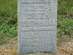
| Burial | : | Charing Cemetery, Charing, Ashford Borough, England |
| Coordinate | : | 51.2120247, 0.7922290 |
| Description | : | Albertus was a cousin. He was the son of Wesley Collins & Martha Butler Collins. On July 27th, 1878 he was united in marriage to Mary Frances Morgan in Smith Co., KS. They shared the same birthday on Christmas day. Together they has a total of fourteen children: Charles Freddie Collins (1879-1885) Estelle M. Collins (1881-1884) Griffin "Griff" Franklin Collins (1884-1960) Lew Allen Collins (1886-1965) Rollie Dillin Collins (1888-1953) Albert Collins (1891-1980) Infant Son Twin (1893-1893) Infant Son Twin (1893-1893) William "Ed" Edgar Collins (1894-1987) Lilly Clara Collins Hasik (1896-1987) Gladis M. Collins (1898-1900) Jessie Jennings Collins (1901-1997) Homer Francis Collins (1903-1984) Carl Curry Collins (1905-1978) Following his older siblings westward, Albertus arrived in Smith County, Kansas... Read More |
frequently asked questions (FAQ):
-
Where is Albertus Collins's memorial?
Albertus Collins's memorial is located at: Charing Cemetery, Charing, Ashford Borough, England.
-
When did Albertus Collins death?
Albertus Collins death on 3 Oct 1924 in Hoxie, Sheridan County, Kansas, USA
-
Where are the coordinates of the Albertus Collins's memorial?
Latitude: 51.2120247
Longitude: 0.7922290
Family Members:
Parent
Spouse

Siblings
Children
Flowers:


Nearby Cemetories:
1. Charing Cemetery
Charing, Ashford Borough, England
Coordinate: 51.2120247, 0.7922290
2. St. Peter and St. Paul Churchyard
Charing, Ashford Borough, England
Coordinate: 51.2102230, 0.7966500
3. Kent County Crematorium
Charing, Ashford Borough, England
Coordinate: 51.2026560, 0.8006770
4. Holy Trinity Churchyard
Charing Heath, Ashford Borough, England
Coordinate: 51.2117420, 0.7510860
5. St. Mary's Churchyard
Stalisfield, Swale Borough, England
Coordinate: 51.2371410, 0.8169790
6. Westwell Burial Ground
Westwell, Ashford Borough, England
Coordinate: 51.1900100, 0.8434000
7. St Mary Churchyard
Westwell, Ashford Borough, England
Coordinate: 51.1919020, 0.8473350
8. St. James Churchyard
Egerton, Ashford Borough, England
Coordinate: 51.1953860, 0.7295170
9. St. Nicholas' Churchyard
Pluckley, Ashford Borough, England
Coordinate: 51.1749440, 0.7548470
10. Church of St. Margaret
Hothfield, Ashford Borough, England
Coordinate: 51.1661000, 0.8158000
11. Lenham Cemetery
Lenham, Maidstone Borough, England
Coordinate: 51.2389480, 0.7223940
12. St Mary Churchyard
Lenham, Maidstone Borough, England
Coordinate: 51.2366860, 0.7191470
13. St Cosmas and St Damian Churchyard
Challock, Ashford Borough, England
Coordinate: 51.2065340, 0.8781660
14. Egerton Free Church Graveyard
Egerton, Ashford Borough, England
Coordinate: 51.1871830, 0.7050080
15. St. Nicholas' Churchyard
Boughton Malherbe, Maidstone Borough, England
Coordinate: 51.2142160, 0.6935330
16. St. Margaret's Churchyard
Wichling, Maidstone Borough, England
Coordinate: 51.2682226, 0.7455862
17. St. Mary Churchyard
Eastling, Swale Borough, England
Coordinate: 51.2740700, 0.8155000
18. St. Laurence Churchyard
Leaveland, Swale Borough, England
Coordinate: 51.2501510, 0.8773610
19. St. Michael and All Angels Churchyard
Throwley, Swale Borough, England
Coordinate: 51.2651000, 0.8540800
20. St Peter Churchyard
Molash, Ashford Borough, England
Coordinate: 51.2328420, 0.8974670
21. Sts Peter & Paul Churchyard Extension
Newnham, Swale Borough, England
Coordinate: 51.2840000, 0.8026500
22. St Peter and St Paul Churchyard
Newnham, Swale Borough, England
Coordinate: 51.2842590, 0.8006070
23. The Beheading of St. John the Baptist Churchyard
Doddington, Swale Borough, England
Coordinate: 51.2843350, 0.7805830
24. St. Mary the Virgin Churchyard
Great Chart, Ashford Borough, England
Coordinate: 51.1422350, 0.8285800