
| Birth | : | 1 Apr 1857 Peoria, Peoria County, Illinois, USA |
| Death | : | 18 Aug 1946 Saint Louis, St. Louis County, Missouri, USA |
| Burial | : | Lancaster Cemetery, Lancaster, Atchison County, USA |
| Coordinate | : | 39.5666275, -95.3054123 |
| Plot | : | 1-030-5 |
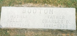
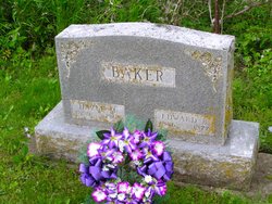
| Description | : | NOTE: Additional Child listed in Obituary - Robert OBITUARY: Mrs. John Baker Died Sunday at St. Louis, Mo. Mrs. John F. Baker, Sr., a former long-time resident of Spirit Lake, passed away Sunday at the home of her daughter, Mrs. Ray Droll in St. Louis, Mo., where she had made her home for the past three years. About a year ago Mrs. Baker suffered a fractured hip as the result of a fall and had been confined to her bed since that time. The remains were brought to Spirit Lake, where the funeral was held Wednesday, Aug. 21, 1946, in the Methodist church, being conducted... Read More |
frequently asked questions (FAQ):
-
Where is Alminia Althea “Minnie” Booton Baker's memorial?
Alminia Althea “Minnie” Booton Baker's memorial is located at: Lancaster Cemetery, Lancaster, Atchison County, USA.
-
When did Alminia Althea “Minnie” Booton Baker death?
Alminia Althea “Minnie” Booton Baker death on 18 Aug 1946 in Saint Louis, St. Louis County, Missouri, USA
-
Where are the coordinates of the Alminia Althea “Minnie” Booton Baker's memorial?
Latitude: 39.5666275
Longitude: -95.3054123
Family Members:
Parent
Spouse

Siblings
Children
Flowers:


Nearby Cemetories:
1. Lancaster Cemetery
Lancaster, Atchison County, USA
Coordinate: 39.5666275, -95.3054123
2. Maple Grove Cemetery
Atchison County, USA
Coordinate: 39.5505981, -95.3597031
3. Campbell Cemetery
Farmington, Atchison County, USA
Coordinate: 39.5186900, -95.3145600
4. Huron Cemetery
Huron, Atchison County, USA
Coordinate: 39.6058006, -95.3585968
5. Monrovia Cemetery
Effingham, Atchison County, USA
Coordinate: 39.5150719, -95.3470993
6. Good Intent Cemetery
Lancaster, Atchison County, USA
Coordinate: 39.6025009, -95.2275009
7. Camp Creek Cemetery
Parnell, Atchison County, USA
Coordinate: 39.5202789, -95.2346573
8. Robinson Family Cemetery
Atchison, Atchison County, USA
Coordinate: 39.4920100, -95.3114700
9. Eden Cemetery (Defunct)
Good Intent, Atchison County, USA
Coordinate: 39.5989300, -95.2163100
10. Pardee Cemetery
Cummings, Atchison County, USA
Coordinate: 39.4914589, -95.2860489
11. Mormon Grove Historical Marker Memorial
Parnell, Atchison County, USA
Coordinate: 39.5572319, -95.1985931
12. Saint Louis Cemetery
Good Intent, Atchison County, USA
Coordinate: 39.6241035, -95.2268753
13. Forest Grove Cemetery
Effingham, Atchison County, USA
Coordinate: 39.5802689, -95.4171524
14. Noffsinger Cemetery
Effingham, Atchison County, USA
Coordinate: 39.4924011, -95.3652344
15. Effingham Cemetery
Effingham, Atchison County, USA
Coordinate: 39.5152359, -95.3971558
16. Saint Anns Catholic Cemetery
Effingham, Atchison County, USA
Coordinate: 39.5186005, -95.4011002
17. Chain Family Cemetery
Huron, Atchison County, USA
Coordinate: 39.6238518, -95.3964767
18. Anderson Cemetery
Doniphan County, USA
Coordinate: 39.6601700, -95.3214200
19. Seventh Day Baptist Original Cemetery
Cummings, Atchison County, USA
Coordinate: 39.4706400, -95.3243400
20. Griffin Cemetery
Cummings, Atchison County, USA
Coordinate: 39.4629707, -95.3053207
21. Pleasant Grove Cemetery
Effingham, Atchison County, USA
Coordinate: 39.4786000, -95.3858000
22. Jackie Jones Cemetery
Cummings, Atchison County, USA
Coordinate: 39.4622000, -95.2631000
23. Yoakum Cemetery
Atchison, Atchison County, USA
Coordinate: 39.5522600, -95.1611400
24. Cummings District Cemetery
Cummings, Atchison County, USA
Coordinate: 39.4599609, -95.2416077